Karamjeet Singh Judge (1923-45) served as a Lieutenant in the 4th Battalion, 15th Punjab Regiment of the British Indian Army in Burma.
His actions on 18th March 1945 during the Battle of Meiktila (Burma Campaign) earned him a place in history as one of many courageous Indians who were awarded Victoria Crosses in recognition of their bravery.
Here’s a bit more about Karamjeet Singh Judge and his sacrifice during the Second World War.
On 18th March 1945 Lieutenant Judge, a Platoon Commander, was ordered to capture a strategically important cotton mill located just outside Myingyan, Burma.
The conditions for an attack were extremely difficult on that day. Lieutenant Judge faced very well defended enemy positions and intense enemy fire. He was supposed to have back up from British tanks but their ability to assist was held back by the unsuitability of the terrain.
Despite the difficult conditions Lieutenant Judge’s platoon spearheaded the British advance in what would come to be known as the Battle of Meiktila. During the battle Lieutenant Judge ‘dominated the entire battlefield by his numerous and successive acts of superb gallantry’ (London Gazette 1945). He continued to inspire his troops, personally leading numerous infantry charges and could always be found at the front with his men.
At one stage whilst leading an infantry attack, Karamjeet was confronted by two Japanese soldiers only 10 yards ahead charging towards him with their bayonets fixed – without hesitation he protected his platoon and fought off the Japanese.
Towards the end of the battle the final pockets of Japanese resistance were proving difficult to clear. The remaining three Japanese defended bunkers began to hold up both the infantry and tank advances. To put an end to this Lieutenant Judge displayed his valour and directed fire from the tanks at the same time as leading a small section in to clear the bunkers.
For what would be the final time, Lieutenant Judge showed the courageous leadership he would later be remembered for. At the same time as directing fire from the tanks he took it upon himself to lead a small section to clear the bunkers. As he approached the first bunk an enemy light machine gun opened fire. This fatally wounded Lieutenant Judge. His death spurred on his section to put an end to the long battle as they attacked and cleared the remaining bunkers. It was a sad day for the Punjab Regiment. They had lost one of their youngest and most courageous officers. However, had it not been for Lieutenant Judge’s action the Battle of Meiktila would have proved much more costly for the British and Indian Forces.
It was this type of commitment and immeasurable courage in putting the cause before self that exemplified the soldiers of the two and a half million strong British Indian Army – the largest volunteer army in history.
———————————————
Battle of Meiktila and Mandalay
The concurrent Battle of Meiktila and Battle of Mandalay were decisive engagements near the end of the Burma Campaign. Collectively, they are sometimes referred to as the Battle of Central Burma. Despite logistical difficulties, the Allies were able to deploy large armoured and mechanised forces in Central Burma, and also possessed air supremacy. Most of the Japanese forces in Burma were destroyed during the battles, allowing the Allies to later recapture the capital, Rangoon, and reoccupy most of the country with little organised opposition.
The Situation in 1945
The Japanese situation
In 1944, the Japanese had sustained several defeats in the mountainous frontier regions of Burma. In particular, at the Battle of Imphal and Battle of Kohima, the Japanese Fifteenth Army had suffered disastrous losses, mainly resulting from disease and starvation.
The heavy Japanese defeat prompted them to make sweeping changes among their commanders and senior staff officers in Burma. On 1 September 1944, Lieutenant General Hyotaro Kimura was appointed commander of the Burma Area Army, succeeding Lieutenant General Masakazu Kawabe whose health had broken down. At this stage of the war, the Japanese were in retreat on most fronts and were concentrating their resources for the defence of the homeland. Kimura had formerly been Vice-Minister for War, and had held other posts with responsibility for mobilising Japanese industry for the war effort. It was hoped that he could use the rice fields, factories and oil wells of Burma to make the Japanese forces there logistically self-sufficient.[1]
Lieutenant General Shinichi Tanaka was appointed to be Kimura’s Chief of Staff, with day-to-day responsibility for operations. He had formerly commanded the 18th Infantry Division in Northern Burma, and had a reputation for inflexible determination. (In a reversal of roles in the aftermath of the Imphal disaster, the former Chief of Staff of the Burma Area Army, Lieutenant General Eitaro Naka, was transferred to command the 18th Division.)[2]
Japanese losses in Burma and India in 1944 had been catastrophic. They were made up with drafts of conscripts, many of whom were not of the best physical categories. Kimura’s staff decreed that their divisions in Burma should have a strength of 10,000 (compared with their paper establishment of nearer 25,000), but most divisions mustered barely half this reduced strength.[3] Furthermore, they lacked anti-tank weapons. To face massed Allied armour, they would be forced to deploy their field artillery in the front line, which would affect their ability to give concentrated fire support to the infantry. Expedients such as lunge mines (an explosive charge on the end of a long pole), or suicide attacks by men wearing explosive charges, were not effective if the enemy tanks were closely supported by infantry.
Other losses handicapped the Japanese. Their 5th Air Division, deployed in Burma, had been reduced to only a few dozen aircraft to face 1,200 Allied aircraft. Their 14th Tank Regiment possessed only 20 tanks.[4]
Kimura accepted that his forces stood little chance against the numerically and materially superior Allies in open terrain. He therefore intended that while the Twenty-Eighth Army defended the coastal Arakan Province, relying on the difficult terrain to slow the Allied advances, and the Thirty-Third Army continued to fight rearguard actions against the American and Chinese forces which were trying to open a land route from India to China, the Fifteenth Army would withdraw behind the Irrawaddy River.[5] He hoped that the Allies would be overstretched trying to overcome this obstacle, perhaps to the point where the Japanese might even attempt a counteroffensive.
The Allied Situation
Series of maps showing the progress of the battles and their relation to the South East Asian theatre of war
The Allied South East Asia Command had begun making plans to reconquer Burma as early as June 1944 (while the Battle of Imphal was still being fought, although its outcome was clear). Three main options were proposed. One was to reoccupy Northern Burma only, to allow the Ledo Road to be completed, thus linking India and China by land. This was rejected, as it could use only a fraction of the available forces and fulfilled only an out-of-date strategic aim. A second option was to capture Rangoon, the capital and main seaport, by a seaborne invasion. This was also impractical, as it would require landing craft and other resources which would not be available until the end of the War in Europe. By default, the plan adopted was for an offensive into Central Burma by the British Fourteenth Army under Lieutenant General William Slim, to reconquer Burma from the north. The operation, originally codenamed Operation Capital, which was intended to capture Mandalay in Central Burma, was renamed Operation Extended Capital to encompass a subsequent pursuit to Rangoon.[6]
In support of Fourteenth Army’s offensive, the Indian XV Corps would advance in the coastal province of Arakan. The corps was also ordered to seize or construct airfields on the coast and on islands just offshore, which could be supplied by sea and which would be used as bases from which aircraft would supply Slim’s troops. The American-led Northern Combat Area Command, consisting mainly of Chinese troops, would continue its advance to link up with Chinese armies attacking from Yunnan province in south-west China and thus complete the Ledo Road linking China and India. It was hoped that XV Corps and the NCAC would distract as many Japanese forces as possible from the decisive front in Central Burma.
The chief problems which Fourteenth Army would face were logistical. The advancing troops would need to be supplied over crude roads stretching for far greater distances than were ever encountered in Europe. Although expedients such as locally constructed river transport and temporary all-weather coverings for roads (made from coarse hessian sacking material impregnated with bitumen and diesel oil) were to be used, transport aircraft were to be vital for supplying the forward units. Disaster threatened as early as 16 December 1944, when 75 American transport aircraft were abruptly transferred to China, where the Japanese Operation Ichi-Go was threatening American airfields.[7] Although aircraft were hastily transferred from the Mediterranean theatre to replace those despatched to China, continuing threats to deprive Fourteenth Army of the support of American transport aircraft were to be a constant concern for Slim during the forthcoming battles.[8]
The Fourteenth Army was supported by 221 Group RAF, which operated B-25 Mitchell bombers, Hawker Hurricane and P-47 Thunderbolt fighters and long-range Bristol Beaufighter fighter-bombers.[9] They could also call upon the B-24 Liberator heavy bombers of the Far Eastern Strategic Air Force. The most important aspect of air support was probably the Combat Cargo Task Force, which included both British and American squadrons of transport aircraft, in particular the ubiquitous C47. Fourteenth Army required 7,000 sorties by transport aircraft every day during the maximum intensity of the fighting.[7]
Most of Slim’s divisions were on a mixed Animal and Mechanical Transport establishment, which allowed them to operate in difficult terrain but restricted their tactical speed of movement to that of marching men or mules. In anticipation of fighting in the open country of Central Burma, Slim reorganised two of his divisions (Indian 5th Division and Indian 17th Division) as partly Motorized infantry and partly Airportable infantry formations.[10]
At this stage of the war, few British infantry reinforcements were available. In spite of expedients such as drafting anti-aircraft gunners into infantry units, the strength of Fourteenth Army’s British formations and of the British units in its Indian formations was dropping, and Indian and Gurkha units were increasingly to bear the brunt of the actions which followed.[11]
Intelligence
In the coming campaign, both the Allies and Japanese were to suffer from lack of intelligence about the enemy, and make incorrect assumptions about their opponent’s intentions.
The Allies had undisputed air superiority. In addition to the results of aerial reconnaissance, they also received reports from behind enemy lines from the reconnaissance units V Force and Z Force and the resistance liaison organisation Force 136. However, they lacked the detailed information available to commanders in Europe through Ultra radio intercepts, partly because Japanese radio security seems to have been good (until near the end of the battle, when their signal and staff arrangements largely collapsed), and partly because Japanese linguists were lacking at all headquarters levels.[12]
On the other hand, the Japanese were almost blind. They had very few aircraft with which to fly air reconnaissance missions, and they would receive little information from the Burmese population which was becoming disillusioned and restive under Japanese military control. Some formations had set up their own intelligence organisations; for example, Twenty-Eighth Army had created a branch of the Hikari Kikan, known as Hayate Tai, whose agents lived deep under cover in the frontier regions of Burma and in some of the remoter regions of Southern Burma.[13] However, these agents could not acquire or report information quickly enough to be tactically useful in a fast-moving mechanised battle.
Opening movements
As the monsoon season ended in late 1944, the Fourteenth Army had established two bridgeheads across the Chindwin River, using prefabricated Bailey bridges. Based on past Japanese actions, Slim assumed that the Japanese would fight in the Shwebo Plain, as far forward as possible between the Chindwin and Irrawaddy Rivers. On 29 November, Indian 19th Division launched British IV Corps‘ attack from the northern bridgeheads at Sittaung and Mawlaik, and on 4 December, Indian 20th Division under Indian XXXIII Corps attacked out of the southern bridgehead at Kalewa.
Both divisions made rapid progress, with little opposition. The 19th Division in particular, under Major General “Pete” Rees was approaching the vital rail centre of Indaw, 80 miles (130 km) east of Sittaung, after only five days. Slim realised at this point that his earlier assumption that the Japanese would fight forward of the Irrawaddy was incorrect. As only one of IV Corps’ divisions had so far been committed, he was able to make major changes to his original plan. The 19th Division was transferred to XXXIII Corps, which was to continue to clear the Shwebo plain and attack towards Mandalay. The remainder of IV Corps, strengthened by Fourteenth Army’s reserve divisions, was switched from the army’s left flank to its right. Its task was now to advance down the Gangaw Valley west of the Chindwin, cross the Irrawaddy near Pakokku and seize the vital logistic and communication centre of Meiktila by a rapid armoured thrust. To persuade the Japanese that IV Corps was still advancing on Mandalay, a dummy corps HQ was set up near Sittaung. All radio traffic to 19th Division was relayed through this installation.
To allow the main body of their divisions to retreat across the Irrawaddy, the Japanese had left rearguards in several towns in the Shwebo Plain. During January, the Indian 19th Division and British 2nd Division cleared Shwebo, while the Indian 20th Division had a hard battle to take Monywa, a major river port on the east bank of the Chindwin. The Japanese rearguards were largely destroyed.[14] The Japanese also retained a foothold in the Sagaing hills, north of the Irrawaddy near Mandalay.
Meanwhile, IV Corps began its advance down the Gangaw Valley. To conceal the presence of heavy units of IV Corps as long as possible, the advance of 7th Indian Infantry Division, which was intended to launch the assault across the Irrawaddy, was screened by the East African 28 Infantry Brigade and the improvised Lushai Brigade. Where these two lightly equipped formations met Japanese resistance at Pauk, the town was heavily bombed by Allied aircraft to soften up the defenders.
The route used by IV Corps required upgrading in several places to allow heavy equipment to pass. At one point, the trail of vehicles stretched from Pauk to Kohima, 350 miles (560 km) to the north by road.[15]
Crossing the Irrawaddy
The 19th Indian Division had slipped units across narrow stretches of the Irrawaddy at Thabeikkyin on 14 January 1945 and Kyaukmyaung 20 miles (32 km) south (and 40 miles (64 km) miles north of Mandalay) the next day. They faced a stiff fight for some weeks against attempts by the reinforced Japanese 15th Division to counter-attack their bridgeheads. The crossings downstream, where the river was much wider, would require more preparation. The assault boats, ferries and other equipment for the task were in short supply in Fourteenth Army, and much of this equipment was worn out, having already seen service in other theatres.
Slim planned for 20th Division of XXXIII Corps and 7th Division of IV Corps to cross simultaneously on 13 February, so as to further mask his ultimate intentions. On XXXIII Corps’ front, 20th Division crossed 20 miles (32 km) west of Mandalay. It successfully established small bridgeheads, but these were counter-attacked nightly for almost two weeks by the Japanese 31st Division. Orbiting patrols of fighter-bombers knocked out several Japanese tanks and guns. Eventually 20th Division expanded its footholds into a single firmly-held bridgehead.[16]
In IV Corps’s sector, it was vital for Slim’s overall plan for 7th Division to seize the area around Pakokku and establish a firm bridgehead quickly. The area was defended by the Japanese 72nd Mixed Brigade and units of the 2nd Division of the Indian National Army, under Shah Nawaz Khan. The 214th Regiment of the Japanese 33rd Division held a bridgehead at Pakokku.
The crossing by Indian 7th Division (which was delayed for 24 hours to repair the assault boats), was made on a wide front. The 28th East African Brigade made a feint towards Yenangyaung to distract the Japanese 72nd Brigade while another brigade attacked Pakokku. However, both the main attack at Nyaungu and a secondary crossing at Pagan (the former capital, and the site of many Buddhist temples) were initially disastrous. Pagan and Nyaungu were defended by two battalions of the INA’s 4th Guerrilla Regiment, with one held in reserve.[17] At Nyaungu, 2/South Lancashire Regiment suffered heavy losses as their assault boats broke down under machine-gun fire which swept the river.[18] Eventually, support from tanks of the 116 Regiment Royal Armoured Corps (formerly the 5th Battalion of the Gordon Highlanders) firing across the river and massed artillery suppressed the INA machine gun positions and allowed 4/15th Punjab Regiment to reinforce a company of the South Lancashire who had established a precarious foothold. The next day, the remaining defenders were sealed into a network of tunnels.[19] At Pagan, 1/11th Sikh Regiment‘s crossing fell into disorder under machine gun fire from the INA’s 9th battalion,[20] but a boat carrying a white flag was seen leaving Pagan. The defenders wished to surrender, and the Sikhs occupied Pagan without resistance.[21]
Slim noted in his memoirs that this action was “the longest opposed river crossing attempted in any theatre of the Second World War.”[17][22] Unknown to the Allies, Pagan was the boundary between the Japanese Fifteenth and Twenty-Eighth Armies. This delayed the Japanese reaction to the crossing.
Starting on 17 February, 255th Indian Tank Brigade and the motorised infantry brigades of 17th Division began crossing into 7th Division’s bridgehead. To further distract Japanese attention from this area, the British 2nd Division began crossing the Irrawaddy only 10 miles (16 km) west of Mandalay on 23 February. This crossing also threatened to be a disaster due to leaky boats and faulty engines, but one brigade crossed successfully and the other brigades crossed into its bridgehead.
Orders of battle
At this point, the Japanese were hastily reinforcing their Central Front with units from the northern front (where the American-led Northern Combat Area Command had largely ceased its operations as its Chinese units were recalled to China) and with reserve units from Southern Burma.
Do you have a family member who served during the Far East campaign? Share your story with us on Facebook or Tweet us @DefenceHQ using #VJDay70.
To find out what is happening to mark VJ Day 70 click here.
As the nation prepares to mark the 70th anniversary of VJ Day on Saturday 15 August, Countess Mountbatten of Burma has urged members of the public to attend and show their support.
Her father, Lord Mountbatten, was the Supreme Allied Commander South East Asia during the Second World War.
Get involved in VJ Day 70
VJ Day commemorations are happening on and around 15 August across the country, with HM Government hosting a ceremony for veterans and their families in London.
VJ Day 70
Her Majesty The Queen and members of The Royal Family will attend a series of events on Saturday 15 August 2015 in London to commemorate the 70th anniversary of VJ Day.
Members of the public are being encouraged to support this anniversary by lining Whitehall in Central London to watch a spectacular flypast of historic and modern military aircraft, view the drumhead service taking place in Horse Guards Parade on big screens, and cheer on the veterans as they parade supported by military bands and current personnel in honour of the role they played in the Second World War.
Visit VJ Day 70 for more information about the event and how you can take part. You can also join the conversation online by following #VJDay70.
Veterans, civilian internees and their descendents
Veterans and civilian internees, along with their descendents and families, can attend a special VJ Day commemorative event at Horse Guards Parade on 15 August.
The event will begin in spectacular style with a flypast of three historic aircraft; a Dakota and Hurricane of the Battle of Britain Memorial Flight and a Royal Navy Swordfish, together with a current RAF Typhoon.
This will be followed by a drumhead service – a church service conducted “in the field” where no altar is available – a wreath-laying ceremony, and a reading of Rudyard Kipling‘s poem ‘The Road to Mandalay’ by famed actor Charles Dance.
Members of the public
London, Whitehall
Big screens will be made available in and around Whitehall so that members of the public can get involved in the Horse Guards ceremony and, and cheer our VJ Day heroes during the parade.
Military bands will also line the route during the parade and the flypast will pass overhead.
VJ Day route map
Staffordshire, National Memorial Arboretum
A service will be held on Saturday 15 August in the Millennium Chapel, followed by a wreath-laying ceremony.
On Sunday 16 August the Far East Prisoner of War Building will be rededicated followed by a wreath-laying at the Far Ear Prisoners of War Grove.
Lichfield, Lichfield Cathedral
A Service of Thanksgiving will be held on Saturday 15 August
Manningtree, Manningtree War Memorial
On Saturday 15 August – The Manningtree and District Royal British Legion Branch will hold a ceremony at the Manningtree War Memorial.
Derbyshire, Hayfield Village War Memorial
Hayfield Royal British Legion Branch will hold a Service of Thanksgiving and commemoration at the village War Memorial on Saturday 15 August.
Portslade, Easthill Park War Memorial
A Far East Prisoners of War Service of Remembrance will be held on Sunday 16 August at the Easthill Park War Memorial in Manor Road, Portslade, near Brighton.
Portsmouth, Guildhall Square
Portsmouth City Council will host a service at the Second World War Memorial, next to the Cenotaph in Guildhall Square on Saturday 15 August. The service will be attended by the Lord Mayor of Portsmouth, veterans, representatives from the Armed Forces and community organisations and will feature readings and a wreath-laying ceremony.
Live coverage of the commemorative events being held in London will also be shown on the Big Screen in Guildhall Square.
On Sunday 16 August a Choral Evensong will be held at Portsmouth Cathedral, High Street, Old Portsmouth.
The beauty of our little planet , in our little insignificant corner of the Milky Way is all the more beautiful because its our HOME.
Earthrise :
Earthrise is a photograph of the Earth taken by astronaut William Anders in 1968, during the Apollo 8 mission. Nature photographer Galen Rowell declared it “the most influential environmental photograph ever taken.”[1] This had been preceded by the crude 1966 black-and-white raster earthrise image taken by the Lunar
Planet Earth seen from space (Full HD 1080p) ORIGINAL
Details
The conversation between Frank Borman and William Anders, during the taking of the Earthrise photograph
NASA | Earthrise: The 45th Anniversary
Earthrise is the name given to NASA image AS8-14-2383, taken by astronaut William Anders during the Apollo 8 mission, the first manned voyage to orbit the Moon.[1][2]
Initially, before Anders found a suitable 70 mm color film, mission commander Frank Borman took a black-and-white photograph[3] of the scene, with the Earth’s terminator touching the horizon. The land mass position and cloud patterns in this image are the same as those of the color photograph entitled Earthrise.[4]
The photograph was taken from lunar orbit on December 24, 1968, with a highly modified Hasselblad 500 EL with an electric drive. The camera had a simple sighting ring rather than the standard reflex viewfinder and was loaded with a 70 mm film magazine containing custom Ektachrome film developed by Kodak. An audio recording of the event is available[5] with transcription[6] which allows the event to be followed closely – excerpt:[7]
Anders: Oh my God! Look at that picture over there! There’s the Earth coming up. Wow, is that pretty.
Borman: Hey, don’t take that, it’s not scheduled. (joking)
Anders: (laughs) You got a color film, Jim?
Hand me that roll of color quick, would you…
Lovell: Oh man, that’s great!
Earthrise video captured by Apollo 10 crew on 1969
There were many images taken at that point. The mission audio tape establishes several photographs were taken, on Borman’s orders, with the enthusiastic concurrence of Lovell and Anders. Anders took the first color shot, then Lovell who notes the setting (1/250th of a second at f/11), followed by Anders with another two at varying exposures.
A nearly full-page black and white reproduction of Borman’s image may be viewed on page 164 of his 1988 autobiography, captioned, “One of the most famous pictures in photographic history — taken after I grabbed the camera away from Bill Anders”. Borman was the mission commander and notes[8] (pg. 212) that this is the image “the Postal Service used on a stamp, and few photographs have been more frequently reproduced” [but see above]. The photograph reproduced in the Frank Borman autobiography is not the same image as the Anders photograph; aside from the orientation, the cloud patterns differ.
The stamp issue reproduces the cloud, color, and crater patterns of the Anders picture. Anders is described (pg. 193) by Borman as holding “a masters degree in nuclear engineering”; Anders was thus tasked as “the scientific crew member … also performing the photography duties that would be so important to the Apollo crew who actually landed on the Moon”.
Geometry
The as-published photograph shows Earth:
Polar orientation: south to left, north to right (Antarctica at 10 o’clock)
Equator: center, running westward toward top right-hand corner
Nightfall terminator crossing the African continent (lightish region to left is Namib Desert, Namibia; to right is Western Sahara/West Africa)
Rotated clockwise approximately 135° from our typical North/South-Pole-oriented perspective
Legacy
In Life ‘s 100 Photographs that Changed the World, wilderness photographer Galen Rowell called Earthrise “the most influential environmental photograph ever taken.”[9] Another author called its appearance the beginning of the environmental movement.[10]
In 1969, the U.S. Postal Service issued a stamp (Scott # 1371) commemorating the Apollo 8 flight around the Moon. The stamp featured a detail (in color) of the Earthrise photograph, and the words, “In the beginning God…”, recalling the Apollo 8 Genesis reading.
2008 video
On April 6, 2008 (Japan Standard Time), the first 1080p high-definition Earthrise video was captured, both a full Earthrise and Earthset video, by the JAXA lunar orbiter mission, SELENE (better known in Japan by its nickname Kaguya). After successfully orbiting the Moon for 1 year and 8 months, it was crashed intentionally onto the lunar surface at 18:25 UTC on June 10, 2009.[11]
Earthrise Revisited 2013, a recreation showing the rising Earth as it must have looked to Anders, Borman, and Lovell in 1968.
A simulation of what the Apollo 8 crew saw as the Earth rose above the lunar horizon during their fourth orbit around the Moon that pauses to overlay two photographs taken by the crew and includes a clock overlay
In 2013, in commemoration of the 45th anniversary of the Apollo 8 mission, NASA issued a video about the taking of the photograph.[12] This computer-generated visualization used data from the Lunar Reconnaissance Orbiter spacecraft, which had provided detailed images of the lunar surface that could be matched with those taken every 20 seconds by an automatic camera on Apollo 8. The resulting video, re-creating what the astronauts would have seen, was synchronized with the recording of the crew’s conversation as they became the first humans to witness an Earthrise. The video included explanatory narration written and read by Andrew Chaikin.[13]
Potential earthrises as seen from the Moon’s surface
An earthrise that might be witnessed from the surface of the Moon would be quite unlike moonrises on Earth. Because the Moon is tidally locked with the Earth, one side of the Moon always faces toward Earth. Interpretation of this fact would lead one to believe that the Earth’s position is fixed on the lunar sky and no earthrises can occur, however, the Moon librates slightly, which causes the Earth to draw a Lissajous figure on the sky. This figure fits inside a rectangle 15°48′ wide and 13°20′ high (in angular dimensions), while the angular diameter of the Earth as seen from Moon is only about 2°. This means that earthrises are visible near the edge of the Earth-observable surface of the Moon (about 20% of the surface). Since a full libration cycle takes about 27 days, earthrises are very slow, and it takes about 48 hours for Earth to clear its diameter.[14] During the course of the month-long lunar orbit, an observer would additionally witness a succession of “Earth phases”, much like the lunar phases seen from Earth. That is what accounts for the half-illuminated globe seen in the photograph.
And now for a bit of me pondering the age old question , Are we alone? Just for fun mind you!
I’m no expert, but I sincerely believe that we are not alone in the universe .
Come on – between 100 billion – 400 billion stars in our galaxy ( Milky Way )
and over one 100 billion galaxies out there!
And I’ve not even touched on the multiverse
The numbers alone our mind boggling
I just find it inconceivable that out of these vast numbers our solar system is the only place that life took hold and evolved into the beautiful earth we know today.
I’m no Expert . But I assume that every thing that was needed to create the conditions for life on earth were no doubt abundant throughout space during the birth and evolution of space and the birth of Galaxies .
If the elements for life found their way to out tiny corner of the Milky Way , why not elsewhere?
I’m not saying that life is abundant throughout our galaxy and the billions of other galaxies out there , but surely the same elements that kick started life on earth must have travelled through space and found a home on other worlds out there.
Unfortunately due to the vast distances to these other worlds and galaxies we will never be able to travel to them or indeed send space ships and probes to unlock their secrets.
Our own Milky Way is so huge that even at the speed of light it would take 100,000 years to travel across it!
And even if we could travel these vast distances and survive the journey we would find that life on these other hostile worlds was beyond our comprehension , life – but not as we know it!
I expect that most life forms out there are single cell and far below the complex life forms that are found on earth.
But what if there are other more advance civilizations out there? No matter how advance they may be they will still be faced with the vast distances of space and time and would face the same frustrations as us , being stuck in their tiny corner of their galaxies and asking themselves the age of question”
“ARE WE ALONE”
The mind boggle….
The Drake Equation
The Drake Equation is used to estimate the number of communicating civilizations in the cosmos, or more simply put, the odds of finding intelligent life in the universe. N = The number of civilizations in the Milky Way galaxy whose electromagnetic emissions are detectable
Funeral of Minder star George Cole held in Reading
The theme tune to the series that made actor George Cole a TV favourite has been played at his funeral.
Cole, who died on 5 August aged 90, was best known as Cockney wheeler-dealer Arthur Daley in Minder, a role he played for 15 years from 1979 to 1994.
Reading a eulogy during the ceremony at Reading Crematorium, Dennis Waterman, said of his time as Cole’s co-star: “We laughed all day long, every day”.
The upbeat song “I Could Be So Good for You” was a hit for Waterman in 1980.
George Edward Cole
George Cole Interview for ‘That’s What I Call Television’
Minder – An Officer and a Car Salesman
George Edward Cole, OBE (22 April 1925 – 5 August 2015) was an English actor whose career spanned more than 70 years. He was known for playing Arthur Daley in the long-running ITV drama show Minder and Flash Harry in the early St Trinian’s films.
Early life
Cole was born in Tooting, London.[1][2] He was given up for adoption at ten days old and adopted by George and Florence Cole, Tooting council employee and cleaner respectively. He attended secondary school in nearby Morden.[1] He left school at 14 to be a butcher’s boy, and had an ambition to join the Merchant Navy, but landed a part in a touring musical and chose acting as a career.
Career
At age 15, Cole was cast in the film Cottage to Let (1941), opposite Scottish actor Alastair Sim. Sim liked Cole, and agreed with his family to take in Cole and his adoptive mother to their home. Acting as his mentor, Sim helped Cole lose his Cockney accent; Cole stayed with the Sim family until he was 27.[3] He later attributed his career success to Sim, with whom he appeared in a total of 11 films, ending with a television film of The Anatomist (1956). Cole also acted opposite Laurence Olivier in The Demi-Paradise (1943) and Olivier’s film version of Henry V (1944), of which he was the last surviving cast member. His career was interrupted by his National service in the Royal Air Force from 1944 to 1947, where he was temporarily a radio operator.
Returning to his acting career, he became familiar to audiences in British comedy films in the 1950s. Cole appeared with Alastair Sim in Scrooge (as the young Scrooge) in 1951, but his best known film role was as “Flash Harry” in the St Trinian’s films (two of which also star Sim), and in the comedy Too Many Crooks (1959). He also starred in the film Take Me High (1973) alongside Cliff Richard and Deborah Watling. He was known for his lead role in the radio comedy A Life of Bliss (1953–69) in which he played an amiable but bumbling bachelor, David Alexander Bliss.[4] (David Tomlinson initially played Bliss). It lasted for six series and 118 episodes, becoming a TV series in 1960. In this form, it ran for two series, but no episode is known to survive.[5]
Cole appeared as a guest star in the Gerry Anderson-produced television series UFO in the episode “Flight Path” (1971). He also made a guest appearance as Mr Downs, a bank manager, in a 1978 episode of the sitcom The Good Life, performed in the presence of the Queen.
His best remembered television role was as the crooked used-car dealer Arthur Daley in the Thames Television series Minder, which he played from 1979 to the show’s conclusion in 1994. Prior to this, he had played a struggling writer in the BBC sitcom Don’t Forget To Write! (1977–79). He also played Sir Giles Lynchwood in the BBC’s adaptation of the Tom Sharpe novel Blott on the Landscape (1985). Cole starred in a number of comedies, such as Comrade Dad (1984–86), Dad (1997–98) and My Good Friend (1995–96).
Cole was cast in the crime-horror film Road Rage as Cyril; it awaits release.[6]
Personal life
Cole was married twice, first to actress Eileen Moore (1954–1962, divorced) and then to actress Penny Morrell (1967–2015, his death).[7] Cole had four children, two from each marriage.
He was invested as an Officer of the Order of the British Empire in 1992.[8] He resided for over 70 years in Stoke Row, Oxfordshire.[9] His autobiography, The World Was My Lobster, was published in 2013.[7]
Stephen Lewis, On the Buses’ ‘Blakey’, dies aged 88
17 December 1926 – 12 August 2015
On the Buses – bye bye blakey.
Actor Stephen Lewis, best known for his role as officious inspector “Blakey” in the 1970s ITV sitcom On the Buses, has died aged 88, his family has announced.
Lewis also played “Smiler” in the BBC’s Last of the Summer Wine.
Born in east London in 1926, he got his start at the Theatre Royal Stratford East under Joan Littlewood.
According to his family, the actor died “quite peacefully” in a nursing home in Wanstead, east London, in the early hours of Wednesday morning.
As “Blakey”, Lewis was forever clashing with Reg Varney’s wily Stan Butler (middle)
In his role as Inspector Cyril “Blakey” Blake, Lewis constantly clashed, and was usually outwitted by, Reg Varney’s wily bus driver Stan Butler.
One of his catchphrases was “I’ll get you for this, Butler” – one he was happy to repeat, according to the manager of the nursing home where he lived out his final years.
The popular sitcom ran from 1969 to 1973 and spawned three big-screen spin-offs: On the Buses, Mutiny on the Buses and Holiday on the Buses.
Lewis’s other sitcoms included Don’t Drink the Water, On the Buses’ short-lived, Spain-based sequel, and the BBC’s railway-themed Oh, Mr Beeching!
Lewis played “Smiler” in Last of the Summer Wine for almost 20 years
He also appeared as Clem “Smiler” Hemmingway in more than 130 episodes of Last of the Summer Wine, starting in 1988 and continuing until 2007.
Lewis wrote Sparrers (later Sparrows) Can’t Sing, a success for Littlewood’s Theatre Workshop that gave Barbara Windsor one of her most notable early roles.
Peter Lewis, the actor’s nephew, said his uncle’s health had gradually deteriorated in recent years but that he had kept his spirits up right until the end.
“He still had his sense of humour, very much so,” said Rashid Ebrahimkhan, manager of the Cambridge Nursing Home. “He was very resilient until the last.”
On the Buses – The “L” Bus
Stephen Lewis
Stephen Lewis (17 December 1926 – 12 August 2015)[3] was an English actor, comedian, director, screenwriter and playwright. In his early stage career he used the name Cato but after writing Sparrers Can’t Sing he was urged by his agent to use his real name.[4][non-primary source needed]
Lewis was born at All Saints Maternity Hospital, in Poplar, London on 17 December 1926.and began his career as a merchant seaman, but was persuaded to go to a performance by the Theatre Workshop, under their director Joan Littlewood. It was common, after these performances, to invite members of the audience to meet the cast. He was invited to an audition and landed the part; he left the sea, becoming a member of the company, and made his West End debut with the transfer of Brendan Behan‘s The Hostage in 1958.[5] In 1960 he wrote Sparrers Can’t Sing with the Theatre Workshop, which was made into the film Sparrows Can’t Sing (1963), starring Barbara Windsor, Roy Kinnear and Lewis himself.
From 1969 Lewis starred in his best remembered role as Blakey (catch phrase “I ‘ate you Butler”) in the British sitcom On the Buses, which ran for 74 half-hour episodes and spawned three films, On the Buses (1971), Mutiny on the Buses (1972) and Holiday on the Buses (1973); he co-wrote 12 episodes with fellow star Bob Grant (conductor Jack Harper). While the lead character Reg Varney played a character intended to be significantly younger than himself, Lewis was made-up to look much older than his actual age, being only 42 when the programme began. A spin-off series, Don’t Drink the Water (1974–75), ran for two series. This featured Blakey retiring to Spain with his sister, Dorothy (Pat Coombs). In the 1990s Lewis’s character Blakey (or a very similar-looking character) appeared regularly on Jim Davidson’s version of The Generation Game on BBC1. He also appeared in Manhunt in a rare straight and villainous role, with Peter Barkworth and Alfred Lynch.
In 1988 he took on one of his longest-running roles, playing the ironically-named “Smiler” Hemingway in the BBC sitcom Last of the Summer Wine. The character recurred in occasional episodes for 17 years before ill health forced Lewis to leave the series in 2007.[citation needed]
William Ellis (Bill) Newton, VC (8 June 1919 – 29 March 1943) was an Australian recipient of the Victoria Cross, the highest decoration for gallantry in the face of the enemy that can be awarded to a member of the British and Commonwealth armed forces.
He was honoured for his actions as a bomber pilot in Papua New Guinea during March 1943 when, despite intense anti-aircraft fire, he pressed home a series of attacks on the Salamaua Isthmus, the last of which saw him forced to ditch his aircraft in the sea. Newton was still officially posted as missing when the award was made in October 1943. It later emerged that he had been taken captive by the Japanese, and executed by beheading on 29 March.
Newton served as a flying instructor in Australia before being posted to No. 22 Squadron, which began operating Boston light bombers in New Guinea late in 1942. Having just taken part in the Battle of the Bismarck Sea, he was on his fifty-second mission when he was shot down and captured. Newton was the only Australian airman to receive a Victoria Cross for action in the South West Pacific theatre of World War II, and the sole Australian to be so decorated while flying with an RAAF squadron.
Family, education and sport
Born in the Melbourne suburb of St Kilda on 8 June 1919, Bill Newton was the youngest child of dentist Charles Ellis Newton and his second wife Minnie.[2][3] His three older half-siblings from Charles’ earlier marriage included two brothers, John and Lindsay, and a sister, Phyllis. Bill entered Melbourne Grammar School in 1929, but two years later switched to the nearby St Kilda Park Central School as the family income was reduced through the impact of the Great Depression.
In 1934, aged fifteen, he was able to return to Melbourne Grammar where, despite struggling with his schoolwork, he completed his Intermediate certificate. He gave up further study when his father died suddenly of a heart attack at the age of fifty-one, and began working in a silk warehouse.
He had earlier attempted to enlist when he turned eighteen in 1937, but his mother refused to give her permission; with Australia now at war, she acquiesced. His brothers—dentists by profession, like their father—also enlisted in the armed forces, John as a surgeon lieutenant in the Royal Australian Navy and Lindsay as a Captain in the Army Medical Corps.
In October 1941, Newton transferred to No. 5 Service Flying Training School at Uranquinty. He found instruction frustrating, as he longed for a combat assignment. His fortunes changed in February 1942, when he was selected for the navigation course on Ansons at the General Reconnaissance School based at Laverton. From there he was sent to No. 1 Operational Training Unit at Sale, Victoria, for conversion to Lockheed Hudson twin-engined light bombers during March and April.
Previously equipped with Hudsons, the unit had just begun converting to the more advanced Douglas Boston when Newton arrived. A comrade described him as a:
“big brash, likeable man who could drink most of us under the table, was a good pilot, good at sports, and had a way with girls”
Newton undertook the first of his fifty-two operational sorties on 1 January 1943, under the leadership of his commanding officer, Squadron Leader Keith Hampshire. During February, Newton flew low-level missions through monsoon conditions and hazardous mountain terrain, attacking Japanese forces ranged against Allied troops in the Morobe province.
In early March, he took part in the Battle of the Bismarck Sea, one of the key engagements in the South West Pacific theatre, bombing and strafing Lae airfield to prevent its force of enemy fighters taking off to intercept Allied aircraft attacking the Japanese fleet.
Newton gained a reputation for driving straight at his targets without evasive manoeuvre, and always leaving them in flames; this earned him the nickname “The Firebug”. The Japanese gunners, however, reportedly knew him as “Blue Cap”, from his habit of wearing an old blue cricket cap on operations. In spite of the hazards of the air war in New Guinea, he was quoted as saying,
“The troops on the ground should get two medals each, before any airman gets one”.
Attacks on Salamaua
Douglas Bostons of No. 22 Squadron over New Guinea, c. 1942–43
On 16 March 1943, Newton led a sortie on the Salamaua Isthmus in which his Boston was hit repeatedly by Japanese anti-aircraft fire, damaging fuselage, wings, fuel tanks and undercarriage. In spite of this he continued his attack and dropped his bombs at low level on buildings, ammunition dumps and fuel stores, returning for a second pass at the target in order to strafe it with machine-gun fire.
Newton managed to get his crippled machine back to base, where it was found to be marked with ninety-eight bullet holes. Two days later, he and his two-man crew made a further attack on Salamaua with five other Bostons. As he bombed his designated target, Newton’s plane was seen to burst into flames, raked by cannon fire from the ground.
Attempting to keep his aircraft aloft as long as possible to get his crew away from enemy lines, he was able to ditch in the sea approximately 1,000 yards (910 m) offshore.
The Boston’s navigator, Sergeant Basil Eastwood, was killed in the forced landing but Newton and his wireless operator, Flight Sergeant John Lyon, survived and managed to swim ashore. Several of the other aircraft in the flight circled the area; one returned to base straight away to inform Hampshire, and the remainder were later forced to depart through lack of fuel. Newton and Lyon originally made their way inland with the help of natives, aiming to contact an Australian Coastwatcher, but subsequently returned to the coast. There they were captured by a Japanese patrol of No. 5 Special Naval Landing Force.
The two airmen were taken to Salamaua and interrogated until 20 March, before being moved to Lae where Lyon was bayoneted to death on the orders of Rear Admiral Ruitaro Fujita, the senior Japanese commander in the area. Newton was brought back to Salamaua where, on 29 March 1943, he was ceremonially beheaded with a Samurai sword by Sub-Lieutenant Uichi Komai, the naval officer who had captured him.
Komai was killed in the Philippines soon after, and Fujita committed suicide at the end of the war.
Revelations and reactions
It was initially believed that Newton had failed to escape from the Boston after it ditched into the sea, and he was posted as missing. Squadron Leader Hampshire had immediately dispatched a sortie to recover the pair that were last seen swimming for shore, but no sign of them was found.
Two weeks later, he wrote a letter to Newton’s mother in which he described her son’s courage and expressed the hope that he might yet be found alive. Hampshire concluded:”.
The details of his capture and execution were only revealed later that year in a diary found on a Japanese soldier. Newton was not specifically named, but circumstantial evidence clearly identified him, as the diary entry recorded the beheading of an Australian flight lieutenant who had been shot down by anti-aircraft fire on 18 March 1943 while flying a Douglas aircraft.
The Japanese observer described the prisoner as “composed” in the face of his impending execution, and:
“unshaken to the last”.
After the decapitation, a seaman slashed open the dead man’s stomach, declaring :
“Something for the other day. Take that.”
General Headquarters South West Pacific Area, while releasing details of the execution on 5 October, initially refused to name Newton. Aside from the lack of absolute certainty as to identification, Air Vice Marshal Bill Bostock, Air Officer Commanding RAAF Command, contended that naming him would change the impact of the news upon Newton’s fellow No. 22 Squadron members “from the impersonal to the closely personal” and hence “seriously affect morale”.
News of the atrocity provoked shock in Australia. In an attempt to alleviate anxiety among the families of other missing airmen, the Federal government announced on 12 October that the relatives of the slain man had been informed of his death.
Victoria Cross
Newton was awarded the Victoria Cross for his actions on 16–18 March, becoming the only Australian airman to earn the decoration in the South West Pacific theatre of World War II, and the only one while flying with an RAAF squadron.
The citation, which incorrectly implied that he was shot down on 17 March rather than the following day, and as having failed to escape from his sinking aircraft, was promulgated in the London Gazette on 19 October 1943:
Newton c. 1942–43
Air Ministry, 19th October, 1943.
The KING has been graciously pleased, on the advice of Australian Ministers, to confer the VICTORIA CROSS on the undermentioned officer in recognition of most conspicuous bravery: —
Flight Lieutenant William Ellis NEWTON (Aus. 748), Royal Australian Air Force, No. 22 (R.A.A.F.) Squadron (missing).
Flight Lieutenant Newton served with No. 22 Squadron, Royal Australian Air Force, in New Guinea from May, 1942, to March, 1943, and completed 52 operational sorties.
Throughout, he displayed great courage and an iron determination to inflict the utmost damage on the enemy. His splendid offensive flying and fighting were attended with brilliant success. Disdaining evasive tactics when under the heaviest fire, he always went straight to his objectives. He carried out many daring machine-gun attacks on enemy positions involving low-flying over long distances in the face of continuous fire at point-blank range.
On three occasions, he dived through intense anti-aircraft fire to release his bombs on important targets on the Salamaua Isthmus. On one of these occasions, his starboard engine failed over the target, but he succeeded in flying back to an airfield 160 miles away. When leading an attack on an objective on 16th March, 1943, he dived through intense and accurate shell fire and his aircraft was hit repeatedly. Nevertheless, he held to his course and bombed his target from a low level. The attack resulted in the destruction of many buildings and dumps, including two 40,000-gallon fuel installations. Although his aircraft was crippled, with fuselage and wing sections torn, petrol tanks pierced, main-planes and engines seriously damaged, and one of the main tyres flat, Flight Lieutenant Newton managed to fly it back to base and make a successful landing.
Despite this harassing experience, he returned next day to the same locality. His target, this time a single building, was even more difficult but he again attacked with his usual courage and resolution, flying a steady course through a barrage of fire. He scored a hit on the building but at the same moment his aircraft burst into flames.
Flight Lieutenant Newton maintained control and calmly turned his aircraft away and flew along the shore. He saw it as his duty to keep the aircraft in the air as long as he could so as to take his crew as far away as possible from the enemy’s positions. With great skill, he brought his blazing aircraft down on the water. Two members of the crew were able to extricate themselves and were seen swimming to the shore, but the gallant pilot is missing. According to other air crews who witnessed the occurrence, his escape-hatch was not opened and his dinghy was not inflated. Without regard to his own safety, he had done all that man could do to prevent his crew from falling into enemy hands.
Flight Lieutenant Newton’s many examples of conspicuous bravery have rarely been equalled and will serve as a shining inspiration to all who follow him.
Legacy
Newton’s medals on display at the Australian War Memorial
Buried initially in an unmarked bomb crater in Salamaua, Newton’s body was recovered and re-interred in Lae War Cemetery after Salamaua’s capture by Allied troops in September 1943.
In early 1944, the recently constructed No. 4 Airfield in Nadzab was renamed Newton Field in his honour. For many years, the story of Newton’s death was intertwined with that of an Australian commando, Sergeant Len Siffleet, who had also been captured in New Guinea.
A famous photograph showing Siffleet about to be executed with a katana was discovered by American troops in April 1944 and was thought to have depicted Newton in Salamaua. However, no photograph of the airman’s execution is known to exist.
Newton’s mother Minnie was presented with her son’s Victoria Cross by the Governor-General, the Duke of Gloucester, on 30 November 1945. She donated it to the Australian War Memorial, Canberra, where it remains on display with his other medals.
Newton is also commemorated on Canberra’s Remembrance Driveway. In the 1990s, his friend Keith Miller successfully fought to ensure that the Victoria Racing Club abandoned a plan to rename the William Ellis Newton Steeplechase—run on Anzac Day—after a commercial sponsor. Later in the decade, Miller also publicly questioned Australia Post‘s exclusion of Newton from a series of stamps featuring notable Australians such as cricketer Sir Donald Bradman.
A plaque dedicated to No. 22 Squadron was unveiled at the Australian War Memorial by the Chief of Air Force, Air Marshal Angus Houston, on 16 March 2003, the sixtieth anniversary of Newton’s attack on Salamaua.
With VJ around the corner I thought I would do a post about Leonard Siffleet , whose lonely end was immortalised in this famous picture. When I first saw this picture I was struck by how calm and dignified Leonard seemed as he waited on the brutal end to his too short life. His sacrifice and death will live long in our memory. I salute you Leonard!
All three men were interrogated, tortured and later beheaded. A photograph of Siffleet’s impending execution became an enduring image of the war, and his identity was often confused with that of other servicemen who suffered a similar fate, in particular Flight Lieutenant Bill Newton, VC.
Early life
Siffleet and fiancée Clarice Lane, 1941
Len Siffleet was born on 14 January 1916 in Gunnedah, New South Wales. The son of an itinerant worker of Dutch ancestry, his siblings included a sister and two brothers. Siffleet made his way to Sydney in the late 1930s, seeking to join the police force, but was prevented from doing so because of his eyesight. He was nevertheless called up for the militia in August 1940, and attached to a searchlight unit at RAAF Station Richmond.
Discharged from the militia after three months, Siffleet returned to his family to help look after his young brothers following their mother’s death. He was working as a shop assistant when he enlisted in the Second Australian Imperial Force (AIF) in September 1941.
Allotted to a signals company based at Ingleburn, New South Wales, he was reported absent without leave on two occasions; he was by this time engaged to Clarice Lane.
Siffleet joined a party led by Sergeant H. N. Staverman of the Royal Netherlands Navy, which included two Ambonese privates, H. Pattiwal and M. Reharing. Code-named “Whiting”, this team was to work in concert with another group known as “Locust”, led by Lieutenant Jack Fryer.
Staverman’s reconnaissance group commenced its mission in north-east New Guinea in July, trekking across mountainous terrain through August and September. At some point Staverman and Pattiwal separated from the others to undertake further exploration of the countryside, and were ambushed by a group of natives. Both were captured and reported as killed, but Pattiwal later escaped and rejoined Siffleet and Reharing. Siffleet signalled Fryer to warn him of the hostile natives and of Japanese patrols, indicating that he was preparing to burn his party’s codes and bury its radio. No more was heard from them after early October.
Clarice Lane (incorrectly addressed as “Clemice” Lane) had in the meantime received two letters from the Allied Intelligence Bureau in July and September, stating that Siffleet was “safe and well”.
Death and legacy
Sergeant Siffleet’s execution at Aitape, 1943
After Pattiwal rejoined Siffleet and Reharing, they attempted to make their way to the Dutch border. They were ambushed by a hundred native villagers near Aitape and, after a brief melée during which Siffleet shot and wounded one of their attackers, the group was captured and handed over to the Japanese. Interrogated and tortured, the team was confined for approximately two weeks before being taken down to Aitape Beach on the afternoon of 24 October 1943.
Bound and blindfolded, surrounded by Japanese and native onlookers, they were forced to the ground and executed by beheading, on the orders of Vice-Admiral Michiaki Kamada of the Imperial Japanese Navy.
The officer who executed Siffleet, Yasuno Chikao, detailed a private to photograph him in the act. Chikao has been variously reported as having died before the end of the war, and as having been captured and sentenced to be hanged, with his sentence subsequently commuted to 10 years’ imprisonment.
The photograph of Siffleet’s execution was discovered on the body of a dead Japanese major near Hollandia by American troops in April 1944. It is believed to be the only surviving depiction of a western prisoner of war being executed by a Japanese soldier.
The photo was published in Australian newspapers and in Life magazine but was thought to depict Flight Lieutenant Bill NewtonVC, who had been captured in Salamaua, Papua New Guinea, and beheaded on 29 March 1943.
It later went on display at the Australian War Memorial. Elsewhere, despite positive identification in 1945 of Siffleet as the soldier pictured, the image continues on occasion to be misidentified as Newton.
Siffleet is commemorated on the Lae Memorial in Lae, Papua New Guinea, together with all other Commonwealth war dead from actions in the region who have no known grave.A memorial park commemorating Siffleet was also dedicated at Aitape in May 2015.
Dorothy Counts (born 1942) was one of the first black students admitted to the Harry Harding High School, in Charlotte, North Carolina. After four days of harassment that threatened her safety, her parents forced her to withdraw from the school.
————————————-
A Walk of Faith
————————————-
History
In 1956, forty black students applied for transfers at a white school. This was after the passing of the Pearsall Plan in North Carolina. At 15 years of age, on 4 September 1957, Dorothy Counts was one of the four black students enrolled at various all-white schools in the district; She was at Harry Harding High School, Charlotte, North Carolina.
Three students were enrolled at other schools, including Central High School. The harassment started when the wife of John Z. Warlick, the leader of the White Citizens Council, urged the boys to “keep her out” and at the same time, implored the girls to spit on her, saying, “spit on her, girls, spit on her.”
Dorothy walked by without reacting, but told the press that many people threw rocks at her—most of which landed in front of her feet—and that many spat on her back. Photographer Douglas Martin won the 1957 World Press Photo of the Year with an image of Counts being mocked by a crowd on her first day of school.
More abuse followed that day. She had trash thrown at her while eating her dinner and the teachers ignored her. The following day, she befriended two white girls, but they soon drew back because of harassment from other classmates.
Her family received threatening phone calls and after four days of extensive harassment—which included a smashed car and having her locker ransacked, her father decided to take his daughter out of the school.[1] At a press conference, he said:
It is with compassion for our native land and love for our daughter Dorothy that we withdraw her as a student at Harding High School. As long as we felt she could be protected from bodily injury and insults within the school’s walls and upon the school premises, we were willing to grant her desire to study at Harding.
The family moved to Pennsylvania, where Counts attended an integrated school in Philadelphia, and later earned a degree from Johnson C. Smith University.
She has spent her professional career in child care resources.
In 2008, Harding High School awarded Counts an honorary diploma.
In 2010, Counts received a public apology from a member of the crowd which harassed her in 1957.[7] In 2010, Harding High School renamed its library in honor of Counts-Scoggins, an honour rarely bestowed upon living persons.
Dorothy Today
See below for other Iconic Pictures & pictures that changed the world.
The views and opinions expressed in these pages/documentaries are soley intended to educate and provide background information to those interested in the Troubles of Northern Ireland. They in no way reflect my own opinions and I take no responsibility for any inaccuracies or factual errors.
The rioting erupted at the end of an Apprentice Boys parade which was passing along the city walls, past the Catholic Bogside. Fierce rioting broke out between local unionists and the police on one side and Catholics on the other. Rioting between police and Bogside residents continued for three days. The police were unable to enter the area and eventually the British Army was deployed to restore order.
The riot, which sparked widespread violence elsewhere in Northern Ireland, is commonly seen as one of the first major confrontations in the conflict known as the Troubles.
Background
Tensions had been building in Derry for over a year before the Battle of the Bogside. In part, this was due to long-standing grievances held by much of the city’s population. The city had a majority Catholic and nationalist population. In 1961, for example, the population was 53,744, of which 36,049 was Catholic and 17,695 Protestant.
Unionists maintained political control of Derry by two means. Firstly, electoral wards were designed so as to give unionists a majority of elected representatives in the city. The Londonderry County Borough, which covered the city, had been won by nationalists in 1921. It was recovered by unionists, however, following re-drawing of electoral boundaries by the unionist government in the Northern Ireland Parliament.
———————————————————
Battle of the Bogside;Full Documentary.
———————————————————
Secondly, only owners or tenants of a dwelling and their spouses were allowed to vote in local elections. Nationalists argued that these practices were retained by unionists after their abolition in Great Britain in 1945 in order to reduce the anti-unionist vote. Figures show that, in Derry city, nationalists comprised 61.6% of parliamentary electors, but only 54.7% of local government electors.
There was also widespread discrimination in employment.
As a result, although Catholics made up 60% of Derry’s population in 1961, due to the division of electoral wards, unionists had a majority of 12 seats to 8 on the city council. When there arose the possibility of nationalists gaining one of the wards, the boundaries were redrawn to maintain unionist control.
Control of the city council gave unionists control over the allocation of public housing, which they allocated in such a way as to keep the Catholic population in a limited number of wards. This policy had the additional effect of creating a housing shortage for Catholics.
Another grievance, highlighted by the Cameron Commission into the riots of 1969, was the issue of perceived regional bias; where Northern Ireland government decisions favoured the mainly Ulster Protestant east of Northern Ireland rather than the mainly Catholic west.
Examples of such controversial decisions affecting Derry were the decision to close the anti-submarine training school in 1965, adding 600 to an unemployment figure already approaching 20%; the decision to site Northern Ireland’s new town at Craigavon and the siting of Northern Ireland’s second university in the mainly unionist town of Coleraine rather than Derry, which had four times the population and was Northern Ireland’s second biggest city.
Activism
In March 1968, a small number of activists in the city founded the Derry Housing Action Committee, with the intention of forcing the government of Northern Ireland to change its housing policies. The group’s founders were mostly local members of the Northern Ireland Labour Party, such as Eamonn McCann, and members of the James Connolly Republican Club (the Northern manifestation of Sinn Féin, which was banned in Northern Ireland). The Housing Action Committee took direct action such as blocking roads and attending local council meetings uninvited in order to force them to house Catholic families who had been on council housing waiting list for a long time.
By the summer of 1968, this group had linked up with the Northern Ireland Civil Rights Association and were agitating for a broader programme of reform within Northern Ireland.
On 5 October 1968, these activists organised a march through the centre of Derry. However, the demonstration was banned. When the marchers, including Members of Parliament Eddie McAteer and Ivan Cooper, defied this ban they were batoned by the Royal Ulster Constabulary. The actions of the police were televised and caused widespread anger across Ireland, particularly among northern nationalists. The following day, 4,000 people demonstrated in solidarity with the marchers in Guildhall Square in the centre of Derry.
This march passed off peacefully, as did another demonstration attended by up to 15,000 people on 16 November. However, these incidents proved to be the start of an escalating pattern of civil unrest, that culminated in the events of August 1969.
Free Derry Corner in the Bogside; the slogan “You are now entering Free Derry” was first painted in January 1969 by John Casey
January to July, 1969
In January 1969, a march by the radical nationalist group People’s Democracy from Belfast to Derry was attacked by off-duty Ulster Special Constabulary members and other Ulster loyalists during the Burntollet bridge incident, five miles outside Derry.[13][14][15] The regular police refused to protect the marchers. When the marchers (many of whom were injured) arrived in Derry on 5 January, fighting broke out between their supporters and the police. That night, police officers broke into homes in the Catholic Bogside area and assaulted several residents.
An inquiry led by Lord Cameron concluded that:
“a number of policemen were guilty of misconduct, which involved assault and battery, malicious damage to property…and the use of provocative sectarian and political slogans”.
After this point, barricades were set up in the Bogside and vigilante patrols organised to keep the police out. It was at this point that the famous mural with the slogan “You are now entering Free Derry” was painted on the corner of Columbs Street by a local activist named John Casey.
On 19 April there were clashes between NICRA marchers, loyalists and the police in the Bogside area. Police officers entered the house of Samuel Devenny (42), a local Catholic who was not involved in the riot, and severely beat him with batons. His teenage daughters were also beaten in the attack. Devenny died of his injuries on 17 July[17] and he is sometimes referred to as the first victim of the Troubles.
Others consider John Patrick Scullion, who was killed 11 June 1966 by the Ulster Volunteer Force, to have been the first victim of the conflict.
On 12 July (“The Twelfth“) there was further rioting in Derry, nearby Dungiven, and Belfast. The violence arose out of the yearly Orange Order marches. During the clashes in Dungiven, Catholic civilian Francis McCloskey (67) was beaten with batons by police officers and died of his injuries the following day.
Following these riots, Irish republicans in Derry set up the Derry Citizens Defence Association, with the intention of preparing for future disturbances. The members of the DCDA were initially Republican Club (and possibly IRA) activists, but they were joined by many other left-wing activists and local people. This group stated their aim as firstly to keep the peace, but if this failed, to organise the defence of the Bogside. To this end, they stockpiled materials for barricades and missiles, ahead of the Apprentice Boys of Derry march on 12 August.
The Apprentice Boys march
The Bogside in 2004, looking down from the city walls. The area has been greatly redeveloped since 1969, with the demolition of much of the old slum housing and the Rossville Street flats.
The annual Apprentice Boys parade on 12 August commemorated the Protestant victory in the Siege of Derry in 1689 and was considered highly provocative by many Catholics. Derry activist Eamonn McCann wrote that the march:
“was regarded as a calculated insult to the Derry Catholics”.
Although the march did not pass through the Bogside, it passed close to it at the junction of Waterloo Place and William Street. It was here that trouble broke out. Initially, some loyalists had thrown pennies from the top of the walls at Catholics in the Bogside below, in return marbles where fired by catapult. As the parade passed the perimeter of the Bogside, Catholics hurled stones and nails resulting in an intense confrontation.
The police, who had suffered a barrage of missiles, then moved in. Whilst the police fought with the rioters at William Street, officers at the Rossville Street barricade encouraged civilian Protestants catapulting stones across the barricade at the Catholics. The police then tried to alleviate the pressure they were under by dismantling the barricade.
The result of this was the creation of a gap allowing Protestants through, convincing the Catholic residents that their homes were going to be attacked.
The police were unable to get into the Bogside. Nationalists lobbed petrol bombs from the top of the Rossville Flats, halting the police advance, with 43 of the 59 officers who made the initial incursion injured.
As this happened the people of Derry, numbering in their hundreds, continued to fight each other, with petrol bombs and stones thrown between loyalists and nationalists.
The Battle
The actions of the Bogside residents were co-ordinated to some extent. The Derry Citizens Defence Association set up a headquarters in the house of Paddy Doherty in Westland Street and tried to supervise the making of petrol bombs and the positioning of barricades. They also set up “Radio Free Derry.” Many local people, however, joined in the rioting on their own initiative and impromptu leaders also emerged, such as Bernadette Devlin, Eamonn McCann and others.
Local youths climbed onto the roof of the High Flats on Rossville Street, from where they bombarded the police below with missiles. When the advantage that this position possessed was realised, the youths were kept supplied with stones and petrol bombs.
The police were in many respects badly prepared for the riot. Their riot shields were too small and did not protect their whole bodies. In addition, their uniforms were not flame resistant and a number were badly burned by petrol bombs. They possessed armoured cars and guns, but were not permitted to use them. Moreover, there was no system in place to relieve officers, with the result that the same policemen had to serve in the rioting for three days without rest.
The police responded to this situation by flooding the area with CS gas, which caused a range of respiratory injuries among the local people. A total of 1,091 canisters containing 12.5g of CS; and 14 canisters containing 50g of CS, were released in the densely populated residential area.
After two days of almost continuous rioting, during which police were drafted in from all over Northern Ireland, the police were exhausted, and were snatching sleep in doorways whenever the opportunity allowed.
On 13 August, Jack Lynch, Taoiseach of the Republic of Ireland made a televised speech about the events in Derry, in which he said that he “could not stand by and watch innocent people injured and perhaps worse.” He promised to send the Irish Army to the border and to set up field hospitals for those injured in the fighting. Lynch’s words were widely interpreted in the Bogside as promising that Irish troops were about to be sent to their aid. Unionists were appalled at this prospect, which they saw as a threatened invasion of Northern Ireland. In fact, although the Irish Army was indeed sent to the border, they restricted their activities to providing medical care for the injured.
By 14 August, the rioting in the Bogside had reached a critical point. Almost the entire community there had been mobilised by this point, many galvanised by false rumours that St Eugene’s Cathedral had been attacked by the police. The police were also beginning to use firearms. Two rioters were shot and injured in Great James’ Street. The B-Specials, a reserve quasi-military, mostly Protestant police force with no training in crowd control, much feared by Catholics for their alleged role in killings in the 1920s, were called up and sent to Derry, provoking fears of a massacre on the part of the Bogsiders.
This marked the first direct intervention of the London government in Ireland since partition. The British troops were at first welcomed by the Bogside residents as a neutral force compared to the police and especially the B-Specials.
Only a handful of radicals in Bogside, notably Bernadette Devlin, opposed the deployment of British troops. This good relationship did not last long however, as the Troubles escalated.
Over 1000 people had been injured in the rioting in Derry, but no one was killed. A total of 691 police men were deployed in Derry during the riot, of whom only 255 were still in action at 12.30 on the 15th. Manpower then fluctuated for the rest of the afternoon: the numbers recorded are 318, 304, 374, 333, 285 and finally 327 at 5.30 pm. While some of the fluctuation in numbers can be put down to exhaustion rather than injury, these figures indicate that the police suffered at least 350 serious injuries.
How many Bogsiders were injured is unclear, as many injuries were never reported.
A call by the Northern Ireland Civil Rights Association for people to stretch police resources to aid the Bogsiders led to rioting in Belfast and elsewhere, which left five Catholics and two Protestants dead.
That same night (the 14th) a loyalist mob burned all of the Catholic homes on Bombay Street. Over 1,500 Catholics were expelled from their homes in Belfast. Taken together with events in Derry, this period of rioting is widely seen as the point in which The Troubles escalated from a situation of civil unrest to one of a three-way armed conflict between nationalists, state forces and unionists.
The views and opinions expressed in these pages/documentaries are soley intended to educate and provide background information to those interested in the Troubles of Northern Ireland. They in no way reflect my own opinions and I take no responsibility for any inaccuracies or factual errors.
My autobiography: A Belfast Child is now available to pre-order on Amazon , launch date is 30th April.
Oded Balilty is a Pulitzer Prize-winning Israeli photographer. Born and raised in Jerusalem, he began his career as a photographer for the Israeli army magazine Bamahane. In 2002, at the height of the second Palestinian uprising, he joined The Associated Press. In 2007, he won the Pulitzer Prize for his photograph of a lone Jewish settler confronting Israeli security officers during the evacuation of a West Bank settlement outpost. He is the only Israeli photographer to ever receive the Pulitzer Prize. From 2007-2008, he was based in Beijing for AP. Balilty lives in Tel Aviv and photographs current events and documentary features for AP in Israel, the Palestinian Territories, and around the world.
Solo Exhibitions
2013 “Restraint,” N&N Gallery, Tel Aviv, Israel
2013 “Israel, Soviet Style,” Russian Photo Forum, Moscow, Russia
2011 “Marginal Notes” N&N Amana Gallery, Tel Aviv
2009 POV Photo festival in Tel Aviv
2009 “Hide and Seek” at the Artist House in Jerusalem
The West Bank, including East Jerusalem, has a land area of 5,640 km2 and 220 km2 water, the northwest quarter of the Dead Sea.[4] It has an estimated population of 2,676,740 (July 2013).[5] More than 80%, about 2,100,000,[4] are Palestinian Arabs, and approximately 500,000 are Jewish Israelis living in the West Bank,[4] including about 192,000 in East Jerusalem,[6] in Israeli settlements. The international community considers Israeli settlements in the West Bank, including East Jerusalem, illegal under international law, though Israel disputes this.[7][8][9][10] The International Court of Justice advisory ruling (2004) concluded that events that came after the 1967 occupation of the West Bank by Israel, including the Jerusalem Law, Israel’s peace treaty with Jordan and the Oslo Accords, did not change the status of the West Bank (including East Jerusalem) as occupied territory with Israel as the occupying power.[11][12]
The name West Bank is a translation of the Arabic term ad-Diffah I-Garbiyyah, given to the territory west of the Jordan River that fell, in 1948, under occupation and administration by Jordan, which claimed subsequently to have annexed it in 1950. This annexation was recognized only by Britain, Iraq and Pakistan.[13] The term was chosen to differentiate the west bank of the River Jordan from the “East Bank” of this river.
Cisjordan
The neo-Latin name Cisjordan or Cis-Jordan (literally “on this side of the River Jordan”) is the usual name for the territory in the Romance languages and Hungarian. The name West Bank, however, has become the standard usage for this geopolitical entity in English and some of the other Germanic languages since its creation following the Jordanian army’s conquest.
In English, the name Cisjordan is occasionally used to designate the entire region between the Jordan River and the Mediterranean, particularly in the historical context of the British Mandate and earlier times.[citation needed] The analogous Transjordan (literally “on the other side of the River Jordan”) has historically been used to designate the region now roughly comprising the state of Jordan, which lies to the east of the Jordan River.
In 1947, it was subsequently designated as part of a proposed Arab state by the United Nations (UN) partition plan for Palestine. The resolution recommended partition of the British Mandate into a Jewish State, an Arab State, and an internationally administered enclave of Jerusalem,[14] a more broad region of the modern-day West Bank was assigned to the Arab State. The resolution designated the territory described as “the hill country of Samaria and Judea” (including what is now also known as the “West Bank”) as part of the proposed Arab state, but following the 1948 Arab-Israeli War this area was captured by Transjordan (renamed Jordan two years after independence in 1946).
1949 Armistice Agreements defined the interim boundary between Israel and Jordan.[15] In 1950, Transjordan annexed the area west of the Jordan River, naming it “West Bank” or “Cisjordan”, as “East Bank” or “Transjordan” designated the area east of the river. Jordan ruled over the West Bank from 1948 until 1967. Jordan’s annexation was never formally recognized by the international community, with the exception of the United Kingdom.[16][17]
The idea of an independent Palestinian state was not raised by the Arab populations there at the time. King Abdullah of Jordan was crowned King of Jerusalem[by whom?] and granted Palestinian Arabs in the West Bank and East Jerusalem Jordanian citizenship.[18]
Israel
In June 1967, the West Bank and East Jerusalem were captured by Israel as a result of the Six-Day War. With the exception of East Jerusalem and the former Israeli-Jordanian no man’s land, the West Bank was not annexed by Israel but has remained under Israeli military control and is referred to as Judea and Samaria Area by Israel. Although the 1974 Arab League summit resolution at Rabat designated the Palestinian Liberation Organization (PLO) as the “sole legitimate representative of the Palestinian people”, Jordan did not officially relinquish its claim to the area until 1988,[19] when it severed all administrative and legal ties with the West Bank and eventually stripped West Bank Palestinians of Jordanian citizenship.[20]
Until 1974, Jordan demanded the restoration of its control over the West Bank.[21] In 1988, Jordan’s King Hussein announced “full legal and administrative disengagement from the West Bank”.[22] On 28 July 1988, King Hussein announced the cessation of a $1.3 billion development program for the West Bank. Over the next few days, he formally dissolved Parliament, ending West Bank representation in the legislature, and severed all administrative and legal ties with the West Bank.[23]
Since the 1993 Oslo Accords, the Palestinian Authority officially controls a geographically non-contiguous territory comprising approx. 11% of the West Bank (known as Area A) which remains subject to Israeli incursions. Area B (approx. 28%) is subject to joint Israeli-Palestinian military and Palestinian civil control. Area C (approx. 61%) is under full Israeli control. Though 164 nations refer to the West Bank, including East Jerusalem, as “Occupied Palestinian Territory”,[24][25] the state of Israel is of the view that only territories captured in war from “an established and recognized sovereign” are considered occupied territories.[26] After the 2007 split between Fatah and Hamas, the West Bank areas under Palestinian control are an exclusive part of the Palestinian Authority, while the Gaza Strip is ruled by Hamas.
From 1517 to 1917 the West Bank was part of the Ottoman Empire. Turkey, successor state to the Ottoman Empire, renounced its territorial claims in 1923, signing the Treaty of Lausanne, and the area now called the West Bank became an integral part of the British Mandate for Palestine. During the Mandate period Britain had no right of sovereignty, which was held by the people under the mandate.[27] In 1947 the UN General Assembly recommended that the area that became the West Bank become part of a future Arab state, but this proposal was opposed by the Arab states at the time. In 1948, Jordan occupied the West Bank and annexed it in 1950.[16]
The territories situated between the Green Line and the former eastern boundary of Palestine under the Mandate were occupied by Israel in 1967 during the armed conflict between Israel and Jordan. Under customary international law, the Court observes, these were therefore occupied territories in which Israel had the status of occupying Power. Subsequent events in these territories have done nothing to alter this situation. The Court concludes that all these territories (including East Jerusalem) remain occupied territories and that Israel has continued to have the status of occupying Power.[11][12]
In the same vein the Israeli Supreme Court stated in the 2004 Beit Sourik case that:
The general point of departure of all parties – which is also our point of departure – is that Israel holds the area in belligerent occupation (occupatio bellica)……The authority of the military commander flows from the provisions of public international law regarding belligerent occupation. These rules are established principally in the Regulations Concerning the Laws and Customs of War on Land, The Hague, 18 October 1907 [hereinafter – the Hague Regulations]. These regulations reflect customary international law. The military commander’s authority is also anchored in IV Geneva Convention Relative to the Protection of Civilian Persons in Time of War 1949.[11][34]
The executive branch of the Israeli government, through the Ministry of Foreign Affairs, has defined the West Bank as disputed territory, whose status can only be determined through negotiations. The Ministry says that occupied territories are territories captured in war from an established and recognized sovereign, and that since the West Bank wasn’t under the legitimate and recognized sovereignty of any state prior to the Six-Day War, it shouldn’t be considered an occupied territory.[26]
The International Court of Justice ruling of 9 July 2004 however found that the West Bank, including East Jerusalem, is territory held by Israel under military occupation, regardless of its status prior to it coming under Israeli occupation and the Fourth Geneva convention applies de jure.[35] The international community regards the West Bank (including East Jerusalem) as territories occupied by Israel.[36]
International law (Article 49 of the Fourth Geneva Convention) prohibits “transfers of the population of an occupying power to occupied territories”, incurring a responsibility on the part of Israel’s government to not settle Israeli citizens in the West Bank.[37]
The future status of the West Bank, together with the Gaza Strip on the Mediterranean shore, has been the subject of negotiation between the Palestinians and Israelis, although the current Road Map for Peace, proposed by the “Quartet” comprising the United States, Russia, the European Union, and the United Nations, envisions an independent Palestinian state in these territories living side by side with Israel (see also proposals for a Palestinian state). However, the “Road Map” states that in the first phase, Palestinians must end all attacks on Israel, whereas Israel must dismantle outposts. Since neither condition has been met since the Road Map was “accepted”, by all sides, final negotiations have not yet begun on major political differences.
The Palestinian Authority believes that the West Bank ought to be a part of their sovereign nation, and that the presence of Israeli military control is a violation of their right to Palestinian Authority rule. The United Nations calls the West Bank and Gaza Strip Israeli-occupied territories. The United States State Department also refers to the territories as occupied.[42][43][44] Many Israelis and their supporters prefer the term disputed territories, because they claim part of the territory for themselves, and state the land has not, in 2000 years, been sovereign.
Palestinian public opinion opposes Israeli military and settler presence on the West Bank as a violation of their right to statehood and sovereignty.[45] Israeli opinion is split into a number of views:
Complete or partial withdrawal from the West Bank in hopes of peaceful coexistence in separate states (sometimes called the “land for peace” position); (In a 2003 poll, 76% of Israelis supported a peace agreement based on that principle).[46]
Maintenance of a military presence in the West Bank to reduce Palestinian terrorism by deterrence or by armed intervention, while relinquishing some degree of political control;
Annexation of the West Bank while considering the Palestinian population with Palestinian Authority citizenship with Israeli residence permit as per the Elon Peace Plan;
Annexation of the West Bank and assimilation of the Palestinian population to fully fledged Israeli citizens;
Transfer of the East Jerusalem Palestinian population (a 2002 poll at the height of the Al Aqsa intifada found 46% of Israelis favoring Palestinian transfer of Jerusalem residents).[47]
In 2005 the United States ambassador to Israel, Daniel C. Kurtzer, expressed U.S. support “for the retention by Israel of major Israeli population centres [in the West Bank] as an outcome of negotiations”,[48] reflecting President Bush‘s statement a year earlier that a permanent peace treaty would have to reflect “demographic realities” on the West Bank.[49] In May 2011 US President Barack Obama officially stated US support for a future Palestinian state based on borders prior to the 1967 War, allowing for land swaps where they are mutually agreeable between the two sides. Obama was the first US president to formally support the policy, but he stated that it had been one long held by the US in its Middle East negotiations.[50][51]
The West Bank has an area of 5,628 square kilometres (2,173 sq mi), which comprises 21.2% of former Mandatory Palestine (excluding Jordan)[52] and has generally rugged mountainous terrain. The total length of the land boundaries of the region are 404 kilometres (251 miles).[53] The terrain is mostly rugged dissected upland, some vegetation in the west, but somewhat barren in the east. The elevation span between the shoreline of the Dead Sea at -408 m to the highest point at Mount Nabi Yunis, at 1,030 m (3,379 ft) above sea level.[54] The area of West Bank is landlocked; highlands are main recharge area for Israel’s coastal aquifers.[53]
There are few natural resources in the area except the highly arable land, which comprises 27% of the land area of the region. It is mostly used as permanent pastures (32% of arable land) and seasonal agricultural uses (40%).[53] Forests and woodland comprise just 1%, with no permanent crops.[53]
Climate
The climate in the West Bank is mostly Mediterranean, slightly cooler at elevated areas compared with the shoreline, west to the area. In the east, the West Bank includes the Judean Desert and the shoreline of the Dead Sea – both with dry and hot climate.
Map of West Bank settlements and closures in January 2006: Yellow = Palestinian urban centers. Light pink = closed military areas or settlement boundary areas or areas isolated by the Israeli West Bank barrier; dark pink = settlements, outposts or military bases. The black line = route of the Barrier
The 1993 Oslo Accords declared the final status of the West Bank to be subject to a forthcoming settlement between Israel and the Palestinian leadership. Following these interim accords, Israel withdrew its military rule from some parts of the West Bank, which was divided into three administrative divisions of the Oslo Accords:
Area A, 2.7%, full civil control of the Palestinian Authority, comprises Palestinian towns, and some rural areas away from Israeli settlements in the north (between Jenin, Nablus, Tubas, and Tulkarm), the south (around Hebron), and one in the center south of Salfit.[56] Area B, 25.2%, adds other populated rural areas, many closer to the center of the West Bank. Area C contains all the Israeli settlements (excluding settlements in East Jerusalem), roads used to access the settlements, buffer zones (near settlements, roads, strategic areas, and Israel), and almost all of the Jordan Valley and the Judean Desert.
Areas A and B are themselves divided among 227 separate areas (199 of which are smaller than 2 square kilometers (1 sq mi)) that are separated from one another by Israeli-controlled Area C. [57] Areas A, B, and C cross the 11 governorates used as administrative divisions by the Palestinian National Authority, Israel, and the IDF and named after major cities. The mainly open areas of Area C, which contains all of the basic resources of arable and building land, water springs, quarries and sites of touristic value needed to develop a viable Palestinian state,[58] were to be handed over to the Palestinians by 1999 under the Oslo Accords as part of a final status agreement. This agreement was never achieved.[59]
According to B’tselem, while the vast majority of the Palestinian population lives in areas A and B, the vacant land available for construction in dozens of villages and towns across the West Bank is situated on the margins of the communities and defined as area C.[60] Less than 1% of area C is designated for use by Palestinians, who are also unable to legally build in their own existing villages in area C due to Israeli authorities’ restrictions,[61][62]
An assessment by the UN Office for the Coordination of Humanitarian Affairs in 2007 found that approximately 40% of the West Bank was taken up by Israeli infrastructure. The infrastructure, consisting of settlements, the barrier, military bases and closed military areas, Israeli declared nature reserves and the roads that accompany them is off-limits or tightly controlled to Palestinians.[63]
In June 2011, the Independent Commission for Human Rights published a report that found that Palestinians in the West Bank and the Gaza Strip were subjected in 2010 to an “almost systematic campaign” of human rights abuse by the Palestinian Authority and Hamas, as well as by Israeli authorities, with the security forces of the PA and Hamas being responsible for torture, arrests and arbitrary detentions.[64]
Through the Jerusalem Law, Israel extended its administrative control over East Jerusalem. This has often been interpreted as tantamount to an official annexation, though Ian Lustick, in reviewing the legal status of Israeli measures, has argued that no such annexation ever took place. The Palestinian residents have legal permanent residency status.[65][66] Rejecting the Jerusalem Law, the UN Security Council passed UN Security Council Resolution 478, declaring that the law was “null and void”. Although permanent residents are permitted, if they wish, to receive Israeli citizenship if they meet certain conditions including swearing allegiance to the State and renouncing any other citizenship, most Palestinians did not apply for Israeli citizenship for political reasons.[67] There are various possible reasons as to why the West Bank had not been annexed[68] to Israel after its capture in 1967. The government of Israel has not formally confirmed an official reason; however, historians and analysts have established a variety of such, most of them demographic. Among those most commonly cited have been:
Reluctance to award its citizenship to an overwhelming number of a potentially hostile population whose allies were sworn to the destruction of Israel.[69][70]
Fear that the population of ethnic Arabs, including Israeli citizens of Palestinian ethnicity, would outnumber the Jewish Israelis west of the Jordan River.[68][69]
The importance of demographic concerns to some significant figures in Israel’s leadership was illustrated when Avraham Burg, a former Knesset Speaker and former chair of the Jewish Agency for Israel, wrote in The Guardian in September 2003,
“Between the Jordan and the Mediterranean there is no longer a clear Jewish majority. And so, fellow citizens, it is not possible to keep the whole thing without paying a price. We cannot keep a Palestinian majority under an Israeli boot and at the same time think ourselves the only democracy in the Middle East. There cannot be democracy without equal rights for all who live here, Arab as well as Jew. We cannot keep the territories and preserve a Jewish majority in the world’s only Jewish state – not by means that are humane and moral and Jewish.”[72]
As of December 2010, 327,750 Israelis live in the 121 settlements in the West Bank officially recognised by the Israeli government, 192,000 Israelis live in settlements in East Jerusalem.[6] There are approximately 100 further settlement outposts which are not officially recognized by the Israeli government and are illegal under Israeli law, but have been provided with infrastructure, water, sewage, and other services by the authorities.[73][74]
The international consensus (including the United Nations) is that all Israeli settlements on the West Bank beyond the Green Line border are illegal under international law.[75][76][77][78] In particular, the European Union as a whole[79] considers the settlements to be illegal. Significant portions of the Israeli public similarly oppose the continuing presence of Jewish Israelis in the West Bank and have supported the 2005 settlement relocation.[80] The majority of legal scholars also hold the settlements to violate international law,[81] however individuals including Julius Stone,[82][83] and Eugene Rostow[84] have argued that they are legal under international law, on a number of different grounds.[85] Immediately after the 1967 war Theodor Meron, legal counsel of Israel’s Foreign Ministry advised Israeli ministers in a “top secret” memo that any policy of building settlements across occupied territories violated international law and would “contravene the explicit provisions of the Fourth Geneva Convention”.[86][87][88]
The UN Security Council has issued several non-binding resolutions addressing the issue of the settlements. Typical of these is UN Security Council resolution 446 which states [the] practices of Israel in establishing settlements in the Palestinian and other Arab territories occupied since 1967 have no legal validity, and it calls on Israel as the occupying Power, to abide scrupulously by the 1949 Fourth Geneva Convention.[89]
The Conference of High Contracting Parties to the Fourth Geneva Convention held in Geneva on 5 December 2001 called upon “the Occupying Power to fully and effectively respect the Fourth Geneva Convention in the Occupied Palestinian Territory, including East Jerusalem, and to refrain from perpetrating any violation of the Convention.” The High Contracting Parties reaffirmed “the illegality of the settlements in the said territories and of the extension thereof.”[90]
On 30 December 2007, Israeli Prime MinisterEhud Olmert issued an order requiring approval by both the Israeli Prime Minister and Israeli Defense Minister of all settlement activities (including planning) in the West Bank.[91] The change had little effect with settlements continuing to expand, and new ones being established. On 31 August 2014, Israel announced it was appropriating 400 hectares of land in the West Bank to eventually house 1,000 Israel families. The appropriation was described as the largest in more than 30 years.[92] According to reports on Israel Radio, the development is a response to the 2014 kidnapping and murder of Israeli teenagers.[92]
Palestinian outposts
A Palestinian demonstration against the demolition of the village Susya
The Haaretz published on December 2005 about demolition of Palestinian outposts in Bil’in,[93] the demolitions sparked a political debate as according to PeaceNow it was a double standard (“After what happened today in Bil’in, there is no reason that the state should defend its decision to continue the construction” credited to Michael Sfard).
In January 2012, the European Union approved the “Area C and Palestinian state building” report. The report said Palestinian presence in Area C has been continuously undermined by Israel and that state building efforts in Area C of the Palestinian Authority (PA) and the EU were of “utmost importance in order to support the creation of a contiguous and viable Palestinian state”. The EU will support various projects to “support the Palestinian people and help maintain their presence”.[94][95]
In May 2012, a petition[96] was filed to the Israeli Supreme Court about the legality of more 15[96] Palestinian outposts and Palestinian building in “Area C”. The cases were filed by the non-profit Regavim: National Land Protection Trust.[97][98]
The petition was one of 30 different petitions with the common ground of illegal land takeover and illegal construction and use of natural resources. Some of the petitions (27) had been set for trials[99] and the majority received a verdict.
Ynet News stated on 11 Jan 2013 that a group of 200 Palestinians with unknown number of foreign activists created an outpost named Bab al-Shams (“Gate of the Sun”), contains 50 tents[100]
Ynet News stated on 18 January 2013 that Palestinian activists built an outpost on a disputed area in Beit Iksa, where Israel plans to construct part of the separation fence in the Jerusalem vicinity while the Palestinians claim that the area belongs to the residents of Beit Iksa. named Bab al-Krama[101]
The Israeli West Bank barrier is a physical barrier ordered for construction by the Israeli Government, consisting of a network of fences with vehicle-barrier trenches surrounded by an on average 60 meters (197 ft) wide exclusion area (90%) and up to 8 meters (26 ft) high concrete walls (10%) (although in most areas the wall is not nearly that high).[102] It is located mainly within the West Bank, partly along the 1949 Armistice line, or “Green Line” between the West Bank and Israel. As of April 2006 the length of the barrier as approved by the Israeli government is 703 kilometers (437 mi) long.[needs update] Approximately 58.4% has been constructed, 8.96% is under construction, and construction has not yet begun on 33% of the barrier.[103] The space between the barrier and the green line is a closed military zone known as the Seam Zone, cutting off 8.5% of the West Bank and encompassing dozens of villages and tens of thousands of Palestinians.[104][105][106]
The barrier generally runs along or near the 1949 Jordanian-Israeli armistice/Green Line, but diverges in many places to include on the Israeli side several of the highly populated areas of Jewish settlements in the West Bank such as East Jerusalem, Ariel, Gush Etzion, Immanuel, Karnei Shomron, Givat Ze’ev, Oranit, and Maale Adumim.
Supporters of the barrier claim it is necessary for protecting Israeli civilians from Palestinian attacks, which increased significantly during the Al-Aqsa Intifada;[107][108] it has helped reduce incidents of terrorism by 90% from 2002 to 2005; over a 96% reduction in terror attacks in the six years ending in 2007,[109] though Israel’s State Comptroller has acknowledged that most of the suicide bombers crossed into Israel through existing checkpoints.[110] Its supporters claim that the onus is now on the Palestinian Authority to fight terrorism.[111]
Opponents claim the barrier is an illegal attempt to annex Palestinian land under the guise of security,[112] violates international law,[113] has the intent or effect to pre-empt final status negotiations,[114] and severely restricts Palestinian livelihoods, particularly limiting their freedom of movement within and from the West Bank thereby undermining their economy.[115]
After the signing of the Oslo Accords, the West Bank was divided into 11 governorates under the jurisdiction of the Palestinian National Authority. Since 2007 there are two governments claiming to be the legitimate government of the Palestinian National Authority, one based in the West Bank and one based in the Gaza Strip.
The economy of the Palestinian territories is chronically depressed, with unemployment rates constantly over 20% since 2000 (19% in the West Bank in first half of 2013).[117]
Consequences of occupation
The main reason for economic depression is the Israeli occupation.[118]
According to a 2007 World Bank report, the Israeli occupation of the West Bank has destroyed the Palestinian economy, in violation of the 2005 Agreement on Movement and Access. All major roads (with a total length of 700 km) are basically off-limits to Palestinians, making it impossible to do normal business. Economic recovery would reduce Palestinian dependence on international aid by one billion dollars per year.[119]
A more comprehensive 2013 World Bank report calculates that, if the Interim Agreement was respected and restrictions lifted, a few key industries alone would produce USD 2.2 billion per annum more (or 23% of 2011 Palestinian GDP) and reduce by some USD 800 million (50%) the Palestinian Authority’s deficit; the employment would increase by 35%.[120]
In August 2014, Palestinian leaders said they would apply to the United Nations Security Council for the establishment of a timetable for ending the Israeli occupation. The application would be made on 15 September 2014, following an Arab League meeting on 5 September 2014 at which support for the move would be requested. Unless a timetable was established, the Palestinian leadership said it would apply to the International Criminal Court where it would hold Israel responsible for its actions not only in the West Bank, but also in the Gaza Strip.[121]
In December 2007, an official census conducted by the Palestinian Authority found that the Palestinian Arab population of the West Bank (including East Jerusalem) was 2,345,000.[122][123] However, the World Bank and American-Israeli Demographic Research Group identified a 32% discrepancy between first-grade enrollment statistics documented by the Palestinian Ministry of Education and Palestinian Central Bureau of Statistics (PCBS)’ 2007 projections,[124] with questions also raised about the PCBS’ growth assumptions for the period 1997–2003.[125]Israeli Border Police in 2006 observed 25,000 Palestinian Arabs emigrating from Palestinian Authority-controlled territories.[126] The Israeli Civil Administration put the number of Palestinians in the West Bank at 2,657,029 as of May 2012.[127][128]
There are 389,250 Israeli settlers living in the West Bank excluding East Jerusalem,[129] as well as around 375,000 living in Israeli-annexed East Jerusalem. There are also small ethnic groups, such as the Samaritans living in and around Nablus, numbering in the hundreds.
As of October 2007, around 23,000 Palestinians in the West Bank worked in Israel every day, while another 9,200 worked in Israeli settlements. In addition, around 10,000 Palestinian traders from the West Bank were allowed to travel every day into Israel.[130]
In 2008, approximately 30% of Palestinians or 754,263 persons living in the West Bank were refugees or descendants of refugees from villages and towns located in what became Israel during the 1948 Arab-Israeli War, according to UNRWA statistics.[131][132][133] A 2011 EU report titled “Area C and Palestinian State Building” reported that before the Israeli occupation in 1967, between 200,000 and 320,000 Palestinians used to live in the Jordan Valley, 90% which is in Area C, but demolition of Palestinian homes and prevention of new buildings has seen the number drop to 56,000, 70% of which live in Area A, in Jericho.[134][135][136] In a similar period, the Jewish population in Area C has grown from 1,200 to 310,000.[134]
The population of the West Bank is 80–85% Muslim (mostly Sunni) and 12–14% Jewish. The remainder are Christian (mostly Greek Orthodox) and others.[141]
Transportation and communications
Roads
Road in the West Bank
In 2010, the West Bank and Gaza Strip together had 4,686 km (2,912 mi) of roadways.[4]
Transportation infrastructure is particularly problematic as Palestinian use of roads in Area C is highly restricted, and travel times can be inordinate; the Palestinian Authority has also been unable to develop roads, airports or railways in or through Area C,[142] while many other roads were restricted only to public transportation and to Palestinians who have special permits from Israeli authorities.[143][144][145]
At certain times, Israel maintained more than 600 checkpoints or roadblocks in the region.[146] As such, movement restrictions were also placed on main roads traditionally used by Palestinians to travel between cities, and such restrictions are still blamed for poverty and economic depression in the West Bank.[147] Underpasses and bridges (28 of which have been constructed and 16 of which are planned) link Palestinian areas separated from each other by Israeli settlements and bypass roads”[148]
As of August 2007[update], a divided highway is currently under construction that will pass through the West Bank. The highway has a concrete wall dividing the two sides, one designated for Israeli vehicles, the other for Palestinian. The wall is designed to allow Palestinians to pass north-south through Israeli-held land and facilitate the building of additional Jewish settlements in the Jerusalem neighborhood.[150]
As of February 2012[update], a plan for 475-kilometer rail network, establishing 11 new rail lines in West Bank, was confirmed by Israeli Transportation Ministry. The West Bank network would include one line running through Jenin, Nablus, Ramallah, Jerusalem, Ma’aleh Adumim, Bethlehem and Hebron. Another would provide service along the Jordanian border from Eilat to the Dead Sea, Jericho and Beit She’an and from there toward Haifa in the west and in also in a northeasterly direction. The proposed scheme also calls for shorter routes, such as between Nablus and Tul Karm in the West Bank, and from Ramallah to the Allenby Bridge crossing into Jordan.[151]
Airports
The only airport in the West Bank is the Atarot Airport near Ramallah, but it has been closed since 2001.
The Palestinian Paltel telecommunication companies provide communication services such as landline, cellular network and Internet in the West Bank and Gaza Strip. Dialling code +970 is used in the West Bank and all over the Palestinian territories. Until 2007, the Palestinian mobile market was monopolized by Jawwal. A new mobile operator for the territories launched in 2009 under the name of Wataniya Telecom. The number of Internet users increased from 35,000 in 2000 to 356,000 in 2010.[152]
Radio and television
The Palestinian Broadcasting Corporation broadcasts from an AM station in Ramallah on 675 kHz; numerous local privately owned stations are also in operation. Most Palestinian households have a radio and TV, and satellite dishes for receiving international coverage are widespread. Recently, PalTel announced and has begun implementing an initiative to provide ADSL broadband internet service to all households and businesses. Israel’s cable television company HOT, satellite television provider (DBS) Yes, AM and FM radio broadcast stations and public television broadcast stations all operate. Broadband internet service by Bezeq’s ADSL and by the cable company are available as well. The Al-Aqsa Voice broadcasts from Dabas Mall in Tulkarem at 106.7 FM. The Al-Aqsa TV station shares these offices.
Higher education
Seven universities are operating in the West Bank:
In 1975, Birzeit College (located in the town of Bir Zeit north of Ramallah) became Birzeit University after adding third- and fourth-year college-level programs.[154]
Most universities in the West Bank have politically active student bodies, and elections of student council officers are normally along party affiliations. Although the establishment of the universities was initially allowed by the Israeli authorities, some were sporadically ordered closed by the Israeli Civil Administration during the 1970s and 1980s to prevent political activities and violence against the IDF. Some universities remained closed by military order for extended periods during years immediately preceding and following the first Palestinian Intifada, but have largely remained open since the signing of the Oslo Accords despite the advent of the Al-Aqsa Intifada (Second Intifada) in 2000.
The founding of Palestinian universities has greatly increased education levels among the population in the West Bank. According to a Birzeit University study, the percentage of Palestinians choosing local universities as opposed to foreign institutions has been steadily increasing; as of 1997, 41% of Palestinians with bachelor’s degrees had obtained them from Palestinian institutions.[160] According to UNESCO, Palestinians are one of the most highly educated groups in the Middle East “despite often difficult circumstances”.[161] The literacy rate among Palestinians in the West Bank and the Gaza Strip according to the Palestinian Central Bureau of Statistics (PCBS) is 94.6% for 2009.[162]
See below for other Iconic Pictures & pictures that changed the world.


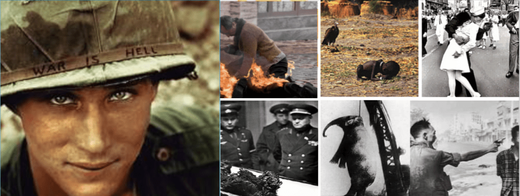


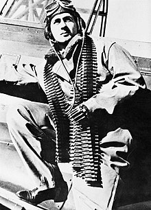


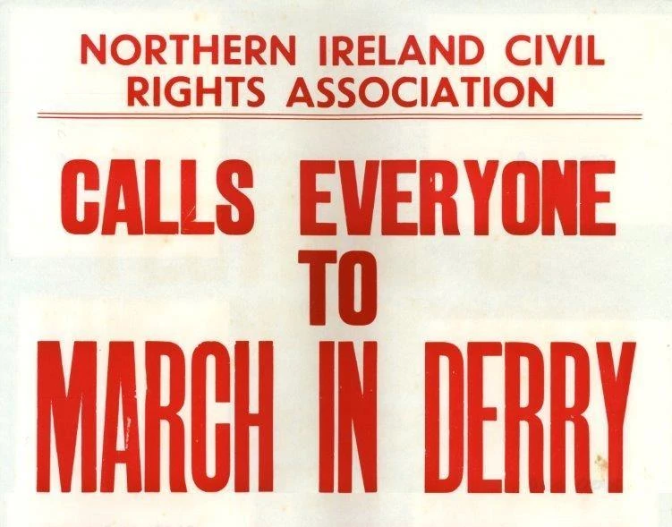


![The West Bank (Arabic: الضفة الغربية aḍ-Ḍiffah al-Ġarbiyyah, Hebrew: הַגָּדָה הַמַּעֲרָבִית, translit. HaGadah HaMa'aravit, Occupied Palestinian Territories.[1]](https://en.wikipedia.org/wiki/File:We-map.png)


