The Battle of Clontarf (Irish: Cath Chluain Tarbh) was a battle that took place on 23 April 1014 at Clontarf, near Dublin, on the east coast of Ireland. It pitted the forces of Brian Boru, high king of Ireland, against a Norse–Irish alliance comprising the forces of Sigtrygg Silkbeard, king of Dublin, Máel Mórda mac Murchada, king of Leinster, and a Viking contingent led by Sigurdof Orkney and Brodir of Mann. It lasted from sunrise to sunset, and ended in a rout of the Viking and Leinster forces. It is estimated that between 7,000 and 10,000 men were killed. Although Brian’s forces were victorious, Brian himself was killed, as were his son Murchad and his grandson Toirdelbach. Leinster king Máel Mórda and Viking leaders Sigurd and Brodir were also slain. After the battle, the Vikings of Dublin were reduced to a secondary power. Brian’s family was temporarily eclipsed, and there was no undisputed high king of Ireland until the late 12th century.
The battle was an important event in Irish history and is recorded in both Irish and Norse chronicles. In Ireland, the battle came to be seen as an event that freed the Irish from foreign domination, and Brian was hailed as a national hero. This view was especially popular during English and British rule in Ireland. Although the battle is today viewed in a more critical light, it still has a hold on popular imagination.[2]
Background
Map of the larger Irish kingdoms in 1014.
The Vikings (or Norsemen) began carrying out raids on Gaelic Ireland in the late eighth century, and over the following few decades they founded a number of settlements along the coast. Vikings first established themselves in Dublin in 838, when they built a fortified area, or longphort, there.[3] During the tenth century Viking Dublin developed into the Kingdom of Dublin—a thriving town and a large area of the surrounding countryside, whose rulers controlled extensive territories in the Irish Sea and, at one time, York.[4] Over time, many Vikings were assimilated into Gaelic society and became the Norse-Gaels. Dublin was closely involved in the affairs of the Kingdom of the Isles, which included the Isle of Man and the Hebrides, and when the Dublin king Amlaíb Cuarán was defeated by Máel Sechnaill mac Domnaill at the Battle of Tara in 980, he was supported by the men of the Isles.[5][6] Amlaíb’s son, Sigtrygg Silkbeard, who was king of Dublin from 990, allied himself with his uncle Máel Mórda mac Murchada, king of Leinster. They met Máel Sechnaill and Brian Boru at the Battle of Glenmama in 999, where they were defeated.[7]
From the time of the seventh-century and the reign of Domnall mac Áedo, the kingship of Tara was a title which was strongly associated with the high kingship of Ireland and was held by members of the Uí Néill dynasty, who controlled the northern half of Ireland.[8] In the tenth century, the Dál gCais, until then a small kingdom in what is now County Clare, began to expand. By the time of his death in 951, Cennétig mac Lorcáin had become king of Thomond. His son, Mathgamain mac Cennétig, was king of Munster when he died in 976.[9] Mathgamain’s brother, Brian Boru, quickly asserted his claim to the kingship of Munster, then invaded Leinster and gained its submission.[10] In 998 he attacked the Uí Néill stronghold of Meath. Máel Sechnaill responded by attacking Munster in 999, and over the following years the two kings struggled for supremacy in Ireland. In 997, Brian and Máel Sechnaill met in Clonfert and reached an agreement where they recognised each other’s reign over their respective halves of the country—Máel Sechnaill in the north and Brian in the south. Brian received the hostages of Leinster and Dublin from Máel Seachnaill, and surrendered the hostages of Connacht to him.[10] The peace was short-lived. After they had jointly defeated the Vikings at Glenmama, Brian resumed his attacks on Máel Seachnaill.[11] He marched on Tara in 1000 with the combined armies of Munster, Osraige, Leinster and Dublin, but after an advance party consisting of the latter two groups was destroyed by Máel Sechnaill, Brian Boru withdrew from the area without giving battle.[12] In 1002 he marched with the same army to Athlone, and took the hostages of Connacht and Meath. He was now the undisputed high king of Ireland.[13]
Revolt of Dublin and Leinster
Brian consolidated his hold on Ireland by eventually obtaining the submission of the northern territories of Cenél nEógain, Cenél Conaill and Ulaid, following a series of circuits of the northern part of the island. He completed the task when, following “a great hosting…by land and sea” into the Uí Néill territory of Cenél Conaill in 1011, the king was brought south to Dál gCais territory to submit to Brian Boru in person at his royal site of Cenn Corad.[14] It was not long, however, before fighting was renewed. Flaithbertach Ua Néill, king of the Cenél nEógain, resented the rise of Brian Boru. Had the old political order persisted, Flaithbertach would have been in line to succeed to the high-kingship. He attacked his Cenél Conaill neighbours in 1012 but, while doing so, Máel Seachnaill attacked the Cenél nEógain inauguration site of Tullahoge. Flaithbertach in turn raided Meath the following year and Máel Sechnaill was forced to back down.[15] Sigtrygg and Máel Mórda took advantage, and themselves raided Meath. Máel Sechnaill sent his army to raid the hinterland north of Dublin as far as Howth but he was defeated. He lost 200 men including his son Flann. Sigtrygg then sent a fleet along the coast to attack the Munster town of Cork, but that was defeated, and Sigtrygg’s nephew was killed.[16] A full-scale conflict was inevitable. Brian brought his army to Leinster in 1013, and camped outside Dublin from September until the end of the year.[17]
No order of battle is given in the contemporary sources; the only leaders named are those who died in the battle. The nearest contemporary accounts are the Annals of Inisfallen and the Annals of Ulster. Among the fallen on Brian’s side, they name the high king himself, his son Murchad and his grandson Toirdelbach, as well as his nephew Conaing, Domnall mac Diarmata of Corcu Baiscind (County Clare), Mac Bethad mac Muiredaig of Ciarraige Luachra (County Kerry), Mael Ruanaidh Ua hEidhin of Uí Fiachrach Aidhne, and Tadhg Ua Cellaigh of Uí Maine (both in south Connacht).[20] On the opposing side are named Máel Morda, Dubgall mac Amlaíb (brother of Sigtrygg), Gilla Ciaráin mac Glún Iairn (probably a nephew of Sigtrygg), Sigurd Hlodvirsson of Orkney, and Brodir, commander of the Viking fleet.[21] No notables from Meath are recorded among the slain; leading to the suggestion that, if present, Máel Sechnaill kept himself and his forces out of harm’s way. But the Annals of Ulster say that Máel Sechnaill and Brian rode together to Dublin, and the Annals of the Four Masters go so far as to say that it was Máel Sechnaill who won the day, and completed the rout after the death of Brian.[22] On the other hand, Cogad Gáedel re Gallaib (“The War of the Irish with the Foreigners”), says that the men of Meath came to the muster with Brian, but “were not faithful to him”.[23]
According to the Cogad, after his arrival at Dublin, Brian sent his forces north across the river to plunder the area known as Fine Gall, and they torched the country as far as Howth. Brian, now in his 70s, did not go with them but stayed behind to pray. The Dublin forces set out by land, and were joined in Clontarf at high tide by the Viking fleet that was in Dublin Bay.[24]
The front line of the Dublin/Leinster forces were the foreign Vikings, led by Brodir, Sigurd and a man called Plait, described as “the bravest knight of all the foreigners”.[25] Behind them were the men of Dublin, commanded by Dubgall mac Amlaíb and Gilla Ciaráin mac Glún Iairn. Behind them again came the Leinstermen, headed by Máel Mórda.[25] Sigtrygg remained in Dublin with enough men to defend it, should the battle go against them. He watched the battle from the walls with his wife Sláine, the daughter of Brian.[26]
At the front of Brian’s forces were the Dál gCais, led by Brian’s son Murchad, Murchad’s 15-year-old son Toirdelbach, Brian’s brother Cudulligh and Domnall mac Diarmata of Corcu Baiscind. Behind them were the other forces of Munster, commanded by Mothla mac Domnaill mic Fáeláin, king of the Déisi Muman, and Magnus mac Amchada, king of Uí Liatháin. Next came the Connachta, led by Mael Ruanaidh Ua hEidhin and Tadhg Ua Cellaigh. To one side of them were Brian’s Viking allies; Fergal ua Ruairc, with the Uí Briúin and the Conmhaícne was placed on the left flank. After the Connachta came Máel Sechnaill and the men of Meath, but (the Cogad says) he had made an agreement with the men of Dublin that if he would not attack them, they would not attack him.[27]
The battle opened with Plait taunting Domnall mac Eimin, a Scottish ally of Brian. The two men marched out into the middle of the field and fought, and both died, “with the sword of each through the heart of the other, and the hair of each in the clenched hand of the other.”[27]
Then the battle proper got under way. It is described in the Cogad as remarkably loud and bloody. The men of Connacht fought the men of Dublin, and the fighting was so fierce that only 100 Connachtmen and twenty Dublinmen survived. The last casualties occurred at “Dubgall’s Bridge”, which Seán Duffy suggests was a bridge over the River Tolka, on the road back to Dublin.[28] Brian’s son Murchad, at the head of the Dál gCais army, took on the foreign Vikings and, according to the Cogad, he himself killed 100 of the enemy—fifty with the sword in his right hand and fifty with the sword in his left.[29] The Vikings wore mail; the Irish did not. Yet the Irish gained the advantage, partly through the use of small spears, which they hurled at the enemy, and partly though numerical superiority.[30]
The battle, which had begun at first light, lasted all day. Eventually, the Dublin/Leinster forces broke, and some withdrew towards their ships, while others made for a nearby wood. However, the tide had come in again, cutting off the passage to the wood, but also carrying off the Viking ships. With no way out, they were killed in large numbers, many of them by drowning.[31]Samuel Haughton, in 1860, calculated that the tide at Clontarf would have been high at 5:30 am and again at 5:55 pm, which is consistent with the account in the Cogad.[32] It was at this point that Brian’s grandson Toirdelbach was killed. He pursued the enemy into the sea, but was hit by a wave and thrown up against the weir, and drowned.[33] Murchad killed Sigurd, the earl of Orkney, but shortly afterwards he himself was killed.[33] Brian was in his tent praying when Brodir found him, and killed him. Brodir himself was then killed.[34]
Aftermath
Viking re-enactors from all over the world at the Battle of Clontarf millennium commemoration in Saint Anne’s Park, Dublin (lining up before charging at the opposition). April 19th, 2014.
Brian’s body was brought to Swords, north of Dublin. There it was met by the coarb of Patrick, the traditional head of the church in Ireland, who brought the body back with him to Armagh, where it was interred after twelve days of mourning. Along with Brian were the body of Murchad and the heads of Conaing, Brian’s nephew, and Mothla, king of the Déisi Muman.[35] Máel Sechnaill was restored as high king of Ireland, and remained secure in his position until his death in 1022.[36]
Though the Annals imply that life was not much changed after the death of Brian Boru, it created a succession crisis, as Brian’s son and heir Murchad had died as well. Brian had two remaining sons who could challenge for the kingship: Donnchad mac Briain, his son with Gormflaith and Tadc mac Briain, his son with Echrad. According to the annals, Donnchad rallied the forces of the Dál gCais at Clontarf and lead them home to Cenn Corad.[37]
Within weeks the Dál gCais, under the new leadership of Donnchad, were battling their old masters the Eóganacht Raithlind. Tadc initially joined his brother against the Eóganacht, but would eventually be killed in 1023 at the order of Donnchad.[37]
Sigtrygg remained king of Dublin until 1036, and was apparently secure enough to go on pilgrimage to Rome in 1028.[38] However, after Clontarf, Dublin had been reduced to a lesser power. In 1052, Diarmait mac Máel na mBó, king of Leinster, captured Dublin and Fine Gall, for the first time asserting Irish overlordship over the Norse of Ireland.[39]
Jules Bianchi was a French motor racing driver who was most recently a driver for Marussia F1 in the FIA Formula One World Championship. He lost his life after succumbing to head injuries sustained in an accident at the 2014 Japanese Grand Prix.
On lap 43 of the 2014 Japanese Grand Prix, which was held on Sunday, 5 October, under intermittent heavy rainfall caused by the approaching Typhoon Phanfone, Bianchi lost control of his car and veered right towards the run-off area on the outside of the Dunlop Curve (technically known as “Turn 7”) of the Suzuka Circuit. He collided head-on with, and perpendicular to, the rear of a tractor crane tending to the removal of Adrian Sutil‘s Sauber after Sutil had spun out of control and crashed in the same area a lap before. Bianchi’s accident caused the race to be red flagged and ended nine laps earlier than the 53-lap full race distance. Bianchi was reported as being unconscious after not responding to either a team radio call or marshals. Spectators’ video footage and photographs of the accident revealed that the left side of Bianchi’s Marussia car was extensively damaged and the roll bar destroyed as it slid under the tractor crane. The impact was such that the tractor crane was partially jolted off the ground causing Sutil’s Sauber, which was suspended in the air by the crane, to fall back to the ground.[43]
In the first instance, Bianchi was medically attended to at the crash site before being transported by ambulance to the circuit’s Medical Centre. Due to safety concerns with landing caused by the precarious weather conditions, it was determined that emergency transport by helicopter was not possible. Bianchi was thus further transported by ambulance for 32 minutes,[44] under police escort, to the Mie Prefectural General Medical Center in Yokkaichi, the nearest hospital to the circuit some 15 km (9.3 mi) away.[45][46][47] Initial reports by his father, Philippe, to television channel France 3, were that Bianchi was in critical condition with a head injury and was undergoing an operation to reduce severe bruising to his head.[48] The FIA subsequently released a statement that CT scans showed Bianchi suffered a “severe head injury” in the crash, and that he would be admitted to intensive care following surgery.[2][49]
Amongst the first hospital visitors were Marussia’s CEO Graeme Lowdon and team principal John Booth, the latter staying by Bianchi’s side even after the inaugural Russian Grand Prix, as well as Ferrari’s then team principal Marco Mattiacci – given Bianchi’s status as a Ferrari Academy driver – and current Formula One driver, Felipe Massa. On the Monday after the Suzuka race, also seen visiting the Mie University were Pastor Maldonado and Bianchi’s manager and assistant manager, Nicolas Todt and Alessandro Alunni Bravi, respectively.[50]
Bianchi’s parents, who arrived in Japan late on Monday – joined, that Thursday, by their other children, Mélanie and Tom, and Jules’ best friend, Lorenz Leclerc[51] – released a statement on Tuesday, 7 October, expressing appreciation for the outpouring of support from the public and for the presence of Professor Gerard Saillant, President of the FIA Medical Commission, and Professor Alessandro Frati, Neurosurgeon of the Sapienza University of Rome, who travelled to Japan at the request of Scuderia Ferrari. They also provided a medical update, confirming that the injury suffered was a diffuse axonal injury and that Bianchi was in a critical but stable condition.[3][52][53] A prognosis of the injury or its after-effects would not be known for weeks or at least a month according to medical specialists.[54]
Within days of the accident, unconfirmed media reports suggested that the crash occurred at a speed exceeding 200 km/h (120 mph)[55] and that the impact generated over 50 g0 (490 m/s2).[56] In the following fortnight, media reports said to be based on information obtained from FIA documents claimed that the speed of impact was recorded at 212 km/h (132 mph)[57] and that the impact generated 92 g0 (900 m/s2).[58]
Bianchi’s crash was the second major accident for the Marussia F1 team within three years; previously, in 2012, at the FIA-approved Duxford Aerodrome testing facility, reserve driver Maria De Villota suffered major head injuries after colliding with a stationary truck, upon returning to the service area from straight-line testing.[59]
Team reactions
The Monday after the Japanese Grand Prix, in which Bianchi suffered severe head injuries, then outgoing Ferrari President, Luca di Montezemolo, disclosed to the media that Bianchi was poised to be the third Ferrari F1 driver in 2015 in the event that the sport moved to three car teams as widely speculated at the time.[60]
At the inaugural Russian Grand Prix on 12 October 2014, in place of the hospitalised Bianchi, the Marussia team originally registered in the participant list the American debutant, Alexander Rossi, before finally deciding to field a single car driven by Bianchi’s team-mate, Max Chilton.[61] In addition, at the same venue:
Fellow Frenchman and Formula One driver, Jean-Eric Vergne, a good friend of Bianchi and was said to have been deeply affected by the Suzuka accident, championed the idea for helmet stickers to honour and support Bianchi.[62]
The Marussia team adopted a “#JB17” livery on the cockpit sides of its MR03 car, being a reference to their injured driver’s initials and race number, in addition to the other Twitter hashtag since the accident, #ForzaJules.
The drivers held a one-minute silence in honour of Bianchi just before the race; the eventual race winner, Lewis Hamilton, dedicated his win to Bianchi.
During the subsequent week of 13 October 2014, Marussia’s CEO Graeme Lowdon confirmed that the team would return to a two-car operation for the remainder of the season. At heart, was the team’s desire to defend their ninth position in the Constructors’ Championship, which was owed to Bianchi thanks to scoring his own and Marussia’s first ever points at the Monaco Grand Prix.[63] However, on 25 October 2014, it was announced that the team would not race at the United States Grand Prix due to financial reasons, with doubts also raised about their ability to participate at the Brazilian Grand Prix.[64] Ultimately, the team folded on 7 November 2014 as announced by its administrator.[65] Bianchi finished the season 17th in the Drivers’ Championship.
FIA reaction
Following Bianchi’s accident, the FIA began an investigation and also considered appropriate changes to safety procedures, such as those at Brazilian Grand Prix, where the location of a tractor crane serving the Senna “S” chicane was altered.
The FIA released its initial findings at a special conference held during the inaugural Russian Grand Prix on the Saturday after the Japanese Grand Prix weekend. Among other things, it was revealed that Bianchi had slowed down at Turn 7 but without disclosing by what margin or the speed of impact, and that the journey to the hospital by ambulance took only an extra seven minutes relative to the helicopter, without any adverse effects on Bianchi’s condition.
Further, the FIA confirmed ongoing research into closed cockpits for Formula One cars, the possibility of fitting protective skirting to all recovery vehicles as well as ways to slow down cars in crash zones more effectively than double yellow flags. With respect to the latter, the FIA moved to quickly consider the introduction of a virtual safety car – or VSC system – which was then tested during the season’s final three Grands Prix in the United States, Brazil and Abu Dhabi – based on a Le Mans racing “slow zone” arrangement that does not neutralise race proceedings as much as safety car periods.[66]
Following on from the above, in the week beginning 13 October 2014, the FIA reportedly emailed all teams to request that they retain any information related to Bianchi’s Suzuka accident, for exclusive use by an accident panel established by the FIA to investigate Bianchi’s accident.[67]
In the week beginning 27 October 2014, Italy’s Autosprint published a story claiming that the accident panel was looking into whether Bianchi’s crash may have been caused by the new-for-2014 brake-by-wire system fitted to all F1 cars. At the same time, the Swiss newspaper Blick reported that a company called Air Zermatt presented to the FIA a proposal for stricken cars to be air lifted from run off areas by helicopter thus avoiding recovery vehicles being on track during any race.[70] This method was first tested in 2005 by the A1 Grand Prix series.[71]
The FIA accident panel presented its 396 page report to the FIA World Motorsport Council; the FIA published a summary of its findings on 3 December 2014.[69] The report was said to contain extensive technical explanations and to have been written in a manner that did not apportion blame to any one party:[72]
Accordingly, the panel found that there was no single cause for Bianchi’s accident but that it was the result of an unfortunate set of circumstances, including the difficult conditions, the speed he was going and the presence of a recovery vehicle on track;
Bianchi was found to not have slowed sufficiently to avoid losing control, however, it was recognised that there is no definition of how much a driver should slow during double waved yellow flags and that it had been normal practice for F1 drivers to slow down only enough for them to show they have done so should they be questioned later;
In relation to whether a safety car should have been deployed, the conclusion was that it had become normal and accepted practice not to do so in situations such as Sutil’s crash, with race officials found to have behaved in a manner “consistent with the regulations and their interpretation following 384 incidents in the preceding eight years”.
In spite of the above, a new virtual safety car (VSC) system was confirmed for introduction in F1 from 2015;
The panel also concluded that “It is not feasible to mitigate the injuries Bianchi suffered by either enclosing the driver’s cockpit, or fitting skirts to the crane” as “Neither approach is practical due to the very large forces involved in the accident between a 700kg car striking a 6500kg crane at a speed of 126 km/h”.
Brake-by-wire, which was introduced in 2014 as a part of the new hybrid engines’ regenerative braking system, also came under examination. The investigation revealed that Bianchi had been operating both brake and accelerator pedals as the car was leaving the track and crossed Suzuka’s Turn 7 run-off area, and that a fail-safe system should have over-ridden the throttle and cut engine power. This fail-safe system is part of the standard electronic control unit supplied to the teams by the FIA, but its parameters are set by the teams given that the ability to operate brake and throttle at the same time is an integral part of a driver’s car control during racing. The panel found that, just because the fail-safe system did not work in these specific circumstances, it did not mean that the Marussia team was culpable in any way. Nevertheless, for 2015 onwards, the FIA decided to define more specifically the boundaries within which teams can alter relevant parameters.
Medical treatment and updates
The first family update following the 5 October 2014 accident during the Japanese Grand Prix came from Bianchi’s father during the week beginning 13 October 2014. He was reported to have stated to Italy’s La Gazzetta dello Sport, that his son’s condition was “desperate”, with doctors describing his survival as a miracle, and that he believed his son would succeed in “the most important qualifying lap of his life”, also drawing hope from Michael Schumacher coming out of his coma.[73] Over the same period, other than providing an official statement on Bianchi’s conditions, the Marussia team also publicly condemned various media reports making speculative assertions about the team’s direct role in the accident.[74]
Since then, Bianchi’s mother, Christine, was said to have voiced her frustrations to an RTL correspondent about not being able to talk, but referring to people shirking responsibility and confirming that her son was being very well treated in hospital.[75]
A week later, Italy’s Omnicorse published a story which claimed that Bianchi’s condition was stable enough for relocation from Japan to Europe, speculating hospitalisation at the Swiss University Hospital of Lausanne (CHUV) where Michael Schumacher received treatment for significant brain injuries suffered following a skiing accident in 2013.[70] In response, via another joint statement by the Bianchi family and the Marussia team on the evening of the United States Grand Prix, it was reconfirmed that Bianchi was still in a critical but stable condition and that his treatment would continue in Yokkaichi, Japan.[76]
Coinciding with the Brazilian Grand Prix weekend, and amidst talks of Marussia’s return from administration for the season finale, the former team CEO, Graeme Lowdon, confirmed that Bianchi’s condition remained unchanged, being stable but critical.[77] He was still in a coma and requiring a medical ventilator.[78] On 19 November, Bianchi’s parents announced that he was no longer in an artificial coma and was breathing unaided. He was flown back to France and admitted at the Centre Hospitalier Universitaire de Nice (CHU), where he remained unconscious and in a critical condition.[79]
In December 2014, a statement from the Bianchi family confirmed no change in Bianchi’s neurological status. In addition, they confirmed that they considered his relocation to France and rehabilitation at the CHU to have been a significant and very comforting step, and they also renewed their thanks for the ongoing support received.[80]
Autoweek reported on 6 March 2015 that, according to the German tabloid Bild, Bianchi remained in a coma with no improvement in his condition.[81]
After the 2015 Australian Grand Prix in March, John Booth, now team principal of the new Manor Marussia F1 Team, paid tribute to Bianchi for scoring points in the 2014 Monaco Grand Prix because the prize money won enabled the team to stay in F1, albeit under a new corporate structure.[82] A commemorative “JB17” logo adorned the 2015 race car.[83]
In April 2015, to again acknowledge the support his family was receiving, Bianchi’s father, Philippe, released an interview to the French newspaper, Nice-Matin. Apart from reconfirming that his son remained in a coma and was medically stable, Philippe described Bianchi’s plight as a daily marathon. He referred to the stark medical advice by Japanese doctors of irreversible damage, contrasting this with the hope brought by seeing Bianchi more active through occasional body movements. Philippe emphasised that although there was no specific therapy, the importance of ongoing support was provided by the daily vigil shared amongst Bianchi’s parents, siblings and German girlfriend, Gina.[84][85]
Coinciding with the 2015 Monaco Grand Prix and the anniversary of Bianchi scoring his first and only Formula One points, the Manor Marussia team commemorated their injured driver with special red wristbands inscribed with “Monaco 2014 P8 JB17”.[86] Moreover, Bianchi’s father provided an update describing his injured son’s condition as “stagnant” notwithstanding which the family continued to hope for a miraculous recovery.[87] On 13 July 2015, however, in another update the father of the injured driver conceded becoming “less optimistic” with the lapse of time and no better progress.[88]
The official announcement was made by his family via a statement released in France, in the early hours of the following day. It commenced stating:[90]
It is with deep sadness that the parents of Jules Bianchi, Philippe and Christine, his brother Tom and sister Mélanie, wish to make it known that Jules passed away last night at the Centre Hospitalier Universitaire (CHU) in Nice, (France) where he was admitted following the accident of 5 October 2014 at Suzuka Circuit during the Japanese Formula 1 Grand Prix.
The family went on to thank treating doctors and supporters, wishing for privacy to mourn in peace.[91]
In addition to McCullough’s dogged, relentless attacking style,[2] he was renowned for his cast-iron chin, having taken on two of boxing’s biggest punchers in Naseem Hamed and Erik Morales, and going the full distance with both of them. During his bout with Morales in 1999, HBO commentator Larry Merchant joked, “If you look in the dictionary, under ‘Tough Irishman’, you’ll find a picture of Wayne McCullough”. McCullough was never once knocked down or stopped by a fighter in his whole professional career.[3]
Amateur career
McCullough had a very successful amateur career, amassing a record of 319 wins and 11 defeats, with over 100 wins coming by way of knockout. As an amateur living in the staunchly loyalistShankill Road area of Belfast, McCullough was selected by the island-wide Irish Amateur Boxing Association to participate in the 1988 Summer Olympics in Seoul, Korea, and was asked to carry the Irish flag because he was the youngest member of the team at 18 years old. He went on to win a silver medal for Ireland at the 1992 Summer Olympics in Barcelona. Representing Northern Ireland at the 1990 Commonwealth Games in Auckland, he won a gold medal and carried the Northern Ireland flag in the closing ceremony.[4] The medal ceremony for his Commonwealth title was marked by an unusual incident. A technical problem with the public address system made it impossible to play the recording of the song “Danny Boy“, used instead of an anthem for medalists from Northern Ireland. The New Zealand official in charge of the sound, Bob Gibson, promptly took the microphone and sang the song unaccompanied.[5] In 1990, McCullough also won Bronze for Ireland at the Boxing World Cup in Mumbai, India.
In 1993 McCullough moved to Las Vegas to train under Eddie Futch, who agreed to train him after seeing him at the Olympics. McCullough always fought in neutral colours and did not have national anthems played at his fights; his supporters in Northern Ireland included Protestants and Catholics. Within a year of turning pro, he had won the North American Boxing Federation title. On 30 July 1995, less than 2½ years since his pro debut, he won the WBC championship by beating the champion Yasuei Yakushiji in Nagoya, Japan to become Ireland’s first ever WBC world champion. He was the first (and to date the only) fighter from Ireland or the UK to travel to Japan and win a belt.
McCullough defended his title twice before vacating the belt and moving up in weight to challenge WBCsuper bantamweight champion Daniel Zaragoza, but lost via a split decision in the WBC “Fight of the Year”. After this fight, his wife Cheryl and Stuart Campbell began to manage his career when his original manager, Mat Tinley, became a boxing promoter.
McCullough unsuccessfully challenged champions Naseem Hamed in 1998, and Erik Morales in 1999. In each of those exciting “Fight of the Year” contenders, he broke his opponent’s lengthy run of KO wins while taking them the distance. Hamed had knocked out 18 opponents straight before McCullough, and was 30-0 at the time with 28 knockouts to his credit. Morales had knocked out 9 of his previous 9 opponents and was 34-0 at the time, also with 28 knockouts. Morales stated that McCullough gave him one of the top three fights of his career and almost quit on his stool after the 9th round (according to Ring magazine).
In October 2000, McCullough was to return to his native Belfast for a homecoming fight. Two days before the fight was scheduled to take place, he was told that he had a cyst on his brain, he couldn’t fight again and that one more blow to the head could kill him. McCullough flew back to Las Vegas and was advised by the Nevada Commission to visit the neurosurgery department at UCLA for a more thorough investigation. Within a few weeks the doctor at UCLA, Neil Martin, called to say he had consulted with some of the top neurosurgeons in the USA and they had come to the conclusion that the cyst was not on his brain, but in a space between the brain and the skull – called the arachnoid mater – and that he saw no reason for him to give up his boxing career.
Nevertheless, the British Boxing Board of Control (BBBC) continued to deny him a license. He was relicensed in Nevada and fought again in January 2002. After a very public battle, the BBBC could no longer deny him a license and later that same year McCullough stepped back into a British ring under the Frank Warren Promotions banner.[6] Thereafter he had mixed success, winning five fights but losing to Scott Harrison and Mexican world champion Óscar Larios on two occasions. The result of his first fight with Larios is widely disputed.[7][8]
On 17 August 2005 McCullough was appointed the first WBC World Ambassador for Peace and Goodwill in Sports.
In September 2005, McCullough became a United States citizen.[9] In November 2005, McCullough released his autobiography, Pocket Rocket: Don’t Quit, in the UK and Ireland. He went on a publicity tour to promote the book, which reached Number 2 on the best sellers list.
McCullough had not fought for over two years and the Kings Hall venue was sold out for the fight. It was agreed that the non-title fight would take place at 8 st 12 lb mark. However, on the day before the fight there was uproar during the weigh-in and the fight was cancelled by the BBBC amid chaotic scenes.[11]
McCullough had already contracted to fight at 2 lb over the 8 st 10 lb championship weight and he weighed in at 8 st 9 lb. However, Martínez failed to make the agreed weight and was 1.75 lb over the agreed weight.[11][11]
Martínez was given a couple of hours to shed the excess weight, but did not return to weigh in again and the scales were closed by a BBBC official. A furious McCullough stated “I couldn’t believe it. He comes in over the weight and then after being asked to take it off he just sits there and does nothing. I just can’t believe what has happened. I was ready to fight and ready to win and he comes in that much over the weight.”[11][12]
Retirement
On 20 June 2008, McCullough fought Juan Ruiz in the Cayman Islands, his first fight in three years. He lost in six rounds, retiring on his stool. Despite being ahead on two of three judges’ scorecards after six rounds, he told his corner he could not go on due to an injury he had sustained in training.
The Belfast boxer took the microphone and revealed this might be his swansong. He said: “I think this could be my last fight and I want to thank you all for coming. I am disappointed with the way things went but I just felt I could not go on.”
Personal life
In May 2004, McCullough changed his name by deed poll to “Wayne Pocket Rocket McCullough”.[13] Today he resides in Las Vegas, Nevada and coaches around the LA area.
Meet Kim Jong II, leader of North Korea – a nation imprisoned by poverty and with a population so hungry, people eat bugs and grass. Now this megalomaniacal dictator is holding the civilized world hostage with what many see as a cunning strategy of extortion, threatening to develop an arsenal of nuclear weapons. It’s a strategy by which the United States has indicated it cannot abide
North Korea (listen), officially the Democratic People’s Republic of Korea (DPRK; Chosŏn’gŭl: 조선민주주의인민공화국; hancha: 朝鮮民主主義人民共和國; MR: Chosŏn Minjujuŭi Inmin Konghwaguk), is a country in East Asia, in the northern part of the Korean Peninsula. The capital and largest city is Pyongyang. North Korea shares a land border with China to the north and north-west, along the Amnok (Yalu) and Tumen rivers. A small section of the Tumen River also forms North Korea’s border with Russia to the northeast.[5] The Korean Demilitarized Zone marks the boundary between North Korea and South Korea. The legitimacy of this border is not accepted by either side, as both states claim to be the legitimate government of the entire peninsula.
Over time North Korea has gradually distanced itself from the world communist movement. Juche, an ideology of national self-reliance, was introduced into the constitution as a “creative application of Marxism–Leninism” in 1972.[26][27] In 2009, the constitution was amended again, removing the brief references to communism (Chosŏn’gŭl: 공산주의).[28]
The means of production are owned by the state through state-run enterprises and collectivized farms, and most services such as healthcare, education, housing and food production are state funded or subsidized.[29] In the 1990s, North Korea suffered from a famine and continues to struggle with food production.[30]
The name Korea derives from Goryeo, itself referring to the ancient kingdom of Goguryeo, the first Korean dynasty visited by Persian merchants who referred to Koryŏ (Goryeo; 고려) as Korea.[35] The term Koryŏ also widely became used to refer to Goguryeo, which renamed itself Koryŏ in the 5th century.[36] (The modern spelling, “Korea“, first appeared in late 17th century in the travel writings of the Dutch East India Company‘s Hendrick Hamel.[36]). Despite the coexistence of the spellings Corea and Korea in 19th century publications, some Koreans believe that Japan, around the time of the Japanese occupation, intentionally standardised the spelling on Korea, making Japan appear first alphabetically.[37] Other commentators have pointed out that Japan continued to refer to Korea as “Corea” and “Chosen,” even after Japan absorbed Korea, and that Japan would have had no need to concern itself with Korea’s alphabetical position in international forums, considering that Japan had absorbed Korea, and thus Korea ceased to appear as an independent entity in international forums.[38]
After Goryeo fell in 1392, Joseon became the official name for the entire territory, though it was not universally accepted. The new official name has its origin in the ancient country of Gojoseon (Old Joseon). In 1897, the Joseon dynasty changed the official name of the country from Joseon to Daehan Jeguk (Korean Empire). The name Daehan, which means “great Han” literally, derives from Samhan (Three Hans). However, the name Joseon was still widely used by Koreans to refer to their country, though it was no longer the official name. Under Japanese rule, the two names Han and Joseon coexisted. There were several groups who fought for independence, the most notable being the Provisional Government of the Republic of Korea.
Korean history begins with the founding of Joseon (often known as “Gojoseon” to prevent confusion with another dynasty founded in the 13th century; the prefix Go- means ‘older,’ ‘before,’ or ‘earlier’) in 2333 BC by Dangun, according to Korean foundation mythology.[39] Gojoseon expanded until it controlled northern Korean Peninsula and some parts of Manchuria. The Gija Joseon was purportedly founded in 12th century BC, and its existence and role have been controversial in the modern era.[40] In the 2nd century BC, Wiman Joseon which fell to the Han China near the end of the century. Later the Han Dynasty defeated the Wiman Joseon and set up Four Commanderies of Han in 108 BC. There was a significant Chinese presence in northern parts of the Korean peninsula during the next century, and the Lelang Commandery persisted for about 400 years until it was conquered by Goguryeo.[41] After many conflicts with the Chinese Han Dynasty, Gojoseon disintegrated, leading to the Proto–Three Kingdoms of Korea period.
In the early centuries of the Common Era, Buyeo, Okjeo, Dongye, and the Samhan confederacy occupied the peninsula and southern Manchuria. Of the various states, Goguryeo, Baekje, and Silla grew to control the peninsula as Three Kingdoms of Korea. The unification of the Three Kingdoms by Silla in 676 led to the North South States Period, in which much of the Korean Peninsula was controlled by Unified Silla, while Balhae succeeded to have the control of northern parts of Goguryeo.
In Unified Silla, poetry and art was encouraged, and Buddhist culture thrived. Relationships between Korea and China remained relatively peaceful during this time. However, Unified Silla weakened under internal strife, and surrendered to Goryeo in 935. Balhae, Silla’s neighbor to the north, was formed as a successor state to Goguryeo. During its height, Balhae controlled most of Manchuria and parts of Russian Far East. It fell to the Khitan in 926.
The peninsula was united by King Taejo of Goryeo in 936. Like Silla, Goryeo was a highly cultural state and created the Jikji in 1377, using the world’s oldest movable metal type printing press.[42] The Mongol invasions in the 13th century greatly weakened Goryeo. After nearly 30 years of war, Goryeo continued to rule Korea, though as a tributary ally to the Mongols. After the Mongolian Empire collapsed, severe political strife followed and the Goryeo Dynasty was replaced by the Joseon Dynasty in 1392, following a rebellion by General Yi Seong-gye.
King Taejo declared the new name of Korea as “Joseon” in reference to Gojoseon, and moved the capital to Hanseong (old name of Seoul). The first 200 years of the Joseon Dynasty were marked by relative peace and saw the creation of Hangul by King Sejong the Great in the 15th century and the rise in influence of Confucianism in the country.
Between 1592 and 1598, Japan invaded Korea. Toyotomi Hideyoshi led the Japanese forces, but his advance was halted by Korean forces with assistance from Righteous army militias and Ming Dynasty Chinese troops. Through a series of successful battles of attrition, the Japanese forces were eventually forced to withdraw, and subsequently signed a peace agreement with diplomats of Ming China. This war also saw the rise of Admiral Yi Sun-sin and his renowned “turtle ship“. In the 1620s and 1630s, Joseon suffered from invasions by the Manchu which eventually extended to China as well.
After another series of wars against Manchuria, Joseon experienced a nearly 200-year period of peace. King Yeongjo and King Jeongjo particularly led a new renaissance of the Joseon Dynasty.
Three Koreans shot for pulling up rails as a protest against seizure of land without payment by the Japanese
The latter years of the Joseon Dynasty were marked by isolation from the outside world. During the 19th century, Korea’s isolationist policy earned it the name the “Hermit Kingdom“. The Joseon Dynasty tried to protect itself against Western imperialism, but was eventually forced to open trade. After the First Sino-Japanese War and the Russo-Japanese War, Korea was occupied by Japan (1910–45).
Japan tried to suppress Korean traditions and culture and ran the economy primarily for its own benefit. Anti-Japanese, pro-liberation rallies took place nationwide on 1 March 1919 (the March 1st Movement). About 7,000 people were killed during the suppression of this movement. Continued anti-Japanese uprisings, such as the nationwide uprising of students in 1929, led to the strengthening of military rule in 1931. After the outbreaks of the Sino-Japanese War in 1937 and World War II, Japan stepped up efforts to extinguish Korean culture.
Koreans were forced to adopt Japanese names. Worship at Japanese Shinto shrines was made compulsory. The school curriculum was radically modified to eliminate teaching in the Korean language and history. Numerous Korean cultural artifacts were destroyed or taken to Japan. Resistance groups known as Dongnipgun (Liberation Army) operated along the Sino-Korean border, fighting guerrilla warfare against Japanese forces. Some of them took part in allied action in China and parts of South East Asia. One of the guerrilla leaders was the communist Kim Il-sung, who later became the leader of North Korea.
During World War II, Koreans at home were forced to support the Japanese war effort. Tens of thousands of men were conscripted into Japan’s military. Around 200,000 girls and women, many from Korea, were forced to engage in sexual services for the Japanese military, with the euphemism “comfort women“.
Suspected communist sympathizers awaiting execution, Jeju in May 1948
At the end of World War II in 1945, the Korean peninsula was divided into two zones along the 38th parallel, with the northern half of the peninsula occupied by the Soviet Union and the southern half by the United States. Initial hopes for a unified, independent Korea evaporated as the politics of the Cold War resulted in the establishment of two separate states with diametrically opposed political, economic, and social systems.
Soviet General Terentii Shtykov recommended the establishment of the Soviet Civil Authority in October 1945, and supported Kim Il-sung as chairman of the Provisional People’s Committee for North Korea, established in February 1946. During the provisional government, Shtykov’s chief accomplishment was a sweeping land reform program that broke North Korea’s stratified class system. Landlords and Japanese collaborators fled to the South, where there was no land reform and sporadic unrest. Shtykov nationalized key industries and led the Soviet delegation to talks on the future of Korea in Moscow and Seoul.[43][44][45][46][47] In September 1946, South Korean citizens had risen up against the Allied Military Government. In April 1948, an uprising of the Jeju islanders was violently crushed. The South declared its statehood in May 1948 and two months later the ardent anti-communist Syngman Rhee became its ruler. The Democratic People’s Republic of Korea was established in the North on 9 September 1948. Shtykov served as the first Soviet Ambassador, while Kim Il-sung became Premier.
Soviet forces withdrew from the North in 1948 and most American forces withdrew from the South the following year. Ambassador Shtykov suspected Rhee was planning to invade the North, and was sympathetic to Kim’s goal of Korean unification under socialism. The two successfully lobbied Joseph Stalin to support a short blitzkrieg of the South, which culminated in the outbreak of the Korean War.[43][44][45][46]
Civilians killed by North Korean forces near Hamhung, October 1950
The military of North Korea invaded the South on 25 June 1950, and swiftly overran most of the country. A United Nations force, led by the United States, intervened to defend the South, and rapidly advanced into North Korea. As they neared the border with China, Chinese forces intervened on behalf of North Korea, shifting the balance of the war again. Fighting ended on 27 July 1953, with an armistice that approximately restored the original boundaries between North and South Korea. More than one million civilians and soldiers were killed in the war. As a result of the war, almost every substantial building in North Korea was destroyed.[48][49]
Although some have referred to the conflict as a civil war, other important factors were involved.[50] The Korean War was also the first armed confrontation of the Cold War and set the standard for many later conflicts. It is often viewed as an example of the proxy war, where the two superpowers would fight in another country, forcing the people in that country to suffer most of the destruction and death involved in a war between such large nations. The superpowers avoided descending into an all-out war against one another, as well as the mutual use of nuclear weapons. It also expanded the Cold War, which to that point had mostly been concerned with Europe.
A heavily guarded demilitarized zone (DMZ) still divides the peninsula, and an anti-communist and anti-North Korea sentiment remains in South Korea. Since the war, the United States has maintained a strong military presence in the South which is depicted by the North Korean government as an imperialist occupation force.[51]
The relative peace between the South and the North following the armistice was interrupted by border skirmishes, celebrity abductions, and assassination attempts. The North failed in several assassination attempts on South Korean leaders, most notably in 1968, 1974 and the Rangoon bombing in 1983; tunnels were frequently found under the DMZ and war nearly broke out over the axe murder incident at Panmunjom in 1976.[52] In 1973, extremely secret, high-level contacts began to be conducted through the offices of the Red Cross, but ended after the Panmunjom incident, with little progress having been made and the idea that the two Koreas would join international organizations separately.[clarification needed][53]
During the 1956 August Faction Incident, Kim Il-sung successfully resisted efforts by the Soviet Union and China to depose him in favor of Soviet Koreans or the pro-Chinese Yanan faction. [54][55] The last Chinese troops withdrew from the country in October 1958, which is the consensus as the latest date when North Korea became effectively independent, though some scholars believe that the 1956 August incident demonstrated independence.[55][54][56] North Korea remained closely aligned to China and the Soviet Union, and the Sino-Soviet split allowed Kim to play the powers off each other. North Korea sought[57] to become a leader of the Non-Aligned Movement, and emphasized the ideology of Juche to distinguish it from both the Soviet Union and China.[58]
Recovery from the war was quick — by 1957 industrial production reached 1949 levels. In 1959, relations with Japan had improved somewhat, and North Korea began allowing the repatriation of Japanese citizens in the country. The same year, North Korea revalued the North Korean won, which held greater value than its South Korean counterpart. Until the 1960s, economic growth was higher than in South Korea, and North Korean GDP per capita was equal to that of its southern neighbor as late as 1976.[59]
In the early 1970s China began normalizing its relations with the West, particularly the U.S., and reevaluating its relations with North Korea. The diplomatic problems culminated in 1976 with the death of Mao Zedong. In response, Kim Il-sung began severing ties with China and reemphasizing national and economic self-reliance enshrined in his Juche Idea, which promoted producing everything within the country. By the 1980s the economy had begun to stagnate, started its long decline in 1987, and almost completely collapsed after the dissolution of the Soviet Union in 1991 when all Russian aid was suddenly halted. The North began reestablishing trade relations with China shortly thereafter, but the Chinese could not afford to provide enough food aid to meet demand.
The Arduous March
In 1992, as Kim Il-sung’s health began deteriorating, Kim Jong-il slowly began taking over various state tasks. Kim Il-sung died of a heart attack in 1994, in the midst of a standoff with the United States over North Korean nuclear weapon development. Kim declared a three-year period of national mourning before officially announcing his position as the new leader.
North Korean efforts to build nuclear weapons were halted by the Agreed Framework, negotiations with U.S. president Bill Clinton. Kim Jong-il instituted a policy called Songun, or “military first”. There is much speculation about this policy being used as a strategy to strengthen the military while discouraging coup attempts. Restrictions on travel were tightened and the state security apparatus was strengthened.
Flooding in the mid-1990s exacerbated the economic crisis, severely damaging crops and infrastructure and led to widespread famine which the government proved incapable of curtailing. In 1996, the government accepted UN food aid. Since the outbreak of the famine, the government has reluctantly tolerated illegal black markets while officially maintaining a state socialist economy. Corruption flourished and disillusionment with the regime spread.
North Korean women present gifts to South Korean business tycoon Chung Ju-yung, 1998
In the late 1990s, North Korea began making attempts at normalizing relations with the West and continuously renegotiating disarmament deals with U.S. officials in exchange for economic aid. At the same time, building on Nordpolitik, South Korea began to engage with the North as part of its Sunshine Policy.[60][61]
21st century
The international environment changed with the election of U.S. president George W. Bush in 2001. His administration rejected South Korea’s Sunshine Policy and the Agreed Framework. The U.S. government treated North Korea as a rogue state, while North Korea redoubled its efforts to acquire nuclear weapons to avoid the fate of Iraq.[62][63][64]
North Koreans bowing in front of statues of Kim Il-sung (left) and Kim Jong-il
In August 2009, former U.S. president Bill Clinton met with Kim Jong-il to secure the release of two American journalists who had been sentenced for entering the country illegally.[67] Current U.S. president Barack Obama‘s position towards North Korea has been to resist making deals with North Korea for the sake of defusing tension, a policy known as “strategic patience.”[68]
On 17 December 2011, the supreme leader of North Korea Kim Jong-il died from a heart attack.[72] His youngest son Kim Jong-un was announced as his successor.
North Korea occupies the northern portion of the Korean Peninsula, lying between latitudes 37° and 43°N, and longitudes 124° and 131°E. It covers an area of 120,540 square kilometres (46,541 sq mi). North Korea shares land borders with China and Russia to the north, and borders South Korea along the Korean Demilitarized Zone. To its west are the Yellow Sea and Korea Bay, and to its east lies Japan across the Sea of Japan (East Sea of Korea).
The capital and largest city is Pyongyang; other major cities include Kaesong in the south, Sinuiju in the northwest, Wonsan and Hamhung in the east and Chongjin in the northeast.
Early European visitors to Korea remarked that the country resembled “a sea in a heavy gale” because of the many successive mountain ranges that crisscross the peninsula.[78] Some 80% of North Korea is composed of mountains and uplands, separated by deep and narrow valleys. All of the Korean Peninsula’s mountains with elevations of 2,000 meters (6,600 ft) or more are located in North Korea. The coastal plains are wide in the west and discontinuous in the east. A great majority of the population lives in the plains and lowlands. According to a United Nations Environmental Programme report in 2003, forest covers over 70 percent of the country, mostly on steep slopes.[79] The longest river is the Amnok (Yalu) River which flows for 790 kilometres (491 mi).[80]
The highest point in North Korea is Baekdu Mountain, a volcanic mountain which forms part of the Chinese/North Korean border with basaltlavaplateau with elevations between 1,400 and 2,744 meters (4,593 and 9,003 ft) above sea level.[78] The Hamgyong Range, located in the extreme northeastern part of the peninsula, has many high peaks including Kwanmobong at approximately 2,541 m (8,337 ft).[78]
Other major ranges include the Rangrim Mountains, which are located in the north-central part of North Korea and run in a north-south direction, making communication between the eastern and western parts of the country rather difficult; and the Kangnam Range, which runs along the North Korea–China border. Mount Kumgang, or Diamond Mountain (approximately 1,638 metres or 5,374 feet), in the Taebaek Range, which extends into South Korea, is famous for its scenic beauty.[78]
Long winters bring bitter cold and clear weather interspersed with snow storms as a result of northern and northwestern winds that blow from Siberia. The daily average high and low temperatures for Pyongyang in January are −3 and −13 °C (27 and 9 °F). On average, it snows thirty-seven days during the winter. Winter can be particularly harsh in the northern, mountainous regions.[81]
Summer tends to be short, hot, humid, and rainy because of the southern and southeastern monsoon winds that bring moist air from the Pacific Ocean. Spring and autumn are transitional seasons marked by mild temperatures and variable winds and bring the most pleasant weather. The daily average high and low temperatures for Pyongyang in August are 29 and 20 °C (84 and 68 °F).[81]
On average, approximately 60% of all precipitation occurs from June to September. Natural hazards include late spring droughts which are often followed by severe flooding. Typhoons affect the peninsula on an average of at least once every summer or early autumn.[81]
In 2015, North Korea experienced extreme drought which affected crops and electricity supplies. According to the Korean Central News Agency, the drought was the worst seen in 100 years.[83]
The unicameral Supreme People’s Assembly (SPA) is the highest organ of state authority and holds the legislative power. Its 687 members are elected every five years by universal suffrage. Supreme People’s Assembly sessions are convened by the SPA Presidium, whose president (Kim Yong-nam since 1998) also represents the state in relations with foreign countries. Deputies formally elect the President, the vice-presidents and members of the Presidium and take part in the constitutionally appointed activities of the legislature: pass laws, establish domestic and foreign policies, appoint members of the cabinet, review and approve the state economic plan, among others.[89] However, the SPA itself cannot initiate any legislation independently of party or state organs. It is unknown whether it has ever criticized or amended bills placed before it, and the elections are based around a single list of WPK-approved candidates who stand without opposition.[90]
The Juche ideology is the cornerstone of party works and government operations. It is viewed by the official North Korean line as an embodiment of Kim Il-sung’s wisdom, an expression of his leadership, and an idea which provides “a complete answer to any question that arises in the struggle for national liberation”.[93]Juche was pronounced in December 1955 in order to emphasize a Korea-centered revolution.[93] Its core tenets are economic self-sufficiency, military self-reliance and an independent foreign policy. The roots of Juche were made up of a complex mixture of factors, including the cult of personality centered on Kim Il-sung, the conflict with pro-Soviet and pro-Chinese dissenters, and Korea’s centuries-long struggle for independence.[94]
It was initially promoted as a “creative application” of Marxism–Leninism, but in the mid-1970s, it was described by state propaganda as “the only scientific thought… and most effective revolutionary theoretical structure that leads to the future of communist society”. Juche eventually replaced Marxist–Leninism entirely by the 1980s,[95] and in 1992 references to the latter were omitted from the constitution.[96] The 2009 constitution dropped references to communism, but retained references to socialism.[97]Juche’s concepts of self-reliance have thus evolved with time and circumstances, but still provide the groundwork for the spartan austerity, sacrifice and discipline demanded by the party.[98]
Some foreign observers have instead described North Korea’s political system as an absolute monarchy[99][100][101] or a “hereditary dictatorship”.[102] Others view its ideology as a racialist-focused nationalism similar to that of Shōwa Japan,[103][104][105][106] or bearing a resemblance to European fascism.[107] A defected North Korean scholar dismisses the idea that Juche is the country’s leading ideology, regarding its public exaltation as designed to deceive foreigners.[108]
The North Korean government exercises control over many aspects of the nation’s culture, and this control is used to perpetuate a cult of personality surrounding Kim Il-sung,[109] and, to a lesser extent, Kim Jong-il.[110] While visiting North Korea in 1979, journalist Bradley Martin noted that nearly all music, art, and sculpture that he observed glorified “Great Leader” Kim Il-sung, whose personality cult was then being extended to his son, “Dear Leader” Kim Jong-il.[111][page needed] Bradley Martin also reported that there is even widespread belief that Kim Il-sung “created the world”, and Kim Jong-il could “control the weather”.[111][page needed]
Such reports are contested by North Korea researcher Brian R. Myers: “divine powers have never been attributed to either of the two Kims. In fact, the propaganda apparatus in Pyongyang has generally been careful not to make claims that run directly counter to citizens’ experience or common sense.”[112] He further explains that the state propaganda painted Kim Jong-il as someone whose expertise lay in military matters and that the famine of the 1990s was partially caused by natural disasters out of Kim Jong-il’s control.[113]
A propaganda poster with Kim Il-sung’s official portrait.
The song “No Motherland Without You“, sung by the North Korean Army Choir, was created especially for Kim Jong-il and is one of the most popular tunes in the country. Kim Il-sung is still officially revered as the nation’s “Eternal President”. Several landmarks in North Korea are named for Kim Il-sung, including Kim Il-sung University, Kim Il-sung Stadium, and Kim Il-sung Square. Defectors have been quoted as saying that North Korean schools deify both father and son.[114] Kim Il-sung rejected the notion that he had created a cult around himself, and accused those who suggested this of “factionalism“.[111] Following the death of Kim Il-sung, North Koreans were prostrating and weeping to a bronze statue of him in an organized event;[115] similar scenes were broadcast by state television following the death of Kim Jong-il.
Critics maintain this Kim Jong-il personality cult was inherited from his father, Kim Il-sung. Kim Jong-il was often the center of attention throughout ordinary life in the DPRK. His birthday is one of the most important public holidays in the country. On his 60th birthday (based on his official date of birth), mass celebrations occurred throughout the country.[116] Kim Jong-il’s personality cult, although significant, was not as extensive as his father’s. One point of view is that Kim Jong-il’s cult of personality was solely out of respect for Kim Il-sung or out of fear of punishment for failure to pay homage.[117] Media and government sources from outside of North Korea generally support this view,[118][119][120][121][122] while North Korean government sources say that it is genuine hero worship.[123]
B. R. Myers also argues that the worship is real and not unlike worship of Adolf Hitler in Nazi Germany.[citation needed] In a more recent event – on 11 June 2012 – a 14-year-old North Korean schoolgirl drowned while attempting to rescue portraits of Kim Il-sung and Kim Jong-il from a flood.[124]
North Korea has a civil law system based on the Prussian model and influenced by Japanese traditions and Communist legal theory.[125]Judiciary procedures are handled by the Central Court (the highest court of appeal), provincial or special city-level courts, people’s courts and special courts. People’s courts are at the lowest level of the system and operate in cities, counties and urban districts, while different kinds of special courts handle cases related to military, railroad or maritime matters.[126]
Judges are theoretically elected by their respective local people’s assemblies, but in practice they’re appointed by the Korean Workers’ Party. The penal code is based on the principle of nullum crimen sine lege (no crime without a law), but remains a tool for political control despite several amendments reducing ideological influence.[126] Courts carry out legal procedures related to not only criminal and civil matters, but also political cases as well.[127] Political prisoners are sent to labor camps, while criminal offenders are incarcerated in a separate system.[128]
The Ministry of People’s Security (MPS) maintains most law enforcement activities. It is one of the most powerful state institutions in North Korea and oversees the national police force, investigates criminal cases and manages non-political correctional facilities.[129] It also handles other aspects of domestic security like civil registration, traffic control, fire departments and railroad security.[130] The State Security Department was separated from the MPS in 1973 to conduct domestic and foreign intelligence, counterintelligence and manage the political prison system. Political camps can be short-term reeducation zones or “total control zones” for lifetime detention.[131]Camp 14 in Kaechon,[132]Camp 15 in Yodok[133] and Camp 18 in Bukchang[134] are described in detailed testimonies.[135]
The security apparatus is very extensive,[136] exerting strict control over residence, travel, employment, clothing, food and family life.[137] Security establishments tightly monitor cellular and digital communications. The MPS, State Security and the police allegedly conduct real-time monitoring of text messages, online data transfer, monitor phone calls and automatically transcribe recorded conversations. They reportedly have the capacity to triangulate a subscriber’s exact location, while military intelligence monitors phone and radio traffic as far as 140 kilometers south of the Demilitarized zone.[138]Mass surveillance is carried out through a system which includes 100,000 CCTV cameras, many of which are installed at the border with China.[139]
The close China-DPRK relationship is celebrated at the Mass Games in Pyongyang
Initially, North Korea had diplomatic ties with only other communist countries. In the 1960s and 1970s, it pursued an independent foreign policy, established relations with many developing countries, and joined the Non-Aligned Movement. In the late 1980s and the 1990s its foreign policy was thrown into turmoil with the collapse of the Soviet bloc. Suffering an economic crisis, it closed 30% of its embassies. At the same time, North Korea sought to build relations with developed free market countries.[140] As a result of its isolation, it is sometimes known as the “hermit kingdom“.[141]
As of 2012[update], North Korea had diplomatic relations with 162 countries, as well as the European Union and the Palestinian Authority, and embassies in 42 countries.[140] North Korea continues to have strong ties with its socialist southeast Asian allies in Vietnam and Laos, as well as with Cambodia.[142] Most of the foreign embassies to North Korea are located in Beijing rather than in Pyongyang.[143] The Korean Demilitarized Zone with South Korea is the most heavily fortified border in the world.[144]
An aid convoy entering North Korea through the Demilitarized Zone in 1998
North Korea’s policy is to seek reunification without what it sees as outside interference, through a federal structure retaining each side’s leadership and systems. In 2000, both North and South Korea signed the June 15th North–South Joint Declaration in which both sides made promises to seek out a peaceful reunification.[149] The Democratic Federal Republic of Korea is a proposed state first mentioned by then North Korean president Kim Il-sung on 10 October 1980, proposing a federation between North and South Korea in which the respective political systems would initially remain.[150]
Inter-Korean relations are at the core of North Korean diplomacy and have seen numerous shifts in the last few decades. In 1972, the two Koreas agreed in principle to achieve reunification through peaceful means and without foreign interference.[151] Despite this, relations remained cool well until the early 1990s, with the exception of a brief period in the early 1980s when North Korea provided flood relief to its southern neighbor and the two countries organized a reunion of 92 separated families.[152]
The Sunshine Policy instituted by South Korean president Kim Dae-jung in 1998 was a watershed in inter-Korean relations. It encouraged other countries to engage with the North, which allowed Pyongyang to normalize relations with a number of European Union states and contributed to the establishment of joint North-South economic projects. The culmination of the Sunshine Policy was the 2000 Inter-Korean Summit, when Kim Dae-jung visited Kim Jong-il in Pyongyang.[153] On 4 October 2007, South Korean president Roh Moo-hyun and Kim Jong-il signed an 8-point peace agreement.[154]
Relations worsened yet again in the late 2000s and early 2010s when South Korean president Lee Myung-bak adopted a more hard-line approach and suspended aid deliveries pending the de-nuclearization of the North. North Korea responded by ending all of its previous agreements with the South.[155] It also deployed additional ballistic missiles[156] and placed its military on full combat alert after South Korea, Japan and the United States threatened to intercept a Unha-2 space launch vehicle.[157] The next few years witnessed a string of hostilities, including the alleged North Korean involvement in the sinking of South Korean warship Cheonan,[69] mutual ending of diplomatic ties,[158] a North Korean artillery attack on Yeonpyeong Island,[159] and an international crisis involving threats of a nuclear exchange.[160]
The Korean People’s Army (KPA) is the name of North Korea’s military organization. The KPA has 1,106,000 active and 8,389,000 reserve and paramilitary troops, making it the largest military institution in the world.[161] About 20% of men aged 17–54 serve in the regular armed forces,[32] and approximately one in every 25 citizens is an enlisted soldier.[33][162] The KPA has five branches: Ground Force, Naval Force, Air Force, Special Operations Force, and Rocket Force. Command of the Korean People’s Army lies in both the Central Military Commission of the Korean Workers’ Party and the independent National Defense Commission. The Ministry of People’s Armed Forces is subordinated to the latter.[163]
Of all KPA branches, the Ground Force is the largest. It has approximately 1 million personnel divided into 80 infantry divisions, 30 artillery brigades, 25 special warfare brigades, 20 mechanized brigades, 10 tank brigades and seven tank regiments.[164] They are equipped with 3,700 tanks, 2,100 APCs and IFVs,[165] 17,900 artillery pieces, 11,000 anti-aircraft guns[166] and some 10,000 MANPADS and anti-tank guided missiles.[167] Other equipment includes 1,600 aircraft in the Air Force and 1,000 vessels in the Navy.[168] North Korea has the largest special forces and the largest submarine fleet in the world.[169]
North Korea possesses nuclear weapons, but its arsenal remains limited. Various estimates put its stockpile at less than 10 plutonium warheads[170][171] and 12–27 nuclear weapon equivalents if uranium warheads are considered.[172] Delivery capabilities[173] are provided by the Rocket Force, which has some 1,000 ballistic missiles with a range of up to 3,000 kilometres.[174]
According to a 2004 South Korean assessment, North Korea possesses a stockpile of chemical weapons estimated to amount to 2,500–5,000 tons, including nerve, blister, blood, and vomiting agents, as well as the ability to cultivate and produce biological weapons including anthrax, smallpox, and cholera.[175][176] Because of its nuclear and missile tests, North Korea has been sanctioned under United Nations Security Council resolutions 1695 of July 2006, 1718 of October 2006, 1874 of June 2009, and 2087 of January 2013.
Much of the equipment is engineered and produced by a domestic defense industry. Weapons are manufactured in roughly 1,800 underground defense industry plants scattered throughout the country, most of them located in Chagang Province.[184] The defense industry is capable of producing a full range of individual and crew-served weapons, artillery, armoured vehicles, tanks, missiles, helicopters, surface combatants, submarines, landing and infiltration craft, Yak-18 trainers and possibly co-production of jet aircraft.[136] According to official North Korean media, military expenditures for 2010 amount to 15.8% of the state budget.[185]
With the exception of a small Chinese community and a few ethnic Japanese, North Korea’s 24,852,000 people are ethnically homogeneous.[186][187] Demographic experts in the 20th century estimated that the population would grow to 25.5 million by 2000 and 28 million by 2010, but this increase never occurred due to the North Korean famine.[188] It began in 1995, lasted for three years and resulted in the deaths of between 300,000 and 800,000 North Koreans annually.[189] The deaths were most likely caused by malnutrition-related illnesses like pneumonia and tuberculosis rather than starvation.[189]
International donors led by the United States initiated shipments of food through the World Food Program in 1997 to combat the famine.[190] Despite a drastic reduction of aid under the Bush Administration,[191] the situation gradually improved: the number of malnourished children declined from 60% in 1998[192] to 37% in 2006[193] and 28% in 2013.[194] Domestic food production almost recovered to the recommended annual level of 5.37 million tons of cereal equivalent in 2013,[195] but the World Food Program reported a continuing lack of dietary diversity and access to fats and proteins.[196]
The famine had a significant impact on the population growth rate, which declined to 0.9% annually in 2002[188] and 0.53% in 2014.[197] Late marriages after military service, limited housing space and long hours of work or political studies further exhaust the population and reduce growth.[188] The national birth rate is 14.5 births per 1,000 population.[198] Two-thirds of households consist of extended families mostly living in two-room units. Marriage is virtually universal and divorce is extremely rare.[199]
A dental clinic at one of North Korea’s major hospitals
North Korea had a life expectancy of 69.8 years in 2013.[200] While North Korea is classified as a low-income country, the structure of North Korea’s causes of death (2013) are unlike that of other low-income countries.[201] Instead, it is closer to worldwide averages, with non-communicable diseases—such as cardiovascular disease and cancers—accounting for two-thirds of the total deaths.[201]
A 2013 study reported that communicable diseases and malnutrition are responsible for 29% of the total deaths in North Korea. This figure is higher than those of high-income countries and South Korea, but half of the average 57% of all deaths in other low-income countries.[201]Infectious diseases like tuberculosis, malaria, and hepatitis B are considered to be endemic to the country as a result of the famine.[202]
A free universal insurance system is in place,[29] but quality of medical care varies significantly by region.[205]Preventive medicine is emphasized through physical exercise and sports, nationwide monthly checkups and routine spraying of public places against disease. Every individual has a lifetime health card which contains a full medical record.[206]
The 2008 census listed the entire population as literate, including those in the age group beyond 80.[199] An 11-year free, compulsory cycle of primary and secondary education is provided in more than 27,000 nursery schools, 14,000 kindergartens, 4,800 four-year primary and 4,700 six-year secondary schools.[192] Some 77% of males and 79% of females aged 30–34 have finished secondary school.[199] An additional 300 universities and colleges offer higher education.[192]Kim Il-sung University is the only one with four-year courses.
Most graduates from the compulsory program do not attend university but begin their obligatory military service or proceed to work in farms or factories instead. The main deficiencies of higher education are the heavy presence of ideological subjects, which comprise 50% of courses in social studies and 20% in sciences,[207] and the imbalances in curriculum. The study of natural sciences is greatly emphasized while social sciences are neglected.[208]Heuristics is actively applied to develop the independence and creativity of students throughout the system.[209] Studying of Russian and English language was made compulsory in upper middle schools in 1978.[210]
North Korea shares the Korean language with South Korea, although some dialect differences exist within both Koreas. North Koreans refer to their Pyongyang dialect as munhwa (“cultured language”) as opposed to South Korea’s Seoul dialect, the p’yojuno (“standard language”), which is viewed as decadent because of its usage of Japanese and English loanwords.[211]
Words from Japanese, Chinese or Western origin have been eliminated from munhwa along with the usage of Chinese hanja characters.[211] Written language uses the chosŏn’gul phonetic alphabet, developed under Sejong the Great (1418 – 1450).[212]
Freedom of religion and the right to religious ceremonies are constitutionally guaranteed, but religions are restricted in practice.[213][214] According to Religious Intelligence, 64.3% of the population are irreligious adherents of the Juche idea, 16% practice Korean shamanism, 13.5% practice Chondoism, 4.5% are Buddhist and 1.7% are Christian.[215]
The influence of Buddhism and Confucianism still has an effect on cultural life.[216][217] Buddhists reportedly fare better than other religious groups. They are given limited funding by the government to promote the religion, because Buddhism played an integral role in traditional Korean culture.[218]
Chondoism (“Heavenly Way”) is an indigenous syncretic belief combining elements of Korean shamanism, Buddhism, Taoism and Catholicism that is officially represented by the WPK-controlled Chongu Party.[219] In contrast, the Open Doors mission claims the most severe persecution of Christians in the world occurs in North Korea.[220] Four state-sanctioned churches exist, but freedom of religion advocates claim these are showcases for foreigners.[221][222] Amnesty International has also expressed concerns about religious persecution in North Korea.[223]
Sneaker-wearing North Korean youths walking in Pyongyang.
According to North Korean documents and refugee testimonies,[224] all North Koreans are sorted into groups according to their Songbun, an ascribed status system based on a citizen’s assessed loyalty to the regime. Based on their own behavior and the political, social, and economic background of their family for three generations as well as behavior by relatives within that range, Songbun is allegedly used to determine whether an individual is trusted with responsibility, given opportunities,[225] or even receives adequate food.[224][226]
Songbun allegedly affects access to educational and employment opportunities and particularly whether a person is eligible to join North Korea’s ruling party.[225] There are 3 main classifications and about 50 sub-classifications. According to Kim Il-sung, speaking in 1958, the loyal “core class” constituted 25% of the North Korean population, the “wavering class” 55%, and the “hostile class” 20%.[224] The highest status is accorded to individuals descended from those who participated with Kim Il-sung in the resistance against Japanese occupation during and before World War II and to those who were factory workers, laborers or peasants in 1950.[227]
While some analysts believe private commerce recently changed the Songbun system to some extent,[228] most North Korean refugees say it remains a commanding presence in everyday life.[224] However the North Korean government claims all citizens are equal and denies any discrimination on the basis of family background.[229]
A map of political prison camps in North Korea. An estimated 40% of prisoners die of malnutrition.[230]
North Korea is widely accused of having one of the worst human rights records in the world.[231] North Koreans have been referred to as “some of the world’s most brutalized people” by Human Rights Watch, because of the severe restrictions placed on their political and economic freedoms.[232][233] The North Korean population is strictly managed by the state and all aspects of daily life are subordinated to party and state planning. Employment is managed by the party on the basis of political reliability, and travel is tightly controlled by the Ministry of People’s Security.[234]
Amnesty International also reports of severe restrictions on the freedom of association, expression and movement, arbitrary detention, torture and other ill-treatment resulting in death, and executions.[235] North Korea also applies capital punishment, including public executions. Human rights organizations estimate that 1,193 executions had been carried out in the country by 2009.[236]
The State Security Department extrajudicially apprehends and imprisons those accused of political crimes without due process.[237] People perceived as hostile to the government, such as Christians or critics of the leadership,[238] are deported to labor camps without trial,[239] often with their whole family and mostly without any chance of being released.[240]
Based on satellite images and defector testimonies, Amnesty International estimates that around 200,000 prisoners are held in six large political prison camps,[238][241] where they are forced to work in conditions approaching slavery.[242] Supporters of the government who deviate from the government line are subject to reeducation in sections of labor camps set aside for that purpose. Those who are deemed politically rehabilitated may reassume responsible government positions on their release.[243]
North Korean defectors[244] have provided detailed testimonies on the existence of the total control zones where abuses such as torture, starvation, rape, murder, medical experimentation, forced labor, and forced abortions have been reported.[135] On the basis of these abuses, as well as persecution on political, religious, racial and gender grounds, forcible transfer of populations, enforced disappearance of persons and forced starvation, the United Nations Commission of Inquiry has accused North Korea of crimes against humanity.[245][246][247] The International Coalition to Stop Crimes Against Humanity in North Korea (ICNK) estimates that over 10,000 people die in North Korean prison camps every year.[248]
The North Korean government rejects the human rights abuses claims, calling them “a smear campaign” and a “human rights racket” aimed at regime change.[249][250][251] In a report to the UN, North Korea dismissed accusations of atrocities as “wild rumors”. The government also admitted some human rights issues related to living conditions and stated that it is working to improve them.[252]
North Korea has been maintaining one of the most closed and centralized economies in the world since the 1940s.[253] For several decades it followed the Soviet pattern of five-year plans with the ultimate goal of achieving self-sufficiency. Extensive Soviet and Chinese support allowed North Korea to rapidly recover from the Korean War and register very high growth rates. Systematic inefficiency began to arise around 1960, when the economy shifted from the extensive to the intensive development stage. The shortage of skilled labor, energy, arable land and transportation significantly impeded long-term growth and resulted in consistent failure to meet planning objectives.[254] The major slowdown of the economy contrasted with South Korea, which surpassed the North in terms of absolute Gross Domestic Product and per capita income by the 1980s.[255] North Korea declared the last seven-year plan unsuccessful in December 1993 and thereafter abandoned planning.[256]
The loss of Eastern Bloc trading partners and a series of natural disasters throughout the 1990s caused severe hardships, including widespread famine. By 2000, the situation improved owing to a massive international food assistance effort, but the economy continues to suffer from food shortages, dilapidated infrastructure and a critically low energy supply.[257] In an attempt to recover from the collapse, the government began structural reforms in 1998 that formally legalized private ownership of assets and decentralized control over production.[258] A second round of reforms in 2002 led to an expansion of market activities, partial monetization, flexible prices and salaries, and the introduction of incentives and accountability techniques.[259] Despite these changes, North Korea remains a command economy where the state owns almost all means of production and development priorities are defined by the government.[257]
The economy is heavily nationalized.[266] Food and housing are extensively subsidized by the state; education and healthcare are free;[267] and the payment of taxes was officially abolished in 1974.[268] A variety of goods are available in department stores and supermarkets in Pyongyang,[269] though most of the population relies on small-scale janmadang markets.[270][271] In 2009, the government attempted to stem the expanding free market by banning janmadang and the use of foreign currency,[257] but the resulting inflation spike and rare public protests caused a reversal of these policies.[272] Private trade is dominated by women because most men are required to be present at their workplace, even though many state-owned enterprises are non-operational.[273]
Industry and services employ 65%[274] of North Korea’s 12.6 million labor force.[275] Major industries include machine building, military equipment, chemicals, mining, metallurgy, textiles, food processing and tourism.[276]Iron ore and coal production are among the few sectors where North Korea performs significantly better than its southern neighbor – it produces about 10 times larger amounts of each resource.[277] The agricultural sector was shattered by the natural disasters of the 1990s.[278] Its 3,500 cooperatives and state farms[279] were among the most productive and successful in the world around 1980[280] but now experience chronic fertilizer and equipment shortages. Rice, corn, soybeans and potatoes are some of the primary crops.[257] A significant contribution to the food supply comes from commercial fishing and aquaculture.[257] Tourism has been a growing sector for the past decade.[281] North Korea aims to increase the number of foreign visitors from 200,000 to one million by 2016 through projects like the Masikryong Ski Resort.[282]
Foreign trade surpassed pre-crisis levels in 2005 and continues to expand.[283] North Korea has a number of special economic zones (SEZs) and Special Administrative Regions where foreign companies can operate with tax and tariff incentives while North Korean establishments gain access to improved technology.[284] Initially four such zones existed, but they yielded little overall success.[285] The SEZ system was overhauled in 2013 when 14 new zones were opened and the Rason Special Economic Zone was reformed as a joint Chinese-North Korean project.[286] The Kaesong Industrial Region is a special economic zone where more than 100 South Korean companies employ some 52,000 North Korean workers.[287] Outside inter-Korean trade, more than 89% of external trade is conducted with China. Russia is the second-largest foreign partner with $100 million worth of imports and exports for the same year.[288] In 2014, Russia wrote off 90% of North Korea’s debt and the two countries agreed to conduct all transactions in rubles.[289][290] Overall, external trade in 2013 reached a total of $7.3 billion (the highest amount since 1990[288]), while inter-Korean trade dropped to an eight-year low of $1.1 billion.[291]
North Korea’s energy infrastructure is obsolete and in disrepair. Power shortages are chronic and would not be alleviated even by electricity imports because the poorly maintained grid causes significant losses during transmission.[292]Coal accounts for 70% of primary energy production, followed by hydroelectric power with 17%.[293] The government under Kim Jong-un has increased emphasis on renewable energy projects like wind farms, solar parks, solar heating and biomass.[294] A set of legal regulations adopted in 2014 stressed the development of geothermal, wind and solar energy along with recycling and environmental conservation.[294][295]
North Korea also strives to develop its own civilian nuclear program. These efforts are under much international dispute due to their military applications and concerns about safety.[296] Russian energy company Gazprom has a project for a $2.5 billion gas pipeline to South Korea through Pyongyang, which is expected to generate an annual revenue of $100 million from transit fees.[297][298]
Transport infrastructure includes railways, highways, water and air routes, but rail transport is by far the most widespread. North Korea has some 5,200 kilometres of railways mostly in standard gauge which carry 80% of annual passenger traffic and 86% of freight, but electricity shortages undermine their efficiency.[293] Construction of a high-speed railway connecting Kaesong, Pyongyang and Sinuiju with speeds exceeding 200 km/h was approved in 2013.[299] North Korea connects with the Trans-Siberian Railway through Rajin.[300]
Road transport is very limited — only 724 kilometers of the 25,554 kilometer road network are paved,[301] and maintenance on most roads is poor.[302] Only 2% of the freight capacity is supported by river and sea transport, and air traffic is negligible.[293] All port facilities are ice-free and host a merchant fleet of 158 vessels.[303] Eighty-two airports[304] and 23 helipads[305] are operational and the largest serve the state-run airline, Air Koryo.[293] Cars are relatively rare, but bicycles are common.[306]
R&D efforts are concentrated at the State Academy of Sciences, which runs 40 research institutes, 200 smaller research centers, a scientific equipment factory and six publishing houses.[307] The government considers science and technology to be directly linked to economic development.[308][309] A five-year scientific plan emphasizing IT, biotechnology, nanotechnology, marine and plasma research was carried out in the early 2000s.[308] A 2010 report by the South Korean Science and Technology Policy Institute identified polymer chemistry, animal cloning, single carbon materials, nanoscience, mathematics, software, nuclear technology and rocketry as potential areas of inter-Korean scientific cooperation. North Korean institutes are strong in these fields of research, although their engineers require additional training and laboratories need equipment upgrades.[310]
Unha-3 space launch vehicle at Sohae Satellite Launching Station
Under its “constructing a powerful knowledge economy” slogan, the state has launched a project to concentrate education, scientific research and production into a number of “high-tech development zones”. However, international sanctions remain a significant obstacle to their development.[311] The Miraewon network of electronic libraries was established in 2014 under similar slogans.[312]
Usage of communication technology is controlled by the Ministry of Post and Telecommunications. An adequate nationwide fiber-optictelephone system with 1.18 million fixed lines[318] and expanding mobile coverage is in place.[319] Most phones are installed for senior government officials and installation requires written explanation why the user needs a telephone and how it will be paid for.[320] Cellular coverage is available with a 3G network operated by Koryolink, a joint venture with Orascom Telecom Holding.[321] The number of subscribers has increased from 3,000 in 2002[322] to almost two million in 2013.[321] International calls through either fixed or cellular service are restricted, and mobile Internet is not available.[321]
Internet access itself is limited to a handful of elite users and scientists. Instead, North Korea has a walled gardenintranet system called Kwangmyong,[323] which is maintained and monitored by the Korea Computer Center.[324] Its content is limited to state media, chat services, message boards,[323] an e-mail service and an estimated 1,000-5,500 websites.[325] Computers employ the Red Star OS, an operating system derived from Linux, with a user shell visually similar to OS X.[325]
Despite a historically strong Chinese influence, Korean culture has shaped its own unique identity.[326] It came under attack during the Japanese rule from 1910 to 1945, when Japan enforced a cultural assimilation policy. Koreans were encouraged to learn and speak Japanese, adopt the Japanese family name system and Shinto religion, and were forbidden to write or speak the Korean language in schools, businesses, or public places.[327]
After the peninsula was divided in 1945, two distinct cultures formed out of the common Korean heritage. North Koreans have little exposure to foreign influence[328] The revolutionary struggle and the brilliance of the leadership are some of the main themes in art. “Reactionary” elements from traditional culture have been discarded and cultural forms with a “folk” spirit have been reintroduced.[328]
Visual arts are generally produced in the aesthetics of Socialist realism.[331] North Korean painting combines the influence of Soviet and Japanese visual expression to instill a sentimental loyalty to the system.[332] All artists in North Korea are required to join the Artists’ Union, and the best among them can receive an official licence to portray the leaders. Portraits and sculptures depicting Kim Il-sung, Kim Jong-il and Kim Jong-un are classed as “Number One works”.[331]
Most aspects of art have been dominated by Mansudae Art Studio since its establishment in 1959. It employs around 1,000 artists in what is likely the biggest art factory in the world where paintings, murals, posters and monuments are designed and produced.[333] The studio has commercialized its activity and sells its works to collectors in a variety of countries including China, where it is in high demand.[332]Mansudae Overseas Projects is a subdivision of Mansudae Art Studio that carries out construction of large-scale monuments for international customers.[333] Some of the projects include the African Renaissance Monument in Senegal,[334] and the Heroes’ Acre in Namibia.[335]
The government emphasized optimistic folk-based tunes and revolutionary music throughout most of the 20th century.[328] Ideological messages are conveyed through massive orchestral pieces like the “Five Great Revolutionary Operas” based on traditional Korean ch’angguk.[336] Revolutionary operas differ from their Western counterparts by adding traditional instruments to the orchestra and avoiding recitative segments.[337]Sea of Blood is the most widely performed of the Five Great Operas: since its premiere in 1971, it has been played over 1,500 times,[338] and its 2010 tour in China was a major success.[337] Western classical music by Brahms, Tchaikovsky, Stravinsky and other composers is performed both by the State Symphony Orchestra and student orchestras.[339]
Unlike the former Soviet Union, no literary underground exists and there are no known dissident writers.[344] All publishing houses are owned by the government or the WPK because they are considered an important tool for propaganda and agitation.[345] The Workers’ Party of Korea Publishing House is the most authoritative among them and publishes all works of Kim Il-sung, ideological education materials and party policy documents.[346] Foreign literature did not appear until 1984, when North Korean editions of Indian, German, Chinese and Russian fairy tales, Tales from Shakespeare and some works of Bertolt Brecht and Erich Kästner were printed.[332]
Kim Il-sung’s personal works are considered “classical masterpieces” while the ones created under his instruction are labeled “models of Juche literature”. These include The Fate of a Self-Defense Corps Man, The Song of Korea and Immortal History, a series of historical novels depicting the suffering of Koreans under Japanese occupation.[328][336] More than four million literary works were published between the 1980s and the early 2000s, but almost all of them belong to a narrow variety of political genres like “army-first revolutionary literature”.[347]
Science fiction is considered a secondary genre because it somewhat departs from the traditional standards of detailed descriptions and metaphors of the leader. The exotic settings of the stories give authors more freedom to depict cyberwarfare, violence, sexual abuse and crime, which are absent in other genres. Sci-fi works glorify technology and promote the Juche concept of anthropocentric existence through depictions of robotics, space exploration and immortality.[348]
Government policies towards film are no different than those applied to other arts — motion pictures serve to fulfill the targets of “social education”. Some of the most influential films are based on historic events (An Jung-geun shoots Itō Hirobumi) or folk tales (Hong Gildong).[336] Most movies have predictable propaganda story lines which make cinema an unpopular entertainment. Viewers only see films that feature their favorite actors.[344] Western productions are only available at private showings to high-ranking Party members,[349] although the 1997 Titanic is frequently shown to university students as an example of Western culture.[350] Access to foreign media products is available through smuggled DVDs and television or radio broadcasts in border areas.[351]
North Korean media are under some of the strictest government control in the world. Freedom of the press in 2013 was 177th out of 178 countries in a Reporters Without Borders index.[352] According to Freedom House, all media outlets serve as government mouthpieces, all journalists are Party members and listening to foreign broadcasts carries the threat of a death penalty.[353] The main news provider is the Korean Central News Agency. All 12 newspapers and 20 periodicals, including Rodong Sinmun, are published in the capital.[354]
There are three state-owned TV stations. Two of them broadcast only on weekends and the Korean Central Television is on air every day in the evenings.[355]Uriminzokkiri and its associated YouTube and Twitter accounts distribute imagery, news and video issued by government media.[356] The Associated Press opened the first Western all-format, full-time bureau in Pyongyang in 2012.[357]
Bias in reporting on North Korea has occurred in international media as a result of the country’s isolation. Nonsensical stories like Kim Jong-un undergoing surgery to look like his grandfather, executing his ex-girlfriend or feeding his uncle to a pack of hungry dogs have been circulated by foreign media as truth despite the lack of a credible source.[358] Many of the claims originate from the South Korean right-wing newspaper The Chosun Ilbo.[359] Max Fischer of The Washington Post has written that “almost any story [on North Korea] is treated as broadly credible, no matter how outlandish or thinly sourced”.[360] Occasional deliberate disinformation on the part of North Korean establishments further complicates the issue.[358]
Korean cuisine has evolved through centuries of social and political change. Originating from ancient agricultural and nomadic traditions in southern Manchuria and the Korean peninsula, it has gone through a complex interaction of the natural environment and different cultural trends.[361]Rice dishes and kimchi are staple Korean food. In a traditional meal, they accompany both side dishes (panch’an) and main courses like juk, pulgogi or noodles. Soju liquor is the best-known traditional Korean spirit.[362]
North Korea (in red) against Brazil at the 2010 FIFA World Cup
North Koreans have an almost obsessive sports mentality and most schools have daily practice in association football, basketball, table tennis, gymnastics, boxing and others. The DPR Korea League is popular inside the country and its games are often televised.[344] The national football team, Chollima, competed in the FIFA World Cup in 2010, when it lost all three matches against Brazil, Portugal and Ivory Coast.[367] Its 1966 appearance was much more successful, seeing a surprise 1-0 victory over Italy and a quarter final loss to Portugal by 3-5.[368] A national team represents the nation in international basketball competitions as well. In December 2013, former American basketball professional Dennis Rodman visited North Korea to help train the national team after he developed a friendship with Kim Jong-un.[369]
Escape from Isis: the brutal treatment of women in Raqqa
Four million women live under the rule of Islamic State extremists in Iraq and Syria. Tonight, Channel 4 screens an important and troubling documentary showing just how hellish that life is.
Al-Raqqah (Arabic: الرقة ar-Raqqah), also called Rakka and Raqqa, is a city in Syria located on the north bank of the Euphrates River, about 160 kilometres (99 miles) east of Aleppo. It is located 40 kilometres (25 miles) east of the Tabqa Dam, Syria’s largest dam. The city was the capital of the Abbasid Caliphate between 796 and 809 under the reign of CaliphHarun al-Rashid. With a population of 220,488 based on the 2004 official census, al-Raqqah was the sixth largest city in Syria.
The area of al-Raqqah has been inhabited since remote antiquity, as attested by the mounds (tell) of Tall Zaydan and Tall al-Bi’a, the latter identified with the Babylonian city Tuttul.[1]
The modern city traces its history to the Hellenistic period, with the foundation of the city of Nikephorion (Greek: Νικηφόριον) by the Seleucid kingSeleucus I Nicator (reigned 301–281 BC). His successor, Seleucus II Callinicus (r. 246–225 BC) enlarged the city and renamed it after himself as Kallinikos (Καλλίνικος, Latinized as Callinicum).[1]
In Roman times, it was part of the province of Osrhoene, but had declined by the 4th century. Rebuilt by the Byzantine emperorLeo I (r. 457–474 AD) in 466, it was named Leontopolis (Λεοντόπολις or “city of Leon”) after him, but the name Kallinikos prevailed.[2] The city played an important role in the Byzantine Empire’s relation with Sassanid Persia and the wars fought between two states. By treaty, it was recognized as one of the few official cross-border trading posts between the two empires (along with Nisibis and Artaxata). In 542, the city was destroyed by the Persian ruler Khusrau I (r. 531–579), who razed its fortifications and deported its population to Persia, but it was subsequently rebuilt by the Byzantine emperor Justinian I (r. 527–565). In 580, during another war with Persia, the future emperor Maurice scored a victory over the Persians near the city, during his retreat from an abortive expedition to capture Ctesiphon.[2]
In the 6th century, Kallinikos became a center of Assyrian monasticism. Dayra d’Mār Zakkā, or the Saint Zacchaeus Monastery, situated on Tall al-Bi’a, became renowned. A mosaic inscription there is dated to the year 509, presumably from the period of the foundation of the monastery. Daira d’Mār Zakkā is mentioned by various sources up to the 10th century. The second important monastery in the area was the Bīzūnā monastery or ‘Dairā d-Esţunā’, the ‘monastery of the column’. The city became one of the main cities of the historical Diyār Muḍar, the western part of the Jazīra.[citation needed] In the 9th century, when al-Raqqah served as capital of the western half of the Abbasid Caliphate, this monastery became the seat of the Syriac Patriarch of Antioch.
Bishopric
Callinicum early became the seat of a Christian diocese. In 388, Emperor Theodosius the Great was informed that a crowd of Christians, led by their bishop, had destroyed the synagogue. He ordered the synagogue rebuilt at the expense of the bishop. Ambrose wrote to Theodosius, pointing out he was thereby “exposing the bishop to the danger of either acting against the truth or of death”,[3] and Theodosius rescinded his decree.[4]
In the year 639 or 640, the city fell to the Muslim conqueror Iyad ibn Ghanm. Since then it has figured in Arabic sources as al-Raqqah.[1] At the surrender of the city, the Christian inhabitants concluded a treaty with Ibn Ghanm, quoted by al-Baladhuri. This allowed them freedom of worship in their existing churches, but forbade the construction of new ones. The city retained an active Christian community well into the Middle Ages—Michael the Syrian records twenty Jacobite bishops from the 8th to the 12th centuries[9]—and had at least four monasteries, of which the Saint Zaccheus Monastery remained the most prominent.[1] The city’s Jewish community also survived until at least the 12th century, when the traveller Benjamin of Tudela visited it and attended its synagogue.[1]
Ibn Ghanm’s successor as governor of al-Raqqah and the Jazira, Sa’id ibn Amir ibn Hidhyam, built the city’s first mosque. This building was later enlarged to monumental proportions, measuring some 73×108 metres, with a square brick minaret added later, allegedly in the mid-10th century. The mosque survived until the early 20th century, being described by the German archaeologist Ernst Herzfeld in 1907, but has since vanished.[1] Many companions of Muhammad lived in al-Raqqah.
In 656, during the First Fitna, the Battle of Siffin, the decisive clash between Ali and the UmayyadMu’awiya took place ca. 45 kilometres (28 mi) west of al-Raqqah, and the tombs of several of Ali’s followers (such as Ammar ibn Yasir and Uwais al-Qarani) are located in al-Raqqah and became a site of pilgrimage.[1] The city also contained a column with Ali’s autograph, but this was removed in the 12th century and taken to Aleppo‘s Ghawth Mosque.[1]
The strategic importance of al-Raqqah grew during the wars at the end of the Umayyad period and the beginning of the Abbasid regime. Al-Raqqah lay on the crossroads between Syria and Iraq and the road between Damascus, Palmyra, and the temporary seat of the caliphate Resafa, al-Ruha’.
Between 771 and 772, the Abbasid caliphal-Mansur built a garrison city about 200 metres to the west of al-Raqqah for a detachment of his Khorasanian Persian army. It was named al-Rāfiqah, “the companion”. The strength of the Abbasid imperial military is still visible in the impressive city wall of al-Rāfiqah.
Al-Raqqah and al-Rāfiqah merged into one urban complex, together larger than the former Umayyad capital Damascus. In 796, the caliph Harun al-Rashid chose al-Raqqah/al-Rafiqah as his imperial residence. For about thirteen years al-Raqqah was the capital of the Abbasid empire stretching from Northern Africa to Central Asia, while the main administrative body remained in Baghdad. The palace area of al-Raqqah covered an area of about 10 square kilometres (3.9 sq mi) north of the twin cities. One of the founding fathers of the Hanafi school of law, Muḥammad ash-Shaibānī, was chief qadi (judge) in al-Raqqah. The splendour of the court in al-Raqqah is documented in several poems, collected by Abu al-Faraj al-Isfahāni in his “Book of Songs” (Kitāb al-Aghāni). Only the small, restored so called Eastern Palace at the fringes of the palace district gives an impression of Abbasid architecture. Some of the palace complexes dating to this period have been excavated by a German team on behalf of the Director General of Antiquities. During this period there was also a thriving industrial complex located between the twin cities. Both German and English teams have excavated parts of the industrial complex revealing comprehensive evidence for pottery and glass production. Apart from large dumps of debris the evidence consisted of pottery and glass workshops containing the remains of pottery kilns and glass furnaces.[10]
Approximately 8 kilometres (5.0 mi) west of al-Raqqah lay the unfinished victory monument called Heraqla from the period of Harun al-Rashid. It is said to commemorate the conquest of the Byzantine city of Herakleia in Asia Minor in 806. Other theories connect it with cosmological events. The monument is preserved in a substructure of a square building in the centre of a circular walled enclosure, 500 metres (1,600 ft) in diameter. However, the upper part was never finished, because of the sudden death of Harun al-Rashid in Khurasan.
After the return of the court to Baghdad in 809, al-Raqqah remained the capital of the western part of the empire including Egypt.
Decline and period of Bedouin domination
Al-Raqqah’s fortunes declined in the late 9th century because of the continuous warfare between the Abbasids and the Tulunids and then with the Shii movement of the Qarmatians. During the period of the Hamdānids in the 940s the city declined rapidly. At the end of the 10th century until the beginning of the 12th century, al-Raqqah was controlled by Bedouin dynasties. The Banu Numayr had their pasture in the Diyār Muḍar and the ‘Uqailids had their center in Qal’at Ja’bar.
Second blossoming
Al-Raqqah experienced a second blossoming, based on agriculture and industrial production, during the Zangid and Ayyubid period in the 12th and first half of the 13th century. Most famous is the blue-glazed so-called Raqqa ware. The still visible Bāb Baghdād (Baghdad Gate) and the so-called Qasr al-Banāt (Castle of the Ladies) are notable buildings from this period. The famous ruler ‘Imād ad-Dīn Zangī who was killed in 1146 was buried here initially. Al-Raqqah was destroyed during the Mongol wars in the 1260s. There is a report about the killing of the last inhabitants of the urban ruin in 1288.
In the 16th century, al-Raqqah again entered the historical record as an Ottoman customs post on the Euphrates. The Eyalet of al-Raqqah (Ottoman form sometimes spelled as Rakka) was created. However, the capital of this eyalet and seat of the vali was not al-Raqqah but ar-Ruhā’ about 200 kilometres (120 mi) north of al-Raqqah. In the 17th century the famous Ottoman traveller and author Evliya Çelebi only noticed Arab and Turkoman nomad tents in the vicinity of the ruins. The citadel was partially restored in 1683 and again housed a Janissary detachment; over the next decades the province of al-Raqqah became the centre of the Ottoman Empire’s tribal settlement (iskân) policy.[11]
The city of al-Raqqah was resettled from 1864 onwards, first as a military outpost, then as a settlement for former Bedouin Arabs and for Chechens, who came as refugees from the Caucasian war theaters in the middle of the 19th century.
20th century
In the 1950s, in the wake of the Korean War, the worldwide cotton boom stimulated an unpreceded growth of the city, and the re-cultivation of this part of the middle Euphrates area. Cotton is still the main agricultural product of the region.
The growth of the city meant on the other hand a removal of the archaeological remains of the city’s great past. The palace area is now almost covered with settlements, as well as the former area of the ancient al-Raqqa (today Mishlab) and the former Abbasid industrial district (today al-Mukhtalţa). Only parts were archaeologically explored. The 12th-century citadel was removed in the 1950s (today Dawwār as-Sā’a, the clock-tower circle). In the 1980s rescue excavations in the palace area began as well as the conservation of the Abbasid city walls with the Bāb Baghdād and the two main monuments intra muros, the Abbasid mosque and the Qasr al-Banāt.
There is a museum, known as the Al-Raqqah Museum, housed in an administration-building erected during the French Mandate period.
In March 2013, during the Syrian civil war, Islamistjihadist militants from Al-Nusra Front and other groups overran the government loyalists in the city and declared it under their control after seizing the central square and pulling down the statue of the former president of Syria Hafez al-Assad.[12]
Since May 2013, ISIL has been increasing its control over the city, at the expense of the Free Syrian Army and the Al-Nusra Front. ISIL has executed Alawites and suspected supporters of Bashar al-Assad in the city and attacked the city’s Shia mosques and Christian churches[15] such as the Armenian CatholicChurch of the Martyrs, which has since been converted into an ISIL headquarters. The Christian population of Al-Raqqah, which was estimated to be as many as 10% of the total population before the civil war began, has largely fled the city.[16][17][18]
In January 2014 it was reported that ISIL militants in the city gained control of the western part of a Syrian army base. The group closed all educational institutions in the city.[19]
On 25 July 2014, ISIL captured the Syrian Army base in Raqqah which garrisoned the 17th Division, and beheaded many soldiers.
Muslims believe that God is one and incomparable[2] and that the purpose of existence is to worship God.[3] Muslims also believe that Islam is the complete and universal version of a primordial faith that was revealed many times before through prophets including Adam, Noah, Abraham, Moses, and Jesus.[4] They maintain that the previous messages and revelations have been partially misinterpreted or altered over time,[5] but consider the Arabic Qur’an to be both the unaltered and the final revelation of God.[6] Religious concepts and practices include the five pillars of Islam, which are basic concepts and obligatory acts of worship, and following Islamic law, which touches on virtually every aspect of life and society, providing guidance on multifarious topics from banking and welfare, to family life and the environment.[7][8]
Islam is a verbal noun originating from the triliteral roots-l-m which forms a large class of words mostly relating to concepts of wholeness, safeness and peace.[19] In a religious context it means “voluntary submission to God”.[20][21]Muslim, the word for an adherent of Islam, is the active participle of the same verb of which Islām is the infinitive. Believers demonstrate submission to God by serving God, following his commands, and rejecting polytheism. The word sometimes has distinct connotations in its various occurrences in the Qur’an. In some verses, there is stress on the quality of Islam as an internal conviction: “Whomsoever God desires to guide, He opens his heart to Islam.”[22] Islam, by its own inner logic, embraces every possible facet of existence, for God has named Himself al-Muḥīṭ, the All-Embracing.[23]
Other verses connect Islām and dīn (usually translated as “religion”): “Today, I have perfected your religion (dīn) for you; I have completed My blessing upon you; I have approved Islam for your religion.”[24] Still others describe Islam as an action of returning to God—more than just a verbal affirmation of faith.[25] In the Hadith of Gabriel, islām is presented as one part of a triad that includes imān (faith), and ihsān (excellence), where islām is defined theologically as Tawhid, historically by asserting that Muhammad is messenger of God, and doctrinally by mandating five basic and fundamental pillars of practice.[26][27]
Islam’s most fundamental concept is a rigorous monotheism, called tawḥīd (Arabic: توحيد). God is described in chapter 112 of the Qur’an as:[28] “Say: He is God, the One and Only; God, the Eternal, Absolute; He begetteth not, nor is He begotten; And there is none like unto Him.”(112:1-4) Muslims and Jews repudiate the Christian doctrine of the Trinity and divinity of Jesus, comparing it to polytheism. In Islam, God is beyond all comprehension and Muslims are not expected to visualize God.[29][30][31][32] God is described and referred to by certain names or attributes, the most common being Al-Rahmān, meaning “The Compassionate” and Al-Rahīm, meaning “The Merciful” (See Names of God in Islam).[33]
Muslims believe that the creation of everything in the universe was brought into being by God’s sheer command, “‘Be’ and so it is,”[34] and that the purpose of existence is to worship God.[35] He is viewed as a personal god who responds whenever a person in need or distress calls him.[36] There are no intermediaries, such as clergy, to contact God who states, “I am nearer to him than (his) jugular vein.”[37] The reciprocal nature is mentioned in the hadith qudsi, “I am as My servant thinks (expects) I am.”[38]
Allāh is the term with no plural or gender used by Muslims and Arabic-speaking Christians and Jews to reference God, while ʾilāh (Arabic: إله) is the term used for a deity or a god in general.[39] Other non-Arab Muslims might use different names as much as Allah, for instance “Tanrı” in Turkish, “Khodā” in Persian or Ḵẖudā in Urdu.
Belief in angels is fundamental to the faith of Islam. The Arabic word for angel (Arabic: ملك malak) means “messenger“, like its counterparts in Hebrew (malʾákh) and Greek (angelos). According to the Qur’an, angels do not possess free will, and therefore worship and obey God in total obedience. Angels’ duties include communicating revelations from God, glorifying God, recording every person’s actions, and taking a person’s soul at the time of death. Muslims believe that angels are made of light. They are described as “messengers with wings—two, or three, or four (pairs): He [God] adds to Creation as He pleases…”[40]
Revelations
11th-century Qur’anic manuscript with vocalization marks.
The Islamic holy books are the records which most Muslims believe were dictated by God to various prophets. Muslims believe that parts of the previously revealed scriptures, the Tawrat (Torah) and the Injil (Gospels), had become distorted—either in interpretation, in text, or both.[5] The Qur’an (literally, “Reading” or “Recitation”) is viewed by Muslims as the final revelation and literal word of God and is widely regarded as the finest literary work in the Arabic language.[41][42]
Muslims believe that the verses of the Qur’an were revealed to Muhammad by God through the archangel Gabriel (Jibrīl) on many occasions between 610 CE until his death on June 8, 632.[43] While Muhammad was alive, all of these revelations were written down by his companions (sahabah), although the prime method of transmission was orally through memorization.[44]
The Qur’an is divided into 114 suras, or chapters, which combined, contain 6,236 āyāt, or verses. The chronologically earlier suras, revealed at Mecca, are primarily concerned with ethical and spiritual topics. The later Medinan suras mostly discuss social and moral issues relevant to the Muslim community.[45]
The Qur’an is more concerned with moral guidance than legal instruction, and is considered the “sourcebook of Islamic principles and values”.[46] Muslim jurists consult the hadith (“reports”), or the written record of Prophet Muhammad’s life, to both supplement the Qur’an and assist with its interpretation. The science of Qur’anic commentary and exegesis is known as tafsir.[47] Rules governing proper pronunciation is called tajwid.
Muslims usually view “the Qur’an” as the original scripture as revealed in Arabic and that any translations are necessarily deficient, which are regarded only as commentaries on the Qur’an.[48]
Prophets
Anbiya are considered prophets of the past in Islam.[49]
Muslims identify the prophets of Islam (Arabic: أنۢبياء anbiyāʾ ) as those humans chosen by God to be his messengers. According to the Qurʼan, the prophets were instructed by God to bring the “will of God” to the peoples of the nations. Muslims believe that prophets are human and not divine, though some are able to perform miracles to prove their claim. Islamic theology says that all of God’s messengers preached the message of Islam—submission to the will of God. The Qurʼan mentions the names of numerous figures considered prophets in Islam, including Adam, Noah, Abraham, Moses and Jesus, among others.[50]
Muslims believe that God finally sent Muhammad as the last law bearing prophet (Seal of the Prophets) to convey the divine message to the whole world (to sum up and to finalize the word of God). In Islam, the “normative” example of Muhammad’s life is called the Sunnah (literally “trodden path”). This example is preserved in traditions known as hadith, which recount his words, his actions, and his personal characteristics. Hadith Qudsi is a sub-category of hadith, regarded as the words of God repeated by Muhammad differing from the Quran in that they are expressed in Muhammad’s words, whereas the Qur’an is understood as the direct words of God. The classical Muslim jurist ash-Shafi’i (d. 820) emphasized the importance of the Sunnah in Islamic law, and Muslims are encouraged to emulate Muhammad’s actions in their daily lives. The Sunnah is seen as crucial to guiding interpretation of the Qur’an.[51]
Belief in the “Day of Resurrection”, Yawm al-Qiyāmah (Arabic: يوم القيامة) is also crucial for Muslims. They believe the time of Qiyāmah is preordained by God but unknown to man. The trials and tribulations preceding and during the Qiyāmah are described in the Qur’an and the hadith, and also in the commentaries of scholars. The Qur’an emphasizes bodily resurrection, a break from the pre-Islamic Arabian understanding of death.[52]
On Yawm al-Qiyāmah, Muslims believe all mankind will be judged on their good and bad deeds and consigned to Jannah (paradise) or Jahannam (hell). The Qurʼan in Surat al-Zalzalah describes this as, “So whoever does an atom’s weight of good will see it (99:7) and whoever does an atom’s weight of evil will see it (99:8).” The Qurʼan lists several sins that can condemn a person to hell, such as disbelief in God (Arabic: كفر kufr), and dishonesty; however, the Qurʼan makes it clear God will forgive the sins of those who repent if he so wills. Good deeds, such as charity, prayer and compassion towards animals,[53][54] will be rewarded with entry to heaven. Muslims view heaven as a place of joy and bliss, with Qurʼanic references describing its features and the physical pleasures to come. Mystical traditions in Islam place these heavenly delights in the context of an ecstatic awareness of God.[55]
Yawm al-Qiyāmah is also identified in the Qur’an as Yawm ad-Dīn (Arabic: يوم الدين), “Day of Religion”;[56]as-sāʿah (Arabic: الساعة), “the Last Hour”;[57] and al-Qāriʿah (Arabic: القارعة), “The Clatterer”.[58]
In accordance with the Islamic belief in predestination, or divine preordainment (al-qadā wa’l-qadar), God has full knowledge and control over all that occurs. This is explained in Qur’anic verses such as “Say: ‘Nothing will happen to us except what Allah has decreed for us: He is our protector’…”[59] For Muslims, everything in the world that occurs, good or bad, has been preordained and nothing can happen unless permitted by God. According to Muslim theologians, although events are pre-ordained, man possesses free will in that he or she has the faculty to choose between right and wrong, and is thus responsible for his actions. According to Islamic tradition, all that has been decreed by God is written in al-Lawh al-Mahfūz, the “Preserved Tablet”.[60]
The Pillars of Islam (arkan al-Islam; also arkan ad-din, “pillars of religion”) are five basic acts in Islam, considered obligatory for all believers. The Quran presents them as a framework for worship and a sign of commitment to the faith. They are (1) the creed (shahadah), (2) daily prayers (salat), (3) almsgiving (zakah), (4) fasting during Ramadan and (5) the pilgrimage to Mecca (hajj) at least once in a lifetime. Both Shia and Sunni sects agree on the essential details for the performance of these acts.[61]
Testimony
Silver coin of the Mughal EmperorAkbar with inscriptions of the Islamic declaration of faith
The Shahadah,[62] which is the basic creed of Islam that must be recited under oath with the specific statement: “‘ašhadu ‘al-lā ilāha illā-llāhu wa ‘ašhadu ‘anna muħammadan rasūlu-llāh“, or “I testify that there is no god but God, Muhammad is the messenger of God.”[63] This testament is a foundation for all other beliefs and practices in Islam. Muslims must repeat the shahadah in prayer, and non-Muslims wishing to convert to Islam are required to recite the creed.[64]
Ritual prayers, called Ṣalāh or Ṣalāt (Arabic: صلاة), must be performed five times a day. Salat is intended to focus the mind on God, and is seen as a personal communication with him that expresses gratitude and worship. Salat is compulsory but flexibility in the specifics is allowed depending on circumstances. The prayers are recited in the Arabic language, and consist of verses from the Qur’an.[65] The prayers are done with the chest in direction of the kaaba though in the early days of Islam, they were done in direction of Jerusalem.
A mosque is a place of worship for Muslims, who often refer to it by its Arabic name, masjid. The word mosque in English refers to all types of buildings dedicated to Islamic worship, although there is a distinction in Arabic between the smaller, privately owned mosque and the larger, “collective” mosque (masjid jāmi’).[66] Although the primary purpose of the mosque is to serve as a place of prayer, it is also important to the Muslim community as a place to meet and study. Al-Masjid al-Nabawi the Prophets Mosque in Madina was also a place of refuge for the poor.[67] Modern mosques have evolved greatly from the early designs of the 7th century, and contain a variety of architectural elements such as minarets.[68]
“Zakāt” (Arabic: زكاة zakāh “alms“) is giving a fixed portion of accumulated wealth by those who can afford it to help the poor or needy and for those employed to collect Zakat; also, for bringing hearts together, freeing captives, for those in debt (or bonded labour) and for the (stranded) traveller.[69][70] It is considered a religious obligation (as opposed to voluntary charity) that the well-off owe to the needy because their wealth is seen as a “trust from God’s bounty”. Conservative estimates of annual zakat is estimated to be 15 times global humanitarian aid contributions.[71] The amount of zakat to be paid on capital assets (e.g. money) is 2.5% (1/40) per year,[72] for people who are not poor. The Qur’an and the hadith also urge a Muslim to give even more as an act of voluntary alms-giving called Sadaqah.[73]
Fasting, (Arabic: صوم ṣawm), from food and drink (among other things) must be performed from dawn to dusk during the month of Ramadhan. The fast is to encourage a feeling of nearness to God, and during it Muslims should express their gratitude for and dependence on him, atone for their past sins, and think of the needy. Sawm is not obligatory for several groups for whom it would constitute an undue burden. For others, flexibility is allowed depending on circumstances, but missed fasts usually must be made up quickly.[74]
The pilgrimage, called the ḥajj (Arabic: حج), has to be done during the Islamic month of Dhu al-Hijjah in the city of Mecca. Every able-bodied Muslim who can afford it must make the pilgrimage to Mecca at least once in his or her lifetime. Rituals of the Hajj include: spending a day and a night in the tents in the desert plain of Mina, then a day in the desert plain of Arafat praying and worshiping God, following the foot steps of Abraham. Then spending a night out in the open, sleeping on the desert sand in the desert plain of Muzdalifah, then moving to Jamarat, symbolically stoning the Devil recounting Abraham’s actions.[75][76][77] Then going to Mecca and walking seven times around the Kaaba which Muslims believe was built as a place of worship by Abraham. Then walking seven times between Mount Safa and Mount Marwah recounting the steps of Abraham’s wife, while she was looking for water for her son Ismael in the desert before Mecca developed into a settlement.
The Shariʻah (literally “the path leading to the watering place”) is Islamic law formed by traditional Islamic scholarship, which most Muslim groups adhere to. Shariʻah “constitutes a system of duties that are incumbent upon a Muslim by virtue of his or her religious belief”.[79]
The Quran set the rights, the responsibilities and the rules for people and for societies to adhere to. Muhammad provided an example, which is recorded in the hadith books, showing how he practically implemented those rules in a society.
Many of the Sharia laws that differ are devised through Ijtihad where there is no such ruling in the Quran or the Hadiths of Islamic prophet Muhammad regarding a similar case.[80][81] As Muhammad’s companions went to new areas,[82] they were pragmatic and in some cases continued to use the same ruling as was given in that area during pre-Islamic times. If the population felt comfortable with it, it was just and they used Ijtihad to deduce that it did not conflict with the Quran or the Hadith. This made it easier for the different communities to integrate into the Islamic State and that assisted in the quick expansion of the Islamic State. Since the Constitution of Medina, was drafted by the Islamic prophetMuhammad the Jews and the Christians continued to use their own laws in the Islamic State and had their own judges.[83][84][85]
The early scholars of Islam including, imam Abu Hanifa, imam Malik ibn Anas and imam Jafar al-Sadiq worked together in Al-Masjid an-Nabawi in Medina along with over 70 other leading jurists and scholars. They did not distinguish between each other or classify them selves as Sunni or Shiʻah. They felt that they were following the religion of Abraham.[94] In the books actually written by these original jurists and scholars, there are very few theological and judicial differences between them.
Fiqh, or “jurisprudence”, is defined as the knowledge of the practical rules of the religion. Much of it has evolved to prevent innovation or alteration in the original religion, known as bid‘ah.
The method Islamic jurists use to derive rulings is known as usul al-fiqh (“legal theory”, or “principles of jurisprudence”). To reduce the divergence, in the 9th century, a student of Malik ibn Anas, the jurist ash-Shafi’i provided a theoretical basis for Islamic law by codifying the principles of jurisprudence (including the four fundamental roots) in his book ar-Risālah.[95] According to ash-Shafi’i, law has four fundamental roots, which are given precedence in this order: the Qur’an, the Hadith (the practice of Muhammad), the consensus of the Muslim jurists (ijma), and analogical reasoning (qiyas). Al-Shafi’i also codified a method to establish the reliability of hadith. Muhammad al-Bukhari[96] then travelled around and collected over 300,000 hadith, but only included 2,602 distinct hadith in his book Sahih al-Bukhari,[96] that passed these tests and he codified as authentic and correct. Sahih al-Bukhari is therefore considered by many to be the most authentic book after the Quran.[97][98] The Arabic word sahih translates as authentic or correct.
They all gave priority to the Qur’an and the Hadith and felt that Islam was completed during the time of Muhammad and they wanted people to refer to the Quran.[99]Ahmad ibn Hanbal rejected the writing down and codifying of the religious rulings he gave. They knew that they might have fallen into error in some of their judgements and stated this clearly. They never introduced their rulings by saying, “This is the judgement of God and His prophet.”[100] There is also very little text actually written down by Jafar al-Sadiq himself. Since Jafar al-Sadiq (702-765) did not write any books, the books followed by the Twelver Shi’a were written by Muhammad ibn Ya’qub al-Kulayni (864- 941), Ibn Babawayh (923-991), and Nasir al-Din al-Tusi (1201-1274).[101][102] Since Jafar al-Sadiq and Zayd ibn Ali did not them selves write any books. But they worked closely with imam Abu Hanifa and imam Malik ibn Anas and the views of imam Jafar al-Sadiq and imam Zayd ibn Ali are in the early Hadith books written by imam Abu Hanifa and imam Malik ibn Anas,[93] the oldest branch of the Shia, the Zaydis to this day and originally the Fatamids, use the Hanafi jurisprudence, as do most Sunnis.[100][103][104]
Islamic law covers all aspects of life, from matters of state, like governance and foreign relations, to issues of daily living. The Qur’an defines hudud as the punishments for five specific crimes: unlawful intercourse, false accusation of unlawful intercourse, consumption of alcohol, theft, and highway robbery. The Qur’an and Sunnah also contain laws of inheritance, marriage, and restitution for injuries and murder, as well as rules for fasting, charity, and prayer.
The differences between the denominations in Islam are primarily political and amplified after the Safavid invasion of Persia in the 1500s and the subsequent Safavid conversion of Iran to Shia Islam due to the politics between the Safavids and the Ottoman Empire.[105] After the demise of the Safavid dynasty, the new ruler of Persia, Nader Shah (1698 to 1747) himself a Sunni attempted to improve relations with Sunni nations by propagating the integration of Shiism by calling it Jaafari Madh’hab.[106] Since Jafar al-Sadiq himself disapproved of people who disapproved of his great grand father Abu Bakr the first caliph.
There are many terms in Islam to refer to religiously sanctioned positions of Islam, but “jurist” generally refers to the educated class of Muslim legal scholars engaged in several fields of Islamic studies. In a broader sense, the term ulema is used to describe the body of Muslim clergy who have completed several years of training and study of Islamic sciences, such as a mufti, qadi, faqih, or muhaddith. Some Muslims include under this term the village mullahs, imams, and maulvis—who have attained only the lowest rungs on the ladder of Islamic scholarship; other Muslims would say that clerics must meet higher standards to be considered ulama (singular Aalim). Some Muslims practise ijtihad whereby they do not accept the authority of clergy.[107] Education is considered very important to Muslims, so that they could distinguish between right and wrong, but when it comes to entry into heaven, the most noble in the sight of God are the most righteous and they may be honest, compassionate and helpful to others but not necessarily very educated.[108]
Many practices fall in the category of adab, or Islamic etiquette. This includes greeting others with “as-salamu `alaykum” (“peace be unto you”), saying bismillah (“in the name of God“) before meals, and using only the right hand for eating and drinking. Islamic hygienic practices mainly fall into the category of personal cleanliness and health. Circumcision of male offspring is also practiced in Islam. Islamic burial rituals include saying the Salat al-Janazah (“funeral prayer”) over the bathed and enshrouded dead body, and burying it in a grave. Muslims are restricted in their diet. Prohibited foods include pork products, blood, carrion, and alcohol. All meat must come from a herbivorous animal slaughtered in the name of God by a Muslim, Jew, or Christian, with the exception of game that one has hunted or fished for oneself. Food permissible for Muslims is known as halal food.[109]
The basic unit of Islamic society is the family, and Islam defines the obligations and legal rights of family members. The father is seen as financially responsible for his family, and is obliged to cater for their well-being. The division of inheritance is specified in the Qur’an, which states that most of it is to pass to the immediate family, while a portion is set aside for the payment of debts and the making of bequests. With some exceptions, the woman’s share of inheritance is generally half of that of a man with the same rights of succession.[110]Marriage in Islam is a civil contract which consists of an offer and acceptance between two qualified parties in the presence of two witnesses. The groom is required to pay a bridal gift (mahr) to the bride, as stipulated in the contract.[111]
The Quran (verse 4:3)[Quran4:3] limits the number of wives to four and only if a man could treat them with fairness and equity. Most families in the Islamic world are monogamous as the rule is a conditional permission not a recommendation.[112][113]
In case of family disputes, the Quran[Quran4:34] directs the husband to treat his spouse kindly and not to overlook her positive aspects, and exhort and appeal for reason. If this fails, the husband may express his displeasure by sleeping in a separate bed. As a last retort, the husband may tap or lightly strike her in a manner which causes no pain and leaves no mark on the body. This has been interpreted by early jurists as a symbolic use of the miswak. Even this measure has been discouraged in several hadeeth, and the prophet never retorted to that measure.[114][115][116] A minority of Islamic scholars contest this interpretation and state that even tapping or striking is not allowed.[117] The man of the house is allowed to beat young children; but not adult children.[118]
To reduce the gap between the rich and the poor, Islamic economic jurisprudence encourages trade,[119] discourages the hoarding of wealth and outlaws interest-bearing loans (usury; the term is riba in Arabic).[120][121] Therefore, wealth is taxed through Zakat, but trade is not taxed. Usury, which allows the rich to get richer without sharing in the risk, is forbidden in Islam. Profit sharing and venture capital where the lender is also exposed to risk is acceptable.[122] Hoarding of food for speculation is also discouraged.[123]
Grabbing other people’s land is also prohibited. The prohibition of usury has resulted in the development of Islamic banking. During the time of Muhammad, any money that went to the state, was immediately used to help the poor. Then in 634, Umar formally established the welfare state Bayt al-mal. The Bayt al-mal or the welfare state was for the Muslim and Non-Muslim poor, needy, elderly, orphans, widows, and the disabled. The Bayt al-mal ran for hundreds of years under the Rashidun Caliphate in the 7th century and continued through the Umayyad period and well into the Abbasid era. Umar also introduced Child Benefit and Pensions for the children and the elderly.[124][125][126][127]
Mainstream Islamic law does not distinguish between “matters of church” and “matters of state”; the scholars function as both jurists and theologians. Currently no government conforms to Islamic economic jurisprudence, but steps have been taken to implement some of its tenets.[128][129][130]
Jihad means “to strive or struggle” (in the way of God). Jihad, in its broadest sense, is “exerting one’s utmost power, efforts, endeavors, or ability in contending with an object of disapprobation“. Depending on the object being a visible enemy, the Devil, and aspects of one’s own self (such as sinful desires), different categories of jihad are defined.[131] Jihad, when used without any qualifier, is understood in its military aspect.[132][133] Jihad also refers to one’s striving to attain religious and moral perfection.[134] Some Muslim authorities, especially among the Shi’a and Sufis, distinguish between the “greater jihad”, which pertains to spiritual self-perfection, and the “lesser jihad”, defined as warfare.[135]
Within Islamic jurisprudence, jihad is usually taken to mean military exertion against non-believer/non-Muslim/Muslim combatants who insulted Islam. The ultimate purpose of military jihad is debated, both within the Islamic community and without. Jihad is the only form of warfare permissible in Islamic law and may be declared against illegal works, terrorists, criminal groups, rebels, apostates, and leaders or states who oppress Muslims.[136][137] Most Muslims today interpret Jihad as only a defensive form of warfare.[138] Jihad only becomes an individual duty for those vested with authority. For the rest of the populace, this happens only in the case of a general mobilization.[137] For most Twelver Shias, offensive jihad can only be declared by a divinely appointed leader of the Muslim community, and as such is suspended since Muhammad al-Mahdi‘s[139] occultation in 868 AD.[140]
History
A panoramic view of Al-Masjid al-Nabawi (the Mosque of the Prophet) in Medina, Hejaz region, today’s Saudi Arabia, the second most sacred Mosque in Islam
Muslim tradition views Muhammad (c. 570 – June 8, 632) as the seal of the prophets.[141] During the last 22 years of his life, beginning at age 40 in 610 CE, according to the earliest surviving biographies, Muhammad reported revelations that he believed to be from God conveyed to him through the archangel Gabriel (Jibril). Muhammad’s companions memorized and recorded the content of these revelations, known as the Qur’an.[142]
During this time, Muhammad in Mecca preached to the people, imploring them to abandon polytheism and to worship one God. Although some converted to Islam, the leading Meccan authorities persecuted Muhammad and his followers. This resulted in the Migration to Abyssinia of some Muslims (to the Aksumite Empire). Many early converts to Islam were the poor and former slaves like Bilal ibn Rabah al-Habashi. The Meccan élite felt that Muhammad was destabilising their social order by preaching about one God and about racial equality, and that in the process he gave ideas to the poor and to their slaves.[143][144][145][146]
the role of Medina as a sacred place (barring all violence and weapons)
the security of women
stable tribal relations within Medina
a tax system for supporting the community in time of conflict
parameters for exogenous political alliances
a system for granting protection of individuals
a judicial system for resolving disputes where non-Muslims could also use their own laws
All the tribes signed the agreement to defend Medina from all external threats and to live in harmony amongst themselves. Within a few years, two battles took place against the Meccan forces: first, the Battle of Badr in 624 – a Muslim victory, and then a year later, when the Meccans returned to Medina, the Battle of Uhud, which ended inconclusively.
The Arab tribes in the rest of Arabia then formed a confederation and during the Battle of the Trench (March-April 627) besieged Medina, intent on finishing off Islam. In 628, the Treaty of Hudaybiyyah was signed between Mecca and the Muslims and was broken by Mecca two years later. After the signing of the Treaty of Hudaybiyyah many more people converted to Islam. At the same time, Meccan trade routes were cut off as Muhammad brought surrounding desert tribes under his control.[149] By 629 Muhammad was victorious in the nearly bloodless conquest of Mecca, and by the time of his death in 632 (at the age of 62) he had united the tribes of Arabia into a single religious polity.[150]
With Muhammad’s death in 632, disagreement broke out over who would succeed him as leader of the Muslim community. Abu Bakr, a companion and close friend of Muhammad, was made the first caliph. Under Abu Bakr the Muslims expanded into Syria after putting down a rebellion by Arab tribes in an episode known as the Ridda wars, or “Wars of Apostasy”.[151] The Quran was compiled into a single volume at this time.
When Umar was assassinated by Persians in 644, the election of Uthman as successor was met with increasing opposition. The standard copies of the Quran were also distributed throughout the Islamic State. In 656, Uthman was also killed, and Ali assumed the position of caliph. After the first civil war (the “First Fitna”), Ali was assassinated by Kharijites in 661. Following a peace treaty, Mu’awiyah came to power and began the Umayyad dynasty.[153]
These disputes over religious and political leadership would give rise to schism in the Muslim community. The majority accepted the legitimacy of the three rulers prior to Ali, and became known as Sunnis. A minority disagreed, and believed that only Ali and some of his descendants should rule; they became known as the Shia.[154] After Mu’awiyah‘s death in 680, conflict over succession broke out again in a civil war known as the “Second Fitna“.
The Umayyad dynasty conquered the Maghreb, the Iberian Peninsula, Narbonnese Gaul and Sindh.[155] Local populations of Jews and indigenous Christians, persecuted as religious minorities and taxed heavily to finance the Byzantine–Sassanid Wars, often aided Muslims to take over their lands from the Byzantines and Persians, resulting in exceptionally speedy conquests.[156][157] Since the Constitution of Medina, Jews and Christians continued to use their own laws in the Islamic State and had their own judges.[83][84][85]
The descendants of Muhammad’s uncle Abbas ibn Abd al-Muttalib rallied discontented non-Arab converts (mawali), poor Arabs, and some Shi’a against the Umayyads and overthrew them with the help of the general Abu Muslim, inaugurating the Abbasid dynasty in 750.[158]
Classical era (750–1258)
During this time, the Delhi Sultanate took over the Indian subcontinent. Religious missions converted Volga Bulgaria to Islam. Many Muslims also went to China to trade, virtually dominating the import and export industry of the Song Dynasty.[159]
Caliphs such as Mamun al Rashid and Al-Mu’tasim made the mutazilite philosophy an official creed and imposed it upon Muslims to follow. Mu’tazila was a Greek influenced school of speculative theology called kalam, which refers to dialectic.[162] Many orthodox Muslims rejected mutazilite doctrines and condemned their idea of the creation of the Quran. In inquisitions, Imam Hanbal refused to conform and was tortured and sent to an unlit Baghdad prison cell for nearly thirty months.[163]
The other branch of kalam was the Ash’ari school founded by Al-Ash’ari. Some Muslims began to question the piety of indulgence in a worldly life and emphasized poverty, humility and avoidance of sin based on renunciation of bodily desires. Ascetics such as Hasan al-Basri would inspire a movement that would evolve into Tasawwuf (Sufism).[164] Beginning in the 13th century, Sufism underwent a transformation, largely because of efforts to legitimize and reorganize the movement by Al-Ghazali, who developed the model of the Sufi order—a community of spiritual teachers and students.[165]
The Tabula Rogeriana, drawn by Al-Idrisi in 1154, one of the most advanced ancient world maps. Al-Idrisi also wrote about the diverse Muslim communities found in various lands.
The first Muslims states independent of a unified Muslim state emerged from the Berber Revolt (739/740-743). In 930, the Ismaili group known as the Qarmatians unsuccessfully rebelled against the Abbassids, sacked Mecca and stole the Black Stone, which was eventually retrieved.[182] The Mongol Empire put an end to the Abbassid dynasty in 1258.[183]
Pre-Modern era (1258–20th century)
By the medieval era most of the countries on the Silk Road were Muslim majority.
The Muslim world was generally in serious political decline starting the 1800s, especially relative to the non-Muslim European powers. This decline was evident culturally; while Taqi al-Din founded an observatory in Istanbul and the Jai Singh Observatory was built in the 18th century, there was not a single Muslim country with a major observatory by the twentieth century.[189] The Reconquista, launched against Muslim principalities in Iberia, succeeded in 1492 and Muslim Sicily was lost to the Normans. By the 19th century the British Empire had formally ended the last Mughal dynasty in India.[190] The Ottoman Empire disintegrated after World War I and the Caliphate was abolished in 1924.[191][192]
The majority Shia group at that time, the Zaydis, used the Hanafi jurisprudence, as did most Sunnis.[100][103][104] The Shia Safavid dynasty rose to power in 1501 and later conquered all of Iran.[193] The ensuing mandatory conversion of Iran to Twelver Shia Islam for the largely Sunni population also ensured the final dominance of the Twelver sect within Shiism over the Zaidi sect, the largest group amongst the Shia before the Safavid Dynasty, and the Ismaili sect.[194]
A revival movement during this period an 18th-century Salafi movement led by Ibn Abd al-Wahhab in today’s Saudi Arabia. Referred to as Wahhabi, their self designation is Muwahiddun (unitarians). Building upon earlier efforts such as those by Ibn Taymiyyah and Ibn al-Qayyim, the movement allegedly seeks to uphold monotheism and purify Islam of what they see as later innovations. Their zeal against idolatrous shrines led to the desecration of shrines around the world, including that of Muhammad and his companions in Mecca and Medina.[195][196] In the 19th century, the Deobandi and Barelwi movements were initiated.
This map shows the 1979 demographic distribution of Muslims within the former Soviet Union as a percentage of the population by administrative division.
Contact with industrialized nations brought Muslim populations to new areas through economic migration. Many Muslims migrated as indentured servants, from mostly India and Indonesia, to the Caribbean, forming the largest Muslim populations by percentage in the Americas.[197] The resulting urbanization and increase in trade in sub-Saharan Africa brought Muslims to settle in new areas and spread their faith, likely doubling its Muslim population between 1869 and 1914.[198] Muslim immigrants, many as guest workers, began arriving, largely from former colonies, into several Western European nations since the 1960s.
New Muslim intellectuals are beginning to arise, and are increasingly separating perennial Islamic beliefs from archaic cultural traditions.[199]Liberal Islam is a movement that attempts to reconcile religious tradition with modern norms of secular governance and human rights. Its supporters say that there are multiple ways to read Islam’s sacred texts, and stress the need to leave room for “independent thought on religious matters”.[200] Women’s issues receive a significant weight in the modern discourse on Islam.[201]
Secular powers such as Chinese Red Guards closed many mosques and destroyed Qurans and Communist Albania became the first country to ban the practice of every religion.[202][203] About half a million Muslims were killed in Cambodia by communists whom, it is argued, viewed them as their primary enemy and wished to exterminate them since they stood out and worshipped their own god.[204] In Turkey, the military carried out coups to oust Islamist governments and headscarves were, as well as in Tunisia, banned in official buildings.[205][206]
Piety appears to be deepening worldwide.[212][213][214] In many places, the prevalence of the Islamic veil is growing increasingly common[215] and the percentage of Muslims favoring Sharia laws has increased.[216] With religious guidance increasingly available electronically, Muslims are able to access views that are strict enough for them rather than rely on state clerics who are often seen as stooges.[213] Some organizations began using the media to promote Islam such as the 24-hour TV channel, Peace TV.[217] Perhaps as a result of these efforts, most experts agree that Islam is growing faster than any other faith in East and West Africa.[218][219]
The largest denomination in Islam is Sunni Islam, which makes up 75%–90% of all Muslims.[9] Sunni Muslims also go by the name Ahl as-Sunnah which means “people of the tradition [of Muhammad]”.[220][221] These hadiths, recounting Muhammad’s words, actions, and personal characteristics, are preserved in traditions known as Al-Kutub Al-Sittah (six major books).
Sunnis believe that the first four caliphs were the rightful successors to Muhammad; since God did not specify any particular leaders to succeed him and those leaders were elected. Sunnis believe that anyone who is righteous and just could be a caliph but they have to act according to the Qur’an and the Hadith, the example of Muhammad and give the people their rights.
All four accept the validity of the others and a Muslim may choose any one that he or she finds agreeable.[222] The Salafi (also known as Ahl al-Hadith (Arabic: أهل الحديث; The people of hadith), or the pejorative term Wahhabi by its adversaries) is an ultra-orthodox Islamic movement which takes the first generation of Muslims as exemplary models.[223]
The Shia constitute 10–20% of Islam and are its second-largest branch.[10]
Maria Massi Dakake argues that Shi’ism as a unique phenomenon within the larger body of Islamic community can not be adequately described as a “sect” or “school”, and it is also wrong to view it as an offshoot or detached community therein. Shiites have always considered themselves an integral part of the Islamic community and, in fact, to represent the elite believers thereof. Additionally, being more than just one of the many schools of Islamic thought, different branches of Shiite scholarship are aspects of a larger and more comprehensive phenomenon, embodying a completely independent system of religious and political authority and historical interpretation that deeply informs its own highly structured intellectual and religious hierarchy. Shiism, as such, despite being a minority, has made remarkable contributions to Islamic civilization that far outweigh its size.[224]
While the Sunnis believe that a Caliph should be elected by the community, Shia’s believe that Muhammad appointed his son-in-law, Ali ibn Abi Talib, as his successor and only certain descendants of Ali could be Imams. As a result, they believe that Ali ibn Abi Talib was the first Imam (leader), rejecting the legitimacy of the previous Muslim caliphs Abu Bakr, Uthman ibn al-Affan and Umar ibn al-Khattab.
Shia Islam has several branches, the most prominent being the Twelvers (the largest branch), Zaidis and Ismailis. Different branches accept different descendants of Ali as Imams. After the death of Imam Jafar al-Sadiq who is considered the sixth Imam by the Twelvers and the Ismaili‘s, the Ismailis recognized his son Isma’il ibn Jafar as his successor whereas the Twelver Shia’s (Ithna Asheri) followed his other son Musa al-Kadhim as the seventh Imam. The Zaydis consider Zayd ibn Ali, the uncle of Imam Jafar al-Sadiq, as their fifth Imam, and follow a different line of succession after him.
Other smaller groups include the Bohra as well as the Alawites and Alevi.[225] Some Shia branches label other Shia branches that do not agree with their doctrine as Ghulat.
Sufism (Tasawwuf) is a mystical-ascetic approach to Islam that seeks to find divine love and knowledge through direct personal experience of God.[226] By focusing on the more spiritual aspects of religion, Sufis strive to obtain direct experience of God by making use of “intuitive and emotional faculties” that one must be trained to use.[227] However, Sufism has been criticized by the Salafi sect for what they see as an unjustified religious innovation.[228][229]Hasan al-Basri was inspired by the ideas of piety and condemnation of worldliness preached by Muhammad and these ideas were later further developed by Al-Ghazali in his books on Sufism. Sufi-majority countries include Senegal, Chad and Niger.[230]
Other denominations
Ahmadiyya is an Islamic reform movement (with Sunni roots) founded by Mirza Ghulam Ahmad[231] that began in India in 1889 and is practiced by 10 to 20 million[232] Muslims around the world. Ahmad claimed to have fulfilled the prophecies concerning the arrival of the ‘Imam Mahdi’ and the ‘Promised Messiah’.
Non-denominational Muslims are Muslims who do not restrict their religious affiliation to any particular branch of Islam.
The Ibadi is a sect that dates back to the early days of Islam and is a branch of Kharijite and is practiced by 1.45 million Muslims around the world.[233] Unlike most Kharijite groups, Ibadism does not regard sinful Muslims as unbelievers.
Mahdavia is an Islamic sect that believes in a 15th-century Mahdi, Muhammad Jaunpuri
The Quranists are Muslims who generally reject the Hadith.
In Arabic, they may be referred to as ghayr muqallids or ghair muqalideen (غير مقلّدين) while they have also been called nonconformists and its doctrine has been termed ghayr muqallidism.[234][235] Such Muslims may defend this stance by pointing to the Quran such as Al Imran verse 103, which asks the Muslims to stay united and not to become divided.[236] The term ghair muqallid literally refers to those who do not use taqlid and by extension do not have a madhab.[237]
A comprehensive 2009 demographic study of 232 countries and territories reported that 23% of the global population, or 1.57 billion people, are Muslims. Of those, it is estimated that over 75–90% are Sunni and 10–20% are Shia[13][220][239] with a small minority belonging to other sects. Approximately 57 countries are Muslim-majority,[240] and Arabs account for around 20% of all Muslims worldwide.[241] The number of Muslims worldwide increased from 200 million in 1900 to 551 million in 1970,[242] and tripled to 1.57 billion by 2009.[citation needed]
The majority of Muslims live in Asia and Africa.[243] Approximately 62% of the world’s Muslims live in Asia, with over 683 million adherents in Indonesia, Pakistan, India, and Bangladesh.[244][245] In the Middle East, non-Arab countries such as Turkey and Iran are the largest Muslim-majority countries; in Africa, Egypt and Nigeria have the most populous Muslim communities.[246]
Most estimates indicate that the People’s Republic of China has approximately 20 to 30 million Muslims (1.5% to 2% of the population).[247][248][249][250] However, data provided by the San Diego State University‘s International Population Center to U.S. News & World Report suggests that China has 65.3 million Muslims.[251] Islam is the second largest religion after Christianity in many European countries,[252] and is slowly catching up to that status in the Americas, with between 2,454,000, according to Pew Forum, and approximately 7 million Muslims, according to the Council on American-Islamic Relations (CAIR), in the United States.[13][253]
The term “Islamic culture” could be used to mean aspects of culture that pertain to the religion, such as festivals and dress code. It is also commonly used to denote the cultural aspects of traditionally Muslim people.[254] Finally, “Islamic civilization” may also refer to the aspects of the synthesized culture of the early Caliphates, including that of non-Muslims,[255] sometimes referred to as ‘Islamicate‘.
Perhaps the most important expression of Islamic art is architecture, particularly that of the mosque (four-iwan and hypostyle).[256] Through the edifices, the effect of varying cultures within Islamic civilization can be illustrated. The North African and Spanish Islamic architecture, for example, has Roman–Byzantine elements, as seen in the Great Mosque of Kairouan which contains marble and porphyry columns from Roman and Byzantine buildings,[257] in the Alhambra palace at Granada, or in the Great Mosque of Cordoba.
Making images of human beings and animals is frowned on in many Islamic cultures and connected with laws against idolatry common to all Abrahamic religions, as ‘Abdullaah ibn Mas’ood reported that Muhammad said, “Those who will be most severely punished by Allah on the Day of Resurrection will be the image-makers” (reported by al-Bukhaari, see al-Fath, 10/382). However this rule has been interpreted in different ways by different scholars and in different historical periods, and there are examples of paintings of both animals and humans in Mughal, Persian and Turkish art. The existence of this aversion to creating images of animate beings has been used to explain the prevalence of calligraphy, tessellation and pattern as key aspects of Islamic artistic culture.[citation needed]
The formal beginning of the Muslim era was chosen to be the Hijra in 622 CE, which was an important turning point in Muhammad’s fortunes. The assignment of this year as the year 1 AH (Anno Hegirae) in the Islamic calendar was reportedly made by Caliph Umar. It is a lunar calendar with days lasting from sunset to sunset.[259] Islamic holy days fall on fixed dates of the lunar calendar, which means that they occur in different seasons in different years in the Gregorian calendar. The most important Islamic festivals are Eid al-Fitr (Arabic: عيد الفطر) on the 1st of Shawwal, marking the end of the fasting month Ramadan, and Eid al-Adha (عيد الأضحى) on the 10th of Dhu al-Hijjah, coinciding with the pilgrimage to Mecca.[260]
Criticism of Islam has existed since Islam’s formative stages. Early written criticism came from Christians, prior to the ninth century, many of whom viewed Islam as a radical Christian heresy.[261] Later there appeared criticism from the Muslim world itself, and also from Jewish writers and from ecclesiastical Christians.[262][263][264]
Objects of criticism include the morality of the life of Muhammad, the last law bearing prophet of Islam, both in his public and personal life.[264][265] Issues relating to the authenticity and morality of the Qur’an, the Islamic holy book, are also discussed by critics.[266][267] Other criticisms focus on the question of human rights in modern Islamic nations, and the treatment of women in Islamic law and practice.[268][269] In wake of the recent multiculturalism trend, Islam’s influence on the ability of Muslim immigrants in the West to assimilate has been criticized.[270]
if you have enjoyed reading my story and daily blogs please consider making a small donation
The Shankill Road (from IrishSeanchill, meaning “old church”) is one of the main roads leading through west Belfast, Northern Ireland. It runs through the predominantly loyalistworking-class area known as the Shankill. The road stretches westwards for about 2.4 km (1.5 mi) from central Belfast and is lined, to an extent, by shops.
The residents live in the many streets which branch off the main road. Much of the area along the Shankill Road forms the five wards of Court district electoral area.
History
Ulster loyalist banner and graffiti on a side street building off the Lower Shankill, early 1970s
The first Shankill residents lived at the bottom of what is now known as Glencairn: a small settlement of ancient people inhabited a ring fort, built where the Ballygomartin and Forth rivers meet.
A settlement around the point at which the Shankill Road becomes the Woodvale Road, at the junction with Cambrai Street, was known as Shankill from the IrishSeanchill meaning ‘old church’. Believed to date back to 455 CE,
it was known as the “Church of St Patrick of the White Ford” and in time had six smaller churches, known as “alterages”, attached to it across the west bank of the River Lagan. The church was an important site of pilgrimage and it is likely that the ford of the River Farset, which later became the core of Belfast, was important because of its site on the pilgrimage route.
As a paved road the Shankill dates back to around the sixteenth century as at the time it was part of the main road to Antrim, a role now filled by the A6.
The lower sections of the Shankill Road were in former times the edge of Belfast with both Boundary Street on the lower Shankill and Townsend Street in the middle Shankill taking their names from the fact that at the time they were built they marked the approximate end of Belfast.
The area expanded greatly in the mid to late 19th century with the growth of the linen industry. Many of the streets in the Shankill area, such as Leopold Street, Cambrai Street and Brussels Street, were named after places and people connected with Belgium or Flanders, where the flax from which the linen was woven was grown.
The linen industry, along with others that had previously been successful in the area, declined in the mid-20th century leading to high unemployment levels, which remain at the present time.
The Harland and Wolff shipyard, although on the other side of Belfast, was also a traditional employer for the area, and it too has seen its workforce numbers decline in recent years. The area was also a regular scene of rioting in the nineteenth century, often of a sectarian nature after Irish Catholic areas on the Falls Road and Ardoyne emerged along with the city’s prosperity.
One such riot occurred on 9 June 1886 following the defeat of the Government of Ireland Bill 1886 when a crowd of around 2,000 locals clashed with Royal Irish Constabulary police attempting to stop the mob from looting a liquor store. Local law enforcement officers had to barricade themselves in Bower’s Hill barracks where a long siege followed.
Bower’s Hill was a name applied to the area of the road between Agnes Street and Crimea Street. The West Belfast Division of the original Ulster Volunteer Force organised on the Shankill and drilled in Glencairn and many of its members saw service in the First World War with the 36th (Ulster) Division.
A garden of remembrance beside the graveyard and a mural on Conway Street commemorate those who fought in the war. Recruitment was also high during the Second World War and that conflict saw damage occur to the Shankill Road as part of the Belfast Blitz when a Luftwaffe bomb hit a shelter on Percy Street, killing many people. The site of the destruction was visited by the Duke and Duchess of Gloucester soon after the attack.
The Troubles
UVF mural in the Shankill
During the Troubles, the Shankill was a centre for loyalist paramilitarism. The modern Ulster Volunteer Force (UVF) had its genesis on the Shankill and its first attack occurred on the road on 7 May 1966 when a group of UVF men led by Gusty Spencepetrol bombed a Catholic-owned pub. Fire also engulfed the house next door, killing the elderly Protestant widow, Matilda Gould (77), who lived there.
This was followed on 27 May by the murder of John Scullion (28), a Catholic, as he walked home from a pub.
On 26 June a Catholic civilian, Peter Ward (18), a native of the Republic of Ireland, was killed and two others wounded as they left a pub on the Shankill’s Malvern Street. Shortly after this attack, Spence and three others were arrested and later convicted.
The Shankill was covered by the West Belfast Battalion of the UDA which was divided into three companies A (Glencairn and Highfield), B (middle Shankill) and C (lower Shankill). During the 1990s C Company under Johnny Adair became one of the most active units in the UDA with gunmen such as Stephen McKeag responsible for several murders.
C Company would later feud with both the UVF and the rest of the UDA until 2003 when they were forced out. Following the exile of Adair and his supporters, as well as the murder of some such as Alan McCullough, the lower Shankill UDA was once again brought into line with the rest of the movement under former Adair supporter Mo Courtney.
Scene of the Shankill Road bombing, as of 2011
The Greater Shankill and its residents were also subjected to a number of bombings and shootings by Irish republican paramilitary forces. During 1971 two pub bombings took place on the Shankill, one in May at the Mountainview Tavern at which several people were injured and a second at the Four Step Inn in September which resulted in two deaths.[21] A further bomb exploded at the Balmoral Furnishing Company on 11 December that same year, resulting in four deaths, including two infants.
Another pub attack followed on 13 August 1975 when the IRA opened fire on patrons outside the Bayardo Bar and then left a bomb inside the crowded bar area, killing four civilians and one UVF member. Brendan McFarlane was given a life sentence for his part in the attack.
The Shankill Road bombing occurred on 23 October 1993. A bomb exploded in Frizzells Fish Shop, below the UDA’s Shankill heaquarters. The bomb exploded prematurely as it was being planted. Nine people were killed in addition to one of the bombers, Thomas Begley. None of the loyalist paramilitaries targeted were hurt, as they had postponed a planned meeting. Begley’s accomplice, Sean Kelly, survived and was imprisoned.
Areas of the Shankill Road
Lower Shankill
Jackie Coulter, a member of C Company of the UDA, commemorated on a mural on Hopewell Crescent
The Shankill Road begins at Peter’s Hill, a road that flows from North Street in Belfast city centre and quickly merges into the Shankill itself at the Westlink. Peter’s Hill is adjacent to the Unity Flats/Carrick Hill, a small nationalist area to the north of the city centre. The area of housing on the lower Shankill around Agnes Street was known colloquially as :
“The Hammer”, one of a number of nicknames applied to districts that included “the Nick”.
The Hammer name is recalled in the Hammer Sports Complex, the home ground of amateur football side Shankill United F.C. The Lower Shankill has been redeveloped in recent years although during the 1960s the housing was ranked as the worst in Belfast. A Lower Shankill Community Association is active in the area whilst the Shankill Leisure Centre is also located here.
The Shankill Women’ s Centre, a women’s educational initiative established by May Blood (now Baroness Blood) in 1987, is also located on the lower Shankill.George McWhirter, a writer and first Poet Laureate of Vancouver, B.C., Canada, also came from the area originally.
The “Diamond Jubilee Bar”, a popular UDA haunt
Several streets link the Shankill Road to the neighbouring Crumlin Road with the area around North Boundary Street formerly the stronghold of Johnny Adair’s C Company. Several members of C Company who have died are commemorated on murals around the area, notably Stephen McKeag, William “Bucky” McCullough, who was killed by the Irish National Liberation Army (INLA) in 1981 as part of a series of tit for tat murders between that group and the UDA and Jackie Coulter, killed by the UVF during a loyalist feud in 2000.
The Shankill theoretically links to the neighbouring Falls Road at a few locations although most of these exits are blocked by peace lines. The entrance at Northumberland Street is sometimes open although it has lockable gates at the midpoint. The Lower Shankill is home to many loyalist pubs, the most notable being the “Malvern Arms”, associated with the UVF, and the “Diamond Jubilee” – a UDA haunt which became notorious as the main meeting place of “C Company” during the early 1990s.
The “Long Bar” and the “Windsor Bar”, both frequented by the UVF in the 1970s, have since vanished. According to investigative journalist Martin Dillon, the latter was used a centre of operations for a UVF platoon led by Anthony “Chuck” Berry.
Middle and upper Shankill
Grave of W.A. Sterling, amongst the youngest people killed on active service during the First World War
Although there is no precise dividing line between the Lower, Middle and Upper Shankill locally it is usually said that the lower Shankill ends at Agnes Street. The area was redeveloped some time before the lower Shankill leading to feelings locally that those in the upper part of the road were better off compared to the “Apaches” of the lower Shankill as they were colloquially known.
A number of Protestant churches are situated in this area including the West Kirk Presbyterian Church, the Shankill Methodist church and the independent Church of God.
The West Belfast Orange Hall is located near the top of the Road. This building, which houses the No. 9 District Orange Lodge, has been revamped by Belfast City Council.[36] The same is true of the nearby Shankill Cemetery, a small graveyard that has received burials for around 1000 years. The graveyard is noted for a statue of Queen Victoria as well as the adjacent memorial to the members of the 36th Ulster Division who died at the Battle of the Somme.
Amongst those buried in the graveyard is Rev Isaac Nelson, a Presbyterian minister who was also active in nationalist politics. Nelson lived at Sugarfield House on the Shankill, which has since given its name to Sugarfield Street.
Also buried here is 2nd Private W.A. Sterling, killed in action with the Royal Air Force on 5 November 1918 at the age of 14.
The “Lawnbrook Social Club” in Centurion Street, one of the drinking dens used by Lenny Murphy and the Shankill Butchers
The area includes Lanark Way, one of the few direct links to the neighbouring nationalist areas, which leads directly to the Springfield Road (although the street is gated close to the Springfield Road end and these are locked at night). A regular route for UDA gunmen seeking access to the Falls during the Troubles, it was dubbed the “Yellow Brick Road” by Stephen McKeag and his men.
A number of pubs frequented by UVF members were located in the area. These included the “Berlin Arms” at the Shankill and Berlin Street junction, and the “Bayardo”, which was situated on the corner of Shankill and Aberdeen Street. The pub was close to “The Eagle” where the UVF “Brigade Staff” had their headquarters in rooms above a chip shop bearing the same name at the Shankill and Spiers Place junction. The “Brown Bear” pub which loyalist Lenny Murphy used as his headquarters to direct his notorious murder gang – the Shankill Butchers – was located on the corner of the Upper Shankill and Mountjoy Street.
The pub, which went out of business, has since been demolished. Another drinking den in the area used by Murphy and his gang was the “Lawnbrook Social Club” in Centurion Street. The “Rex Bar” on the middle Shankill is one of the oldest pubs on the Shankill Road and frequented by members of the UVF. This bar was attacked by members of the UDA’s C Company in 2000 to launch a loyalist feud between the two groups.
The terms Greater Shankill is used by a number of groups active in the area, most notably the Greater Shankill Partnership, to refer to both the Shankill Road and the unionist/loyalist areas that surround it. The main areas identified within this area are Woodvale, Glencairn and Highfield. The Greater Shankill as a whole has a population of around 22,000.
Woodvale
Woodvale Park
The Woodvale area begins after Ainsworth Avenue when the road changes from Shankill Road to Woodvale Road. As well as extensive housing the Woodvale area also contains the Woodvale Presbyterian Church, a building on the corner of the Woodvale and Ballygomartin Roads that dates back to 1899.
The area takes its name from Woodvale Park, a public gardens and sports area that was opened in 1888. Also found locally is St. Matthew’s Church of Ireland, which was rebuilt in 1872, taking its name from the original church which had sat in the grounds of the graveyard. The architecture of this church is called trefoil, which means it is built in the shape of a shamrock. The shamrock is the national emblem of Ireland and was supposedly used by St. Patrick, the patron saint of Ireland to explain the Holy Trinity of Father, Son and Holy Ghost.
There is a book about the church which says that St. Matthew’s is actually a copy of a church in Salonika, as the rounded “leaves” do not have the indentations of the leaves of the shamrock. The water in the stone outside the front door was thought to cure warts and, certainly up to the 1990s, was considered to cure colic if a new, open, safety pin was thrown in.
The oldest stone in the Shankill graveyard was known locally as the “Bullaun Stone” and was traditionally said to cure warts if the effected area was rubbed on the stone. It was removed to the grounds of St Matthews in 1911.
Glencairn
Ballygomartin Road, as viewed from Springmartin Road, showing its largely rural nature
Glencairn is an area based around the Ballygomartin Road, which runs off the Woodvale Road, as well the Forthriver Road. It is bordered by the Crumlin Road. As well as a large housing estate the area also includes Glencairn Park, a large woodland area at the bottom of Divis Mountain. Previously the estate of the Cunningham family the area was open to the public in 1962.
The park features Fernhill House, the ancestral family home, which was not only used by Edward Carson to drill his Ulster Volunteers but was also the setting for the announcement of the Combined Loyalist Military Command (CLMC) ceasefire on 13 October 1994.
It subsequently became a museum but closed down in late 2010-early 2011. A further area of housing, known as the Lyndhurst area after a number of local streets, lies to the west of Glencairn Park (with the Glencairn estate to the east of the woodland area). The Lyndhurst area hit the headlines in 2003 when two leading loyalists, Jim Spence of the UDA and Jackie Mahood of the Loyalist Volunteer Force, were reported as brawling in the streets of the Lyndhurst area where they both lived.
The Ballygomartin Road extends as far as the nationalist Upper Whiterock Road although after Springmartin the area is mainly countryside. The estate was the scene of the killings of two prominent loyalists. In 1982 Lenny Murphy was shot and killed by the Provisional IRA close to his girlfriend’s house on the estate.
In 2001 William Stobie was killed by members of the UDA, a group to which Stobie had formerly belonged, after intimating that he would testify at a public inquiry into the death of Pat Finucane. Stobie’s killing, which occurred near his home on Forthriver Road, was publicly claimed by the Red Hand Defenders, a cover name used by various loyalist groups on ceasefire.
Highfield
The Springmartin barrier, with New Barnsley police station at one end
Highfield is a housing estate situated around the West Circular and Springmartin Roads, both of which run off the Ballygomartin Road. Highfield comes close to the nationalist Springfield Road and there is limited access between the two areas through West Circular and Springmartin. Due to its location parts of the area are sometimes known as the Springmartin estate.
Highfield is seen as an enclave and has been the scene of frequent sectarian tension. As a consequence the Springmartin Road is home to an 18-foot-high (5.5 m) peace line that runs for the length of the road from the junction with the Springfield Road until near that with the Ballygomartin Road.
In May 1972 the area was the scene of a two-day gun battle between republican and loyalist paramilitaries and the British Army, although a combination of the peace lines and demographic changes meant that such open conflict was not repeated later in the Troubles.
The abstentionist policy of Sinn Féin MP Gerry Adams, who was West Belfast’s MP until his resignation in 2011, led to an attempted legal challenge by local councillor Frank McCoubrey who argued that Shankill residents were being denied their right to representation.
Wayne McCullough, a gold medalist at the Commonwealth Games and a world champion in the Bantamweight division and an olympic silver medalist at the 1992 Summer Olympics representing Ireland is a native of the Shankill. He is one of a number of boxers from the area to be featured on a mural on Gardiner Street celebrating the area’s strong heritage in boxing.
The image has since been moved to Hopewell Crescent. McCullough trained in the Albert Foundry boxing club, located in the Highfield estate where he grew up.
Other locals to make an impact in the sport have included Jimmy Warnock, a boxer from the 1930s who beat world champion Benny Lynch twice, and his brother Billy. Football is also a popular sport in the area with local teams including Shankill United, Albert Foundry, who play on the West Circular Road, Lower Shankill, who share the Hammer ground with United and Woodvale who won the Junior Cup in 2011.
All four clubs are members of the Northern Amateur Football League. The main club in the area however is Linfield with a Linfield superstore trading on the Shankill Road despite the club being based on the Lisburn Road in south Belfast.
A Linfield Supporters and Social Club is situated on Crimea Street. An Ulster Rangers club is also open on the road, with the Glasgow club widely supported amongst Northern Irish Protestants. Norman Whiteside, the ex Northern Ireland and Manchester United midfielder, lived on the Shankill. Whiteside also lends his name to the Norman Whiteside Sports Facility, a community sports area used by Woodvale F.C.
he facility is located on Sydney Street West between the Shankill and the neighbouring Crumlin Road. The Ballygomartin Road is also home to a cricket ground of the same name which in 2005 hosted a List-A match between Canada and Namibia in the 2005 ICC Trophy. The ground is the home of Woodvale Cricket Club, established in 1887.
The school, by then known as Mount Gilbert Community College, closed permanently in 2007 after a fall in pupil numbers. Primary schools in the greater Shankill area included Forth River Primary School on the Ballygomartin Road. Established in 1841, the original building was cramped and inspection reports over the years commented on the high standard of teaching despite the inadequacy of the building.
During the 1980s and 1990s, closure and amalgamation were both suggested and vehemently opposed by everyone connected with the school. Ultimately a new £1.4m state-of-the-art school was announced as a replacement for the old building and this new school, which is on the adjacent Cairnmartin Road, was officially opened by Prince Andrew, Duke of York in 2005.
Others primary schools in the area include three on the Shankill Road itself in Glenwood Primary School, established in 1981, Edenbrooke Primary School on Tennent Street and Malvern Primary School as well as Black Mountain Primary School and Springhill Primary School on Springmartin Road.
Shankill Graveyard
About the cemetery
Shankill Graveyard is one of the oldest cemeteries in Belfast.
It has been used for burials for more than 1,000 years and, although they no longer take place in the graveyard, it remains an important historical site. One of the oldest legible stones belongs to George McAuley who died in 1685.
A memorial stone book is located in a special landscaped portion of the cemetery, which includes an area of grass where cremated remains can be scattered.
The site’s gates and railings are listed due to their historical significance.
Another feature is the sculpture of Queen Victoria by artist John Cassidy, which you can see from the main entrance. The statue was originally located at in Durham Street, before being moved to the cemetery in 2003. It was carved from Portland stone in 1897 to celebrate the queen’s diamond jubilee and shows her wearing a dress of Nottingham lace.
History
The earliest church on this site, dating back to around 1306, is believed to have been the White Church of the Chapels of the Ford.
Although the name ‘Shankill’ means ‘old church’ (from the Irish ‘séan chill’), the name did not come into common use until the 17th century.
During the 18th century, most burials were of local people but, during the 19th century, residents from the nearby linen settlements of Glenalina, Ligoniel, Oldpark and Springfield were also buried in the cemetery. During this time, the site changed from a rural community graveyard to a town cemetery.
Many paupers and victims of the plague and other diseases are also buried in Shankill Graveyard, in unmarked graves. In fact, the Black Death sparked such fear, the ground surrounding the victims’ graves was ordered to be closed over and never reopened, in case the disease was ‘released’.
In 1834, a watchtower was built by William Sayers and Israel Milliken so families could guard new graves for a small fee. The idea was to prevent bodysnatchers from stealing ‘fresh’ remains for use in medical research.
Shankill Graveyard was handed over to the public in 1958, after it had fallen into disrepair following the decision to no longer accept new burials. Belfast Corporation (now the council) cleared and renovated the site, turning it into a ‘rest garden’ for local residents to enjoy.
—————————————————————————–
The Legend of Margorie McCall ~ 1705
Lived Once , Buried Twice
Times were hard in the 1700s, and people made a penny wherever they could. Some trades were frowned upon, however, and rightly so. One such trade was that of the resurrectionist, also known as a grave robber or ‘sack-em up’. These unsavoury types provided cadavers to the many private medical schools throughout the UK, and at the start of the 18th Century business was booming. Probably the most famous of the practitioners of this particular trade were Burke and Hare, who found infamy almost 100 years later. Their notoriety wasn’t really due to their grave-robbing, but more to do with their fresh supply of corpses to order. They were both originally from Ireland, but they met in Edinburgh, from where they went on to supply students of anatomy with more than their quota of cadavers.
The resurrectionists weren’t unique to Edinburgh. In Ireland, surgeons were prepared to pay a fair price for the newly deceased and this provided employment opportunities for the local resurrectionists. This practice was however to prove a hair raising experience for once such band of greave robbers in Lurgan in 1705.
Margorie McCall was wed to a doctor. They lived in Church Place, Lurgan, Co Armagh and by all accounts were very happy. When Margorie fell ill, her husband John was beside himself with worry – in the early 1700s many illnesses we consider minor today could be fatal and ‘the fever’ was a great catch-all for many of these ailments. Sadly, Margorie succumbed to her bout of fever and was buried in Shankill Church of Ireland Cemetery, not far from her home in Church Place. She was hastily buried for fear of the fever spreading, and that should have been the end of that; however, she was to become one of the most famous women in Lurgan – and is still talked about today.
There was quite a lot of commotion at the wake concerning a valuable ring that Marjorie was wearing. Many of the mourners tried in vain to prise the ring from her fingers – perhaps because they anticipated the possibility that grave robbers would desecrate Marjorie’s resting place in order to steal the ring. Margorie was buried still wearing her beautiful gold wedding ring. Due to her husband’s inability to remove it from her finger, which had swollen considerably since her death, but news of the treasure leaked out to the resurrectionists. They spotted the opportunity to gain themselves a bonus.
After the wake – which was traditionally an attempt to avoid premature burial as the family of the deceased would sit and watch over the body for a few days to see if the person awakened – Marjorie was duly interred in Shankill Graveyard.
That evening, before the soil had time to settle on Margorie’s coffin, the grave-robbers paid a visit. Working under cover of darkness they grappled in the dirt until they reached and opened her coffin. True to the rumour, the ring was still on her finger. Before removing the body, they attempted to purloin the valuable item, but it wouldn’t budge. Being businessmen, they weren’t about to allow such a prize to make its way to a surgeon’s slab, and since she couldn’t get any deader, they agreed to cut off her finger to free the ring.
Our Bereavement Services Office is located on the Ground Floor, Cecil Ward Building, 4-10 Linenhall Street, Belfast, BT2 8BP.
Our phone number is 028 9027 0296.
Contact our Bereavement Services Office if you have a query about our cemeteries.
Office opening hours
Day
Time
Monday and Friday
8.30am – 4pm
Tuesday, Wednesday and Thursday
9am – 4pm
Saturday
8.30am 11.30am
Cemetery opening hours
From 7.30am to dusk daily.
Access information
Take Metro 11A/B/C/D from Belfast city centre. There is no car parking available at the cemetery, which is fully accessible to those with disabilities.
The views and opinions expressed in these documentary are soley intended to educate and provide background information to those interested in the Troubles of Northern Ireland.
They in no way reflect my own opinions and I take no responsibility for any inaccuracies or factual errors.
The UDA – Ulster Defence Association the largest Paramilitary group in Ireland has now reorganised, rearmed and has stepped up it’s campaign for the 1st time since the 1970’s and for the 1st time ever has killed more people in 1 year than the IRA. Those are the words of ‘This Weeks’ presenter Margaret Gilmore. This is a historical documentary created in 1992 please don’t dislike it because you hate the UDA or Loyalism.
Falklands Crisis was a 1982 war between Argentina and the United Kingdom. The conflict resulted from the long-standing dispute over the sovereignty of the Falkland Islands and South Georgia and the South Sandwich Islands, which lie in the South Atlantic, east of Argentina.
The conflict was a major episode in the protracted confrontation over the territories’ sovereignty. Argentina asserted (and maintains to this day) that the islands are Argentinian territory,[6] and the Argentine government thus characterised its military action as the reclamation of its own territory. The British government regarded the action as an invasion of a territory that had been a Crown colony since 1841. Falkland Islanders, who have inhabited the islands since the early 19th century, are predominantly descendants of British settlers, and favour British sovereignty. Neither state, however, officially declared war (both sides did declare the Islands areas a war zone and officially recognised that a state of war existed between them) and hostilities were almost exclusively limited to the territories under dispute and the area of the South Atlantic where they lie.
The conflict has had a strong impact in both countries and has been the subject of various books, articles, films, and songs. Patriotic sentiment ran high in Argentina, but the outcome prompted large protests against the ruling military government, hastening its downfall. In the United Kingdom, the Conservative Party government, bolstered by the successful outcome, was re-elected the following year. The cultural and political weight of the conflict has had less effect in Britain than in Argentina, where it remains a continued topic for discussion.[7]
Relations between the United Kingdom and Argentina were restored in 1989 following a meeting in Madrid, Spain, at which the two countries’ governments issued a joint statement.[8] No change in either country’s position regarding the sovereignty of the Falkland Islands was made explicit. In 1994, Argentina’s claim to the territories was added to its constitution.[9]
In the period leading up to the war – and, in particular, following the transfer of power between the military dictators General Jorge Rafael Videla and General Roberto Eduardo Viola late in March 1981 – Argentina had been in the midst of a devastating economic stagnation and large-scale civil unrest against the military junta that had been governing the country since 1976.[13] In December 1981 there was a further change in the Argentine military regime bringing to office a new junta headed by General Leopoldo Galtieri (acting president), Brigadier Basilio Lami Dozo and Admiral Jorge Anaya. Anaya was the main architect and supporter of a military solution for the long-standing claim over the islands,[14] calculating that the United Kingdom would never respond militarily.[15]
By opting for military action, the Galtieri government hoped to mobilise the long-standing patriotic feelings of Argentines towards the islands, and thus divert public attention from the country’s chronic economic problems and the regime’s ongoing human rights violations.[16] Such action would also bolster its dwindling legitimacy. The newspaper La Prensa speculated in a step-by-step plan beginning with cutting off supplies to the Islands, ending in direct actions late in 1982, if the UN talks were fruitless.[17]
The ongoing tension between the two countries over the islands increased on 19 March when a group of Argentine scrap metal merchants (actually infiltrated by Argentine marines) raised the Argentine flag at South Georgia, an act that would later be seen as the first offensive action in the war. The Royal Navy ice patrol vessel HMS Endurance was dispatched from Stanley to South Georgia in response, subsequently leading to the invasion of South Georgia by Argentine forces on 3 April. The Argentine military junta, suspecting that the UK would reinforce its South Atlantic Forces,[18] ordered the invasion of the Falkland Islands to be brought forward to 2 April.
Britain was initially taken by surprise by the Argentine attack on the South Atlantic islands, despite repeated warnings by Royal Navy captain Nicholas Barker and others. Barker believed that Defence Secretary John Nott‘s 1981 review (in which Nott described plans to withdraw the Endurance, Britain’s only naval presence in the South Atlantic) sent a signal to the Argentines that Britain was unwilling, and would soon be unable, to defend its territories and subjects in the Falklands.[19][20]
On 2 April 1982, The Argentine forces mounted amphibious landings off the Falkland Islands, following the civilian occupation of South Georgia on 19 March, before the Falklands War began. The invasion was met with a nominal defence organised by the Falkland Islands’ GovernorSir Rex Hunt, giving command to Major Mike Norman of the Royal Marines. The events of the invasion included the landing of Lieutenant Commander Guillermo Sanchez-Sabarots’ Amphibious Commandos Group, the attack on Moody Brook barracks, the engagement between the troops of Hugo Santillan and Bill Trollope at Stanley, and the final engagement and surrender at Government House.
The cover of Newsweek magazine, 19 April 1982, depicts HMS Hermes, flagship of the British Task Force.
Word of the invasion first reached Britain from Argentine sources.[21] A Ministry of Defence operative in London had a short telex conversation with Governor Hunt’s telex operator, who confirmed that Argentines were on the island and in control.[21][22] Later that day, BBC journalist Laurie Margolis was able to speak with an islander at Goose Green via amateur radio, who confirmed the presence of a large Argentine fleet and that Argentine forces had taken control of the island.[21]Operation Corporate was the codename given to the British military operations in the Falklands War. The commander of task force operations was Admiral Sir John Fieldhouse. Operations lasted from 1 April 1982 to 20 June 1982.[23] The British undertook a series of military operations as a means of recapturing the Falklands from Argentine occupation. The British government had taken action prior to the 2 April invasion. In response to events on South Georgia, the submarines HMS Splendid and HMS Spartan were ordered to sail south on 29 March, whilst the stores ship Royal Fleet Auxiliary (RFA) Fort Austin was dispatched from the Western Mediterranean to support HMS Endurance.[24] Lord Carrington had wished to send a third submarine, but the decision was deferred due to concerns about the impact on operational commitments.[24] Coincidentally, on 26 March, the submarine HMS Superb left Gibraltar and it was assumed in the press it was heading south. There has since been speculation that the effect of those reports was to panic the Argentine junta into invading the Falklands before nuclear submarines could be deployed.[24]
The following day, during a crisis meeting headed by the Prime Minister Margaret Thatcher, the Chief of the Naval Staff, Admiral Sir Henry Leach, advised them that “Britain could and should send a task force if the islands are invaded”. On 1 April, Leach sent orders to a Royal Navy force carrying out exercises in the Mediterranean to prepare to sail south. Following the invasion on 2 April, after an emergency meeting of the cabinet, approval was given to form a task force to retake the islands. This was backed in an emergency session of the House of Commons the next day.[25]
On 6 April, the British Government set up a War Cabinet to provide day-to-day political oversight of the campaign.[3] This was the critical instrument of crisis management for the British with its remit being to “keep under review political and military developments relating to the South Atlantic, and to report as necessary to the Defence and Overseas Policy Committee”. Until it was dissolved on 12 August, the War Cabinet met at least daily. Although Margaret Thatcher is described as dominating the War Cabinet, Lawrence Freedman notes in the Official History of the Falklands Campaign that she did not ignore opposition or fail to consult others. However, once a decision was reached she “did not look back”.[3]
Position of third party countries
On the evening of 3 April, the United Kingdom’s United Nations ambassador Sir Anthony Parsons put a draft resolution to the United Nations Security Council. The resolution, which condemned the hostilities and demanded the immediate Argentine withdrawal from the Islands, was adopted by the council the following day as United Nations Security Council Resolution 502, which passed with ten votes in support, one against (Panama) and four abstentions (China, the Soviet Union, Poland and Spain).[25][26][27] The UK received further political support from the Commonwealth of Nations and the European Economic Community. The EEC also provided economic support by imposing economic sanctions on Argentina. Argentina itself was politically backed by a majority of countries in Latin America and some members of the Non-Aligned Movement.[citation needed] On 20 May 1982, the Prime Minister of New Zealand, Rob Muldoon, announced that he would make HMNZS Canterbury, a Leander class frigate, available for use where the British thought fit to release a Royal Navy vessel for the Falklands.[28]
The war was an unexpected event in a world strained by the Cold War and the North–South divide. The response of some countries was the effort to mediate the crisis and later as the war began, the support (or criticism) based in terms of anti-colonialism, political solidarity, historical relationships or realpolitik.
The United States was concerned by the prospect of Argentina turning to the Soviet Union for support,[29] and initially tried to mediate an end to the conflict. However, when Argentina refused the US peace overtures, US Secretary of State Alexander Haig announced that the United States would prohibit arms sales to Argentina and provide material support for British operations. Both Houses of the US Congress passed resolutions supporting the US action siding with the United Kingdom.[30]
The US provided the United Kingdom with military equipment ranging from submarine detectors to the latest missiles.[31][32][33][34] President Ronald Reagan approved the Royal Navy’s request to borrow the Sea Harrier-capable amphibious assault ship USS Iwo Jima (LPH-2) if the British lost an aircraft carrier. The United States Navy developed a plan to help the British man the ship with American military contractors, likely retired sailors with knowledge of the Iwo Jima ’s systems.[35] France provided dissimilar aircraft training so Harrier pilots could train against the French aircraft used by Argentina.[36] French and British intelligence also worked to prevent Argentina from obtaining more Exocet missiles on the international market,[37] while at the same time Peru attempted to purchase 12 missiles for Argentina, in a failed secret operation.[38][39]Chile gave support to Britain in the form of intelligence about Argentine military and early warning radar.[40][41] Throughout the war, Argentina was afraid of a Chilean military intervention in Patagonia and kept some of her best mountain regiments away from the Falklands near the Chilean border as a precaution.[42]
In recent years, it has become known that a listening post located in Fauske, Norway was vital in giving the British intelligence information regarding Argentinian fleet locations. The listening post was designated Fauske II by Norway. The information was “stolen” from Soviet spy satellites, which were the only space assets that covered the South Atlantic.[43] Western powers such as the United States and the UK did not have their own satellite presence in this area at the time. A high ranking British military source claimed that the intelligence the British got from the Fauske II post as “Incredibly vital”:
When the war broke out, we had almost no intelligence information from this area. It was here we got help from the Norwegians, who gave us a stream of information about the Argentinian warships positions. The information came to us all the time and straight to our war headquarters at Northwood. The information was continuously updated and told us exactly where the Argentinian ships were.[43][44]
While France overtly backed the United Kingdom, a French technical team remained in Argentina throughout the war. French government sources have said that the French team was engaged in intelligence-gathering; however, it simultaneously provided direct material support to the Argentines, identifying and fixing faults in Exocet missile launchers.[45] According to the book Operation Israel, advisers from Israel Aerospace Industries were already in Argentina and continued their work during the conflict. The book also claims that Israel sold weapons and drop tanks in a secret operation in Peru.[46][47] Peru also openly sent “Mirages, pilots and missiles” to Argentina during the war.[48] Peru had earlier transferred ten Hercules transport planes to Argentina soon after the British Task Force had set sail in April 1982.[49] Nick van der Bijl records that, after the Argentine defeat at Goose Green, Venezuela and Guatemala offered to send paratroops to the Falklands.[50] Through Libya, under Muammar Gaddafi, Argentina received 20 launchers and 60 SA-7 missiles, as well as machine guns, mortars and mines; all in all, the load of four trips of two Boeing 707s of the AAF, refuelled in Recife with the knowledge and consent of the Brazilian government.[51] Some of these clandestine logistics operations were mounted by the Soviet Union.[52]
HMS Invincible, part of the task force. Pictured in 1990
Royal Navy Fleet Air Arm Sea Harrier FRS1. The gloss paint scheme was altered to a duller one en route south.
The British government had no contingency plan for an invasion of the islands, and the task force was rapidly put together from whatever vessels were available.[53] The nuclear submarine Conqueror set sail from France on 4 April, whilst the two aircraft carriers Invincible and Hermes, in the company of escort vessels, left Portsmouth only a day later.[25] On its return to Southampton from a world cruise on 7 April, the ocean liner SS Canberra was requisitioned and set sail two days later with 3 Commando Brigade aboard.[25] The ocean liner Queen Elizabeth 2 was also requisitioned and left Southampton on 12 May with 5th Infantry Brigade on board.[25] The whole task force eventually comprised 127 ships: 43 Royal Navy vessels, 22 Royal Fleet Auxiliary ships and 62 merchant ships.[53]
The retaking of the Falkland Islands was considered extremely difficult. The US Navy considered a successful counter-invasion by the British “…a military impossibility.”[54] Firstly, the British were significantly constrained by the disparity in deployable air cover.[55] The British had 42 aircraft (28 Sea Harriers and 14 Harrier GR.3s) available for air combat operations,[56] against approximately 122 serviceable jet fighters, of which about 50 were used as air superiority fighters and the remainder as strike aircraft, in Argentina’s air forces during the war.[57] Crucially, the British lacked AEW aircraft.
Many of the British were also concerned by the Argentine surface fleet because it possessed many of the same weapons systems and capabilities as the British fleet, specifically Exocet-equipped vessels, in addition to two Type 209 submarines.[58] For this reason, the British planned to screen their fleet with submarines. They also envisaged a naval retreat on the appearance of Argentine ships to avoid surface combat.
Encounters began in April; the British Task Force was shadowed by Boeing 707 aircraft of the Argentine Air Force during their travel to the south.[59] Several of these flights were intercepted by Sea Harriers outside the British-imposed exclusion zone; the unarmed 707s were not attacked because diplomatic moves were still in progress and the UK had not yet decided to commit itself to armed force. On 23 April, a Brazilian commercial Douglas DC-10 from VARIG Airlines en route to South Africa was intercepted by British Harriers who visually identified the civilian plane.[60]
Recapture of South Georgia and the attack on Santa Fe
The first landings of SAS troops took place on 21 April, but—with the southern hemisphere autumn setting in—the weather was so bad that their landings and others made the next day were all withdrawn after two helicopters crashed in fog on Fortuna Glacier. On 23 April, a submarine alert was sounded and operations were halted, with Tidespring being withdrawn to deeper water to avoid interception. On 24 April, the British forces regrouped and headed in to attack.
With Tidespring now far out to sea, and the Argentine forces augmented by the submarine’s crew, Major Sheridan decided to gather the 76 men he had and make a direct assault that day. After a short forced march by the British troops and a naval bombardment demonstration by two Royal Navy vessels (Antrim and Plymouth), the Argentine forces surrendered without resistance. The message sent from the naval force at South Georgia to London was, “Be pleased to inform Her Majesty that the White Ensign flies alongside the Union Jack in South Georgia. God Save the Queen.” The Prime Minister, Margaret Thatcher, broke the news to the media, telling them to “Just rejoice at that news, and congratulate our forces and the Marines!”[62]
On 1 May, British operations on the Falklands opened with the “Black Buck 1” attack (of a series of five) on the airfield at Stanley. A Vulcan bomber from Ascension flew on an 8,000-nautical-mile (15,000 km; 9,200 mi) round trip dropping conventional bombs across the runway at Stanley and back to Ascension. The mission required repeated refuelling, and required several Victor tanker aircraft operating in concert, including tanker to tanker refuelling. The overall effect of the raids on the war is difficult to determine, and the raids consumed precious tanker resources from Ascension,[63] but also prevented Argentina from stationing fast jets on the islands.
The raids did minimal damage to the runway, and damage to radars was quickly repaired. As of 2014[update] the Royal Air Force Web site still states that all the three bombing missions had been successful,[64] but historian Lawrence Freedman, who had access to classified documents, said in a 2005 book that the subsequent bombing missions were failures.[65] Argentine sources said that the Vulcan raids influenced Argentina to withdraw some of its Mirage IIIs from Southern Argentina to the Buenos Aires Defence Zone.[66][67][68] This was later described as propaganda by Falklands veteran Commander Nigel Ward.[69] In any case, the effect of the Vulcan raids on Argentina’s deployment of defensive fighters was watered down when British officials made clear that there would be no strikes on air bases in Argentina.[70]
Of the five Black Buck raids, three were against Stanley Airfield, with the other two anti-radar missions using Shrikeanti-radiation missiles.
The Falklands had only three airfields. The longest and only paved runway was at the capital, Stanley, and even that was too short to support fast jets (although an arrestor gear was fitted in April to support Skyhawks). Therefore, the Argentines were forced to launch their major strikes from the mainland, severely hampering their efforts at forward staging, combat air patrols and close air support over the islands. The effective loiter time of incoming Argentine aircraft was low, and they were later compelled to overfly British forces in any attempt to attack the islands.
The first major Argentine strike force comprised 36 aircraft (A-4 Skyhawks, IAI Daggers, English Electric Canberras, and Mirage III escorts), and was sent on 1 May, in the belief that the British invasion was imminent or landings had already taken place. Only a section of Grupo 6 (flying IAI Dagger aircraft) found ships, which were firing at Argentine defences near the islands. The Daggers managed to attack the ships and return safely. This greatly boosted morale of the Argentine pilots, who now knew they could survive an attack against modern warships, protected by radar ground clutter from the Islands and by using a late pop up profile. Meanwhile, other Argentine aircraft were intercepted by BAE Sea Harriers operating from HMS Invincible. A Dagger[71] and a Canberra were shot down.
Combat broke out between Sea Harrier FRS Mk 1 fighters of No. 801 Naval Air Squadron and Mirage III fighters of Grupo 8. Both sides refused to fight at the other’s best altitude, until two Mirages finally descended to engage. One was shot down by an AIM-9L Sidewinderair-to-air missile (AAM), while the other escaped but was damaged and without enough fuel to return to its mainland air base. The plane made for Stanley, where it fell victim to friendly fire from the Argentine defenders.[72]
As a result of this experience, Argentine Air Force staff decided to employ A-4 Skyhawks and Daggers only as strike units, the Canberras only during the night, and Mirage IIIs (without air refuelling capability or any capable AAM) as decoys to lure away the British Sea Harriers. The decoying would be later extended with the formation of the Escuadrón Fénix, a squadron of civilian jets flying 24 hours-a-day simulating strike aircraft preparing to attack the fleet. On one of these flights, an Air Force Learjet was shot down, killing the squadron commander, Vice Commodore Rodolfo De La Colina, the highest-ranking Argentine officer to die in the war.[73][74] Stanley was used as an Argentine strongpoint throughout the conflict. Despite the Black Buck and Harrier raids on Stanley airfield (no fast jets were stationed there for air defence) and overnight shelling by detached ships, it was never out of action entirely. Stanley was defended by a mixture of surface-to-air missile (SAM) systems (Franco-German Roland and British Tigercat) and Swiss-built Oerlikon 35 mm twin anti-aircraft cannons. Lockheed Hercules transport night flights brought supplies, weapons, vehicles, and fuel, and airlifted out the wounded up until the end of the conflict.
The only Argentine Hercules shot down by the British was lost on 1 June when TC-63 was intercepted by a Sea Harrier in daylight[75][76] when it was searching for the British fleet north-east of the islands after the Argentine Navy retired its last SP-2H Neptune due to airframe attrition.
Various options to attack the home base of the five Argentine Etendards at Río Grande were examined and discounted (Operation Mikado), subsequently five Royal Navy submarines lined up, submerged, on the edge of Argentina’s 12-nautical-mile (22 km; 14 mi) territorial limit to provide early warning of bombing raids on the British task force.[77]
Sinking of ARA General Belgrano
The ARA Belgrano.
Alferez Sobral
Two British naval task forces (one of surface vessels and one of submarines) and the Argentine fleet were operating in the neighbourhood of the Falklands and soon came into conflict. The first naval loss was the World War II-vintage Argentine light cruiserARA General Belgrano. The nuclear-poweredsubmarine HMS Conqueror sank General Belgrano on 2 May. Three hundred and twenty-three members of General Belgrano ’s crew died in the incident. Over 700 men were rescued from the open ocean despite cold seas and stormy weather. The losses from General Belgrano totalled nearly half of the Argentine deaths in the Falklands conflict and the loss of the ship hardened the stance of the Argentine government.
Regardless of controversies over the sinking, due to disagreement on the exact nature of the Maritime Exclusion Zone and whether General Belgrano had been returning to port at the time of the sinking, it had a crucial strategic effect: the elimination of the Argentine naval threat. After her loss, the entire Argentine fleet, with the exception of the conventional submarine ARA San Luis,[61] returned to port and did not leave again during the fighting. The two escorting destroyers and the battle group centred on the aircraft carrier ARA Veinticinco de Mayo both withdrew from the area, ending the direct threat to the British fleet that their pincer movement had represented.
In a separate incident later that night, British forces engaged an Argentine patrol gunboat, the ARA Alferez Sobral, that was searching for the crew of the Argentine Air Force Canberra light bomber shot down on 1 May. Two Royal Navy Lynx helicopters fired four Sea Skua missiles at her. Badly damaged and with eight crew dead, Alferez Sobral managed to return to Puerto Deseado two days later. The Canberra’s crew were never found.
Sinking of HMS Sheffield
HMS Sheffield
On 4 May, two days after the sinking of Belgrano, the British lost the Type 42 destroyerHMS Sheffield to fire following an Exocet missile strike from the Argentine 2nd Naval Air Fighter/Attack Squadron. Sheffield had been ordered forward with two other Type 42s to provide a long-range radar and medium-high altitude missile picket far from the British carriers. She was struck amidships, with devastating effect, ultimately killing 20 crew members and severely injuring 24 others. The ship was abandoned several hours later, gutted and deformed by the fires that continued to burn for six more days. She finally sank outside the Maritime Exclusion Zone on 10 May.
The incident is described in detail by Admiral Sandy Woodward in his book One Hundred Days, Chapter One. Woodward was a former commanding officer of Sheffield.[78]
The tempo of operations increased throughout the second half of May as the United Nations’ attempts to mediate a peace were rejected by the British, who felt that any delay would make a campaign impractical in the South Atlantic storms. The destruction of Sheffield (the first Royal Navy ship sunk in action since World War II) had a profound impact on the British public, bringing home the fact that the “Falklands Crisis”, as the BBC News put it, was now an actual “shooting war”.
British special forces operations
Given the threat to the British fleet posed by the Etendard-Exocet combination, plans were made to use C-130s to fly in some SAS troops to attack the home base of the five Etendards at Río Grande, Tierra del Fuego. The operation was codenamed “Mikado“. The operation was later scrapped, after acknowledging that its chances of success were limited, and replaced with a plan to use HMS Onyx to drop SAS operatives several miles offshore at night for them to make their way to the coast aboard rubber inflatables and proceed to destroy Argentina’s remaining Exocet stockpile.[79]
An SAS reconnaissance team was dispatched to carry out preparations for a seaborne infiltration. A Westland Sea King helicopter carrying the assigned team took off from HMS Invincible on the night of 17 May, but bad weather forced it to land 50 miles (80 km) from its target and the mission was aborted.[80] The pilot flew to Chile, landed south of Punta Arenas, and dropped off the SAS team. The helicopter’s crew of three then destroyed the aircraft, surrendered to Chilean police on 25 May, and were repatriated to the UK after interrogation. The discovery of the burnt-out helicopter attracted considerable international attention. Meanwhile, the SAS team crossed and penetrated deep into Argentina, but cancelled their mission after the Argentines suspected an SAS operation and deployed some 2,000 troops to search for them. The SAS men were able to return to Chile, and took a civilian flight back to the UK.[81]
During the night of 21 May, the British Amphibious Task Group under the command of Commodore Michael Clapp (Commodore, Amphibious Warfare – COMAW) mounted Operation Sutton, the amphibious landing on beaches around San Carlos Water,[nb 5] on the northwestern coast of East Falkland facing onto Falkland Sound. The bay, known as Bomb Alley by British forces, was the scene of repeated air attacks by low-flying Argentine jets.[82][83]
By dawn the next day, they had established a secure beachhead from which to conduct offensive operations. From there, BrigadierJulian Thompson‘s plan was to capture Darwin and Goose Green before turning towards Port Stanley. Now, with the British troops on the ground, the Argentine Air Force began the night bombing campaign against them using Canberra bomber planes until the last day of the war (14 June).
At sea, the paucity of the British ships’ anti-aircraft defences was demonstrated in the sinking of HMS Ardent on 21 May, HMS Antelope on 24 May, and MV Atlantic Conveyor (struck by two AM39 Exocets) on 25 May along with a vital cargo of helicopters, runway-building equipment and tents. The loss of all but one of the Chinook helicopters being carried by the Atlantic Conveyor was a severe blow from a logistical perspective.
Also lost on this day was HMS Coventry, a sister to Sheffield, whilst in company with HMS Broadsword after being ordered to act as a decoy to draw away Argentine aircraft from other ships at San Carlos Bay.[84]HMS Argonaut and HMS Brilliant were badly damaged. However, many British ships escaped being sunk because of weaknesses of the Argentine pilots’ bombing tactics described below.
To avoid the highest concentration of British air defences, Argentine pilots released ordnance from very low altitude, and hence their bomb fuzes did not have sufficient time to arm before impact. The low release of the retarded bombs (some of which the British had sold to the Argentines years earlier) meant that many never exploded, as there was insufficient time in the air for them to arm themselves. A simple free-fall bomb in a low altitude release, impacts almost directly below the aircraft, which is then within the lethal fragmentation zone of the explosion.
A retarded bomb has a small parachute or air brake that opens to reduce the speed of the bomb to produce a safe horizontal separation between the two. The fuze for a retarded bomb requires that the retarder be open a minimum time to ensure safe separation. The pilots would have been aware of this—but due to the high concentration required to avoid SAMs, Anti-Aircraft Artillery (AAA), and British Sea Harriers, many failed to climb to the necessary release point. The Argentinian forces solved the problem by fitting improvised retarding devices, allowing the pilots to effectively employ low-level bombing attacks on 8 June.
In his autobiographical account of the Falklands War, Admiral Woodward blamed the BBC World Service for disclosing information that led the Argentines to change the retarding devices on the bombs. The World Service reported the lack of detonations after receiving a briefing on the matter from a Ministry of Defence official. He describes the BBC as being more concerned with being “fearless seekers after truth” than with the lives of British servicemen.[85] Colonel ‘H’. Jones levelled similar accusations against the BBC after they disclosed the impending British attack on Goose Green by 2 Para.
Thirteen bombs hit British ships without detonating.[86]Lord Craig, the retired Marshal of the Royal Air Force, is said to have remarked: “Six better fuses and we would have lost”[87] although Ardent and Antelope were both lost despite the failure of bombs to explode. The fuzes were functioning correctly, and the bombs were simply released from too low an altitude.[85][88] The Argentines lost 22 aircraft in the attacks.[nb 6]
Battle of Goose Green
Infantry deployment in East Falklands after landing in San Carlos
From early on 27 May until 28 May, 2 Para, (approximately 500 men) with artillery support from 8 (Alma) Commando Battery, Royal Artillery, approached and attacked Darwin and Goose Green, which was held by the Argentine 12th Infantry Regiment. After a tough struggle that lasted all night and into the next day, the British won the battle; in all, 17 British and 47 Argentine soldiers were killed. In total 961 Argentine troops (including 202 Argentine Air Force personnel of the Condor airfield) were taken prisoner.
The BBC announced the taking of Goose Green on the BBC World Service before it had actually happened. It was during this attack that Lieutenant ColonelH. Jones, the commanding officer of 2 Para, was killed at the head of his battalion while charging into the well-prepared Argentine positions. He was posthumously awarded the Victoria Cross.
With the sizeable Argentine force at Goose Green out of the way, British forces were now able to break out of the San Carlos beachhead. On 27 May, men of 45 Cdo and 3 Para started a loaded march across East Falkland towards the coastal settlement of Teal Inlet.
Special forces on Mount Kent
Meanwhile, 42 Commando prepared to move by helicopter to Mount Kent.[nb 7] Unknown to senior British officers, the Argentine generals were determined to tie down the British troops in the Mount Kent area, and on 27 and 28 May they sent transport aircraft loaded with Blowpipe surface-to-air missiles and commandos (602nd Commando Company and 601st National Gendarmerie Special Forces Squadron) to Stanley. This operation was known as Operation AUTOIMPUESTA (Self-Determination-Initiative).
For the next week, the SAS and the Mountain and Arctic Warfare Cadre (M&AWC) of 3 Commando Brigade waged intense patrol battles with patrols of the volunteers’ 602nd Commando Company under Major Aldo Rico, normally 2nd in Command of the 22nd Mountain Infantry Regiment. Throughout 30 May, Royal Air Force Harriers were active over Mount Kent. One of them, Harrier XZ963, flown by Squadron Leader Jerry Pook—in responding to a call for help from D Squadron, attacked Mount Kent’s eastern lower slopes, and that led to its loss through small-arms fire. Pook was subsequently awarded the Distinguished Flying Cross.[89]
The Argentine Navy used their last AM39 Exocet missile attempting to attack HMS Invincible on 30 May. There are Argentine claims that the missile struck;[90][91] however, the British have denied this, some citing that HMS Avenger shot it down.[92][93] When Invincible returned to the UK after the war, she showed no signs of missile damage.
On 31 May, the M&AWC defeated Argentine Special Forces at the Battle of Top Malo House. A 13-strong Argentine Army Commando detachment (Captain José Vercesi’s 1st Assault Section, 602nd Commando Company) found itself trapped in a small shepherd’s house at Top Malo. The Argentine commandos fired from windows and doorways and then took refuge in a stream bed 200 metres (700 ft) from the burning house. Completely surrounded, they fought 19 M&AWC marines under Captain Rod Boswell for 45 minutes until, with their ammunition almost exhausted, they elected to surrender.
Three Cadre members were badly wounded. On the Argentine side, there were two dead, including Lieutenant Ernesto Espinoza and Sergeant Mateo Sbert (who were decorated for their bravery). Only five Argentines were left unscathed. As the British mopped up Top Malo House, Lieutenant Fraser Haddow’s M&AWC patrol came down from Malo Hill, brandishing a large Union Flag. One wounded Argentine soldier, Lieutenant Horacio Losito, commented that their escape route would have taken them through Haddow’s position.
601st Commando tried to move forward to rescue 602nd Commando Company on Estancia Mountain. Spotted by 42 Commando, they were engaged with 81mm mortars and forced to withdraw to Two Sisters mountain. The leader of 602nd Commando Company on Estancia Mountain realised his position had become untenable and after conferring with fellow officers ordered a withdrawal.[94]
The Argentine operation also saw the extensive use of helicopter support to position and extract patrols; the 601st Combat Aviation Battalion also suffered casualties. At about 11.00 am on 30 May, an Aerospatiale SA-330 Puma helicopter was brought down by a shoulder-launched Stingersurface-to-air missile (SAM) fired by the SAS in the vicinity of Mount Kent. Six National Gendarmerie Special Forces were killed and eight more wounded in the crash.[95]
As Brigadier Thompson commented, “It was fortunate that I had ignored the views expressed by Northwood HQ that reconnaissance of Mount Kent before insertion of 42 Commando was superfluous. Had D Squadron not been there, the Argentine Special Forces would have caught the Commando before de-planing and, in the darkness and confusion on a strange landing zone, inflicted heavy casualties on men and helicopters.”[96]
By 1 June, with the arrival of a further 5,000 British troops of the 5th Infantry Brigade, the new British divisional commander, Major General Jeremy Moore RM, had sufficient force to start planning an offensive against Stanley. During this build-up, the Argentine air assaults on the British naval forces continued, killing 56. Of the dead, 32 were from the Welsh Guards on RFA Sir Galahad and RFA Sir Tristram on 8 June. According to Surgeon-Commander Rick Jolly of the Falklands Field Hospital, more than 150 men suffered burns and injuries of some kind in the attack, including, famously, Simon Weston.[97]
The Guards were sent to support an advance along the southern approach to Stanley. On 2 June, a small advance party of 2 Para moved to Swan Inlet house in a number of Army Westland Scout helicopters. Telephoning ahead to Fitzroy, they discovered that the area was clear of Argentines and (exceeding their authority) commandeered the one remaining RAF Chinook helicopter to frantically ferry another contingent of 2 Para ahead to Fitzroy (a settlement on Port Pleasant) and Bluff Cove (a settlement on Port Fitzroy).
This uncoordinated advance caused great difficulties in planning for the commanders of the combined operation, as they now found themselves with a 30 miles (48 km) string of indefensible positions on their southern flank. Support could not be sent by air as the single remaining Chinook was already heavily oversubscribed. The soldiers could march, but their equipment and heavy supplies would need to be ferried by sea.
Plans were drawn up for half the Welsh Guards to march light on the night of 2 June, whilst the Scots Guards and the second half of the Welsh Guards were to be ferried from San Carlos Water in the Landing Ship Logistics (LSL) Sir Tristram and the landing platform dock (LPD) Intrepid on the night of 5 June. Intrepid was planned to stay one day and unload itself and as much of Sir Tristram as possible, leaving the next evening for the relative safety of San Carlos. Escorts would be provided for this day, after which Sir Tristram would be left to unload using a Mexeflote (a powered raft) for as long as it took to finish.
Political pressure from above to not risk the LPD forced Commodore Clapp to alter this plan. Two lower-value LSLs would be sent, but with no suitable beaches to land on, Intrepid’s landing craft would need to accompany them to unload. A complicated operation across several nights with Intrepid and her sister ship Fearless sailing half-way to dispatch their craft was devised.
The attempted overland march by half the Welsh Guards failed, possibly as they refused to march light and attempted to carry their equipment. They returned to San Carlos and landed directly at Bluff Cove when Fearless dispatched her landing craft. Sir Tristram sailed on the night of 6 June and was joined by Sir Galahad at dawn on 7 June. Anchored 1,200 feet (370 m) apart in Port Pleasant, the landing ships were near Fitzroy, the designated landing point.
The landing craft should have been able to unload the ships to that point relatively quickly, but confusion over the ordered disembarcation point (the first half of the Guards going direct to Bluff Cove) resulted in the senior Welsh Guards infantry officer aboard insisting that his troops should be ferried the far longer distance directly to Port Fitzroy/Bluff Cove. The alternative was for the infantrymen to march via the recently repaired Bluff Cove bridge (destroyed by retreating Argentine combat engineers) to their destination, a journey of around seven miles (11 km).
On Sir Galahad ’s stern ramp there was an argument about what to do. The officers on board were told that they could not sail to Bluff Cove that day. They were told that they had to get their men off ship and onto the beach as soon as possible as the ships were vulnerable to enemy aircraft. It would take 20 minutes to transport the men to shore using the LCU and Mexeflote. They would then have the choice of walking the seven miles to Bluff Cove or wait until dark to sail there. The officers on board said that they would remain on board until dark and then sail. They refused to take their men off the ship. They possibly doubted that the bridge had been repaired due to the presence on board Sir Galahad of the Royal Engineer Troop whose job it was to repair the bridge. The Welsh Guards were keen to rejoin the rest of their Battalion, who were potentially facing the enemy without their support. They had also not seen any enemy aircraft since landing at San Carlos and may have been overconfident in the air defences. Ewen Southby-Tailyour gave a direct order for the men to leave the ship and go to the beach. The order was ignored.
The longer journey time of the landing craft taking the troops directly to Bluff Cove and the squabbling over how the landing was to be performed caused an enormous delay in unloading. This had disastrous consequences. Without escorts, having not yet established their air defence, and still almost fully laden, the two LSLs in Port Pleasant were sitting targets for two waves of Argentine A-4 Skyhawks.
The disaster at Port Pleasant (although often known as Bluff Cove) would provide the world with some of the most sobering images of the war as TV news video footage showed Navy helicopters hovering in thick smoke to winch survivors from the burning landing ships.
British casualties were 48 killed and 115 wounded.[98] Three Argentine pilots were also killed. The air strike delayed the scheduled British ground attack on Stanley by two days.[99] However, Argentine General Mario Menendez, commander of Argentine forces in the Falklands, was told that 900 British soldiers had died. He expected that the losses would cause enemy morale to drop and the British assault to stall.
Fall of Stanley
The road to Stanley
Argentine prisoners of war – Port Stanley.
On the night of 11 June, after several days of painstaking reconnaissance and logistic build-up, British forces launched a brigade-sized night attack against the heavily defended ring of high ground surrounding Stanley. Units of 3 Commando Brigade, supported by naval gunfire from several Royal Navy ships, simultaneously attacked in the Battle of Mount Harriet, Battle of Two Sisters, and Battle of Mount Longdon. Mount Harriet was taken at a cost of 2 British and 18 Argentine soldiers. At Two Sisters, the British faced both enemy resistance and friendly fire, but managed to capture their objectives. The toughest battle was at Mount Longdon. British forces were bogged down by assault rifle, mortar, machine gun, artillery fire, sniper fire, and ambushes. Despite this, the British continued their advance.
During this battle, 13 were killed when HMS Glamorgan, straying too close to shore while returning from the gun line, was struck by an improvised trailer-based Exocet MM38 launcher taken from the destroyer ARA Seguí by Argentine Navy technicians.[100] On the same day, Sergeant Ian McKay of 4 Platoon, B Company, 3 Para died in a grenade attack on an Argentine bunker, which earned him a posthumous Victoria Cross. After a night of fierce fighting, all objectives were secured. Both sides suffered heavy losses.
The night of 13 June saw the start of the second phase of attacks, in which the momentum of the initial assault was maintained. 2 Para, with CVRT support from The Blues and Royals, captured Wireless Ridge at the Battle of Wireless Ridge, with the loss of 3 British and 25 Argentine lives, and the 2nd battalion, Scots Guards captured Mount Tumbledown at the Battle of Mount Tumbledown, which cost 10 British and 30 Argentine lives.
A pile of discarded Argentine weapons in Port Stanley
With the last natural defence line at Mount Tumbledown breached, the Argentine town defences of Stanley began to falter. In the morning gloom, one company commander got lost and his junior officers became despondent. Private Santiago Carrizo of the 3rd Regiment described how a platoon commander ordered them to take up positions in the houses and “if a Kelper resists, shoot him”, but the entire company did nothing of the kind.[101]
A ceasefire was declared on 14 June and the commander of the Argentine garrison in Stanley, Brigade General Mario Menéndez, surrendered to Major General Jeremy Moore the same day.
The Argentine Thule Garrison at the Corbeta Uruguay base
On 20 June, the British retook the South Sandwich Islands (which involved accepting the surrender of the Southern Thule Garrison at the Corbeta Uruguay base), and declared hostilities over. Argentina had established Corbeta Uruguay in 1976, but prior to 1982 the United Kingdom had contested the existence of the Argentine base only through diplomatic channels.
Of the 86 Royal Navy personnel, 22 were lost in HMS Ardent, 19 + 1 lost in HMS Sheffield, 19 + 1 lost in HMS Coventry and 13 lost in HMS Glamorgan. Fourteen naval cooks were among the dead, the largest number from any one branch in the Royal Navy.
Thirty-three of the British Army’s dead came from the Welsh Guards, 21 from the 3rd Battalion, the Parachute Regiment, 18 from the 2nd Battalion, the Parachute Regiment, 19 from the Special Air Service, 3 from Royal Signals and 8 from each of the Scots Guards and Royal Engineers. The 1st battalion/7th Duke of Edinburgh’s Own Gurkha Rifles lost one man killed.
Two more British deaths may be attributed to Operation Corporate, bringing the total to 260:
Captain Brian Biddick from SS Uganda underwent an emergency operation on the voyage to the Falklands. Later he was repatriated by an RAF medical flight to the hospital at Wroughton where he died on 12 May.[114]
Paul Mills from HMS Coventry suffered from complications from a skull fracture sustained in the sinking of his ship and died on 29 March 1983; he is buried in his home town of Swavesey.[115]
There were 1,188 Argentine and 777 British non-fatal casualties.
Before British offensive operations began, the British and Argentine governments agreed to establish an area on the high seas where both sides could station hospital ships without fear of attack by the other side. This area, a circle 20 nautical miles in diameter, was referred to as the Red Cross Box (
Hecla at HM Naval Base Gibraltar, during conversion to a hospital ship for service during the Falklands War
The hospital ships were non-warships converted to serve as hospital ships. The three British naval vessels were survey vessels and Uganda was a passenger liner. Almirante Irizar was an icebreaker, Bahia Paraiso was an Antarctic supply transport and Puerto Deseado was a survey ship. The British and Argentine vessels operating within the Box were in radio contact and there was some transfer of patients between the hospital ships. For example, the British hospital ship SS Uganda on four occasions transferred patients to an Argentinian hospital ship. The British naval hospital ships operated as casualty ferries, carrying casualties from both sides from the Falklands to Uganda and operating a shuttle service between the Red Cross Box and Montevideo.
Throughout the conflict officials of the International Committee of the Red Cross (ICRC) conducted inspections to verify that all concerned were abiding by the rules of the Geneva Convention. On 12 June, some personnel transferred from the Argentine hospital ship to the British ships by helicopter. Argentine naval officers also inspected the British casualty ferries in the estuary of the River Plate.
British casualty evacuation
Hydra worked with Hecla and Herald, to take casualties from Uganda to Montevideo, Uruguay, where a fleet of Uruguayan ambulances would meet them. RAFVC10 aircraft then flew the casualties to the UK for transfer to the Princess Alexandra Royal Air Force Hospital at RAF Wroughton, near Swindon.[citation needed]
This brief war brought many consequences for all the parties involved, besides the considerable casualty rate and large materiel loss, especially of shipping and aircraft, relative to the deployed military strengths of the opposing sides.
In the United Kingdom, Margaret Thatcher’s popularity increased. The success of the Falklands campaign was widely regarded as the factor in the turnaround in fortunes for the Conservative government, who had been trailing behind the SDP-Liberal Alliance in the opinion polls for months before the conflict began, but after the success in the Falklands the Conservatives returned to the top of the opinion polls by a wide margin and went on to win the following year’s general election by a landslide.[116] Subsequently, Defence Secretary Nott’s proposed cuts to the Royal Navy were abandoned.
The islanders subsequently had full British citizenship restored in 1983, their lifestyle improved by investments Britain made after the war and by the liberalisation of economic measures that had been stalled through fear of angering Argentina. In 1985, a new constitution was enacted promoting self-government, which has continued to devolve power to the islanders.
In Argentina, the Falklands War meant that a possible war with Chile was avoided. Further, Argentina returned to a democratic government in the 1983 general election, the first free general election since 1973. It also had a major social impact, destroying the military’s image as the “moral reserve of the nation” that they had maintained through most of the 20th century.
Various figures have been produced for the number of veterans who have committed suicide since the war. Some studies have estimated that 264 British veterans and 350–500 Argentine veterans have committed suicide since 1982.[117][118][119] However, a detailed study[120] of 21,432 British veterans of the war commissioned by the UK Ministry of Defence found that only 95 had died from “intentional self-harm and events of undetermined intent (suicides and open verdict deaths)”, a ratio no higher than that of the general population.[121]
Military analysis
Militarily, the Falklands conflict remains the largest air-naval combat operation between modern forces since the end of the Second World War. As such, it has been the subject of intense study by military analysts and historians. The most significant “lessons learned” include: the vulnerability of surface ships to anti-ship missiles and submarines, the challenges of co-ordinating logistical support for a long-distance projection of power, and reconfirmation of the role of tactical air power, including the use of helicopters.
In 1986, the BBC broadcast the Horizon programme, In the Wake of HMS Sheffield, which discussed lessons learned from the conflict—and measures since taken to implement them, such as stealth ships and close-in weapon systems.
Memorials
The Monumento a los Caídos en Malvinas (“Monument for the Fallen in the Falklands”) in Plaza San Martín, Buenos Aires; a member of the historic Patricios regiment stands guard.[nb 8]
During the war, British dead were put into plastic body bags and buried in mass graves. After the war, the bodies were recovered; 14 were reburied at Blue Beach Military Cemetery and 64 were returned to Britain.
Many of the Argentine dead are buried in the Argentine Military Cemetery west of the Darwin Settlement. The government of Argentina declined an offer by Britain to have the bodies repatriated to the mainland.[124]
Minefields
Although some minefields have been cleared, a substantial number of them still exist in the islands, such as this one at Port William on East Falkland.
As of 2011, there were 113 uncleared minefields on the Falkland Islands and unexploded ordnance (UXOs) covering an area of 13 km2 (5.0 sq mi). Of this area, 5.5 km2 (2.1 sq mi) on the Murrell Peninsula were classified as being “suspected minefields” – the area had been heavily pastured for the previous 25 years without incident. It was estimated that these minefields had 20,000 anti-personnel mines and 5,000 anti-tank mines. No human casualties from mines or UXO have been reported in the Falkland Islands since 1984, and no civilian mine casualties have ever occurred on the islands. The UK reported six military personnel were injured in 1982 and a further two injured in 1983. Most military accidents took place while clearing the minefields in the immediate aftermath of the 1982 conflict or in the process of trying to establish the extent of the minefield perimeters, particularly where no detailed records existed.
On 9 May 2008, the Falkland Islands Government asserted that the minefields, which represent 0.1% of the available farmland on the islands “present no long term social or economic difficulties for the Falklands,” and that the impact of clearing the mines would cause more problems than containing them. However, the British Government, in accordance with its commitments under the Mine Ban Treaty has a commitment to clear the mines by the end of 2019. [125][126] In May 2012, it was announced that 3.7 km2 (1.4 sq mi) of Stanley Common (which lies between the Stanley – Mount Pleasant road and the shoreline) was made safe and had been opened to the public, opening up a 3-kilometre (1.9 mi) stretch of coastline and a further two kilometres of shoreline along Mullet’s Creek.[127]
Selected war correspondents were regularly flown to Port Stanley in military aircraft to report on the war. Back in Buenos Aires, newspapers and magazines faithfully reported on “the heroic actions of the largely conscript army and its successes”.[17]
Officers from the intelligence services were attached to the newspapers and ‘leaked’ information confirming the official communiqués from the government. The glossy magazines Gente and Siete Días swelled to 60 pages with colour photographs of British warships in flames – many of them faked – and bogus eyewitness reports of the Argentine commandos’ guerrilla war on South Georgia (6 May) and an already dead Pucará pilot’s attack on HMS Hermes[17] (Lt. Daniel Antonio Jukic had been killed at Goose Green during a British air strike on 1 May). Most of the faked photos actually came from the tabloid press. One of the best remembered headlines was “Estamos ganando” (“We’re winning”) from the magazine Gente, that would later use variations of it.[128]
The Argentine troops on the Falkland Islands could read Gaceta Argentina—a newspaper intended to boost morale among the servicemen. Some of its untruths could easily be unveiled by the soldiers who recovered corpses.[129]
The Malvinas course united the Argentines in a patriotic atmosphere that protected the junta from critics, and even opponents of the military government supported Galtieri; Ernesto Sabato said: “Don’t be mistaken, Europe; it is not a dictatorship who is fighting for the Malvinas, it is the whole Nation. Opponents of the military dictatorship, like me, are fighting to extirpate the last trace of colonialism.”[130] The Madres de Plaza de Mayo were even exposed to death threats from ordinary people.[17]
HMS Invincible was repeatedly sunk in the Argentine press,[131] and on 30 April 1982 the Argentine magazine Tal Cual showed Prime Minister Thatcher with an eyepatch and the text: Pirate, witch and assassin. Guilty![132] Three British reporters sent to Argentina to cover the war from the Argentine perspective were jailed until the end of the war.[133]
United Kingdom
The Sun ’s “Gotcha” headline
Seventeen newspaper reporters, two photographers, two radio reporters and three television reporters with five technicians sailed with the Task Force to the war. The Newspaper Publishers’ Association selected them from among 160 applicants, excluding foreign media. The hasty selection resulted in the inclusion of two journalists among the war reporters who were interested only in Queen Elizabeth II’s son Prince Andrew, who was serving in the conflict.[134] The Prince flew a helicopter on multiple missions, including anti-surface warfare, Exocet missile decoy and casualty evacuation.
Merchant vessels had the civilian Inmarsat uplink, which enabled written telex and voice report transmissions via satellite. SS Canberra had a facsimile machine that was used to upload 202 pictures from the South Atlantic over the course of the war. The Royal Navy leased bandwidth on the US Defense Satellite Communications System for worldwide communications. Television demands a thousand times the data rate of telephone, but the Ministry of Defence was unsuccessful in convincing the US to allocate more bandwidth.[135]
TV producers suspected that the enquiry was half-hearted; since the Vietnam War television pictures of casualties and traumatised soldiers were recognised as having negative propaganda value. However, the technology only allowed uploading a single frame per 20 minutes – and only if the military satellites were allocated 100% to television transmissions. Videotapes were shipped to Ascension Island, where a broadband satellite uplink was available, resulting in TV coverage being delayed by three weeks.[135]
The press was very dependent on the Royal Navy, and was censored on site. Many reporters in the UK knew more about the war than those with the Task Force.[135]
The Royal Navy expected Fleet Street to conduct a Second World War-style positive news campaign[136] but the majority of the British media, especially the BBC, reported the war in a neutral fashion.[137] These reporters referred to “the British troops” and “the Argentinian troops” instead of “our lads” and the “Argies”.[138] The two main tabloid papers presented opposing viewpoints: The Daily Mirror was decidedly anti-war, whilst The Sun became well known for headlines such as “Stick It Up Your Junta!,” which, along with the reporting in other tabloids,[139] led to accusations of xenophobia[131][139][140] and jingoism.[131][140][141][142]The Sun was condemned for its “Gotcha” headline following the sinking of the ARA General Belgrano.[143][144][145]
There were wide-ranging influences on popular culture in both the UK and Argentina, from the immediate postwar period to the present. The then elderly Argentinian writer Jorge Luis Borges described the war as “a fight between two bald men over a comb”.[146] The words yomp and Exocet entered the British vernacular as a result of the war. The Falklands War also provided material for theatre, film and TV drama and influenced the output of musicians. In Argentina, the military government banned the broadcasting of music in the English language, giving way to the rise of local rock musicians.[147]
The Great Famine (Irish: an Gorta Mór) or the Great Hunger was a period of mass starvation, disease and emigration in Ireland between 1845 and 1852.[1] It is sometimes referred to, mostly outside Ireland, as the Irish Potato Famine because about two-fifths of the population was solely reliant on this cheap crop for a number of historical reasons.[2][3] During the famine approximately 1 million people died and a million more emigrated from Ireland,[4] causing the island’s population to fall by between 20% and 25%.[5]
The proximate cause of famine was a potato disease commonly known as potato blight,[6] which ravaged potato crops throughout Europe during the 1840s. However the impact in Ireland was disproportionate as one third of the population was dependent on the potato for a range of ethnic, religious, political, social and economic reasons, such as land acquisition, absentee landlords and the Corn Laws, which all contributed to the disaster to varying degrees and remain the subject of intense historical debate.
The massive famine soured the already strained relations between many of the Irish people and the British Crown, heightening Irish republicanism, which eventually led to Irish independence in the next century. Modern historians regard it as a dividing line in the Irish historical narrative, referring to the preceding period of Irish history as “pre-Famine”.
In the 40 years that followed the union, successive British governments grappled with the problems of governing a country which had, as Benjamin Disraeli put it in 1844, “a starving population, an absentee aristocracy, and an alien Church, and in addition the weakest executive in the world.”[9] One historian calculated that between 1801 and 1845, there had been 114 commissions and 61 special committees enquiring into the state of Ireland and that “without exception their findings prophesied disaster; Ireland was on the verge of starvation, her population rapidly increasing, three-quarters of her labourers unemployed, housing conditions appalling and the standard of living unbelievably low.”[10]
Laws that restricted the rights of Irish Catholics
In the 17th and 18th centuries, Irish Catholics had been prohibited by the penal laws from purchasing or leasing land, from voting, from holding political office, from living in or within 5 miles (8 km) of a corporate town, from obtaining education, from entering a profession, and from doing many other things necessary for a person to succeed and prosper in society. The laws had largely been reformed by 1793, and in 1829, Irish Catholics could again sit in parliament following the Act of Emancipation.[11]
Landlords and tenants
During the 18th century, the “middleman system” for managing landed property was introduced. Rent collection was left in the hands of the landlords’ agents, or middlemen. This assured the landlord of a regular income, and relieved them of any responsibility; the tenants however were subject to exploitation by the middlemen.[12]
Catholics made up 80% of the population, the bulk of whom lived in conditions of poverty and insecurity despite Catholic emancipation in 1829. At the top of the “social pyramid” was the “ascendancy class“, the English and Anglo-Irish families who owned most of the land, and who had more or less limitless power over their tenants. Some of their estates were vast: the Earl of Lucan owned over 60,000 acres (240 km2). Many of these landlords lived in England and were called “absentee landlords“. The rent revenue was sent to England,[13] collected from “impoverished tenants” who were paid minimal wages to raise crops and livestock for export.[14]
In 1843, the British Government considered that the land question in Ireland was the root cause of disaffection in the country. They set up a Royal Commission, chaired by the Earl of Devon, to enquire into the laws regarding the occupation of land. Daniel O’Connell described this commission as “perfectly one-sided”, being made up of landlords and no tenants.[15] Devon reported in February 1845 that “It would be impossible adequately to describe the privations which they [the Irish labourer and his family] habitually and silently endure … in many districts their only food is the potato, their only beverage water … their cabins are seldom a protection against the weather … a bed or a blanket is a rare luxury … and nearly in all their pig and a manure heap constitute their only property.”[16] The Commissioners concluded that they could not “forbear expressing our strong sense of the patient endurance which the labouring classes have exhibited under sufferings greater, we believe, than the people of any other country in Europe have to sustain.”[16]
The Commission stated that bad relations between landlord and tenant were principally responsible. There was no hereditary loyalty, feudal tie or paternalism as existed in England. Ireland was a conquered country. The Earl of Clare said of the landlords, “confiscation is their common title.”[17] According to the historian Cecil Woodham-Smith, the landlords regarded the land as a source of income from which to extract as much money as possible. With the Irish “brooding over their discontent in sullen indignation” according to the Earl of Clare, Ireland was seen as a hostile place in which to live, and as a consequence absentee landlords were common, with some visiting their property once or twice in a lifetime, if ever.[17] The rents from Ireland were then spent elsewhere; an estimated £6,000,000 was remitted out of Ireland in 1842.[17]
According to Woodham-Smith, the ability of the middlemen was measured by the amount of money they could contrive to extract.[12] They were described in evidence before the Commission as “land sharks”, “bloodsuckers” and “the most oppressive species of tyrant that ever lent assistance to the destruction of a country”.[12]
The middlemen leased large tracts of land from the landlords on long leases with fixed rents, which they then sublet as they saw fit. They split the holding into smaller and smaller parcels to increase the amount of rent they could obtain. Tenants could be evicted for reasons such as non-payment of rents (which were high), or if the landlord decided to raise sheep instead of grain crops. The cottier paid his rent by working for the landlord.[18] Any improvements made on the holdings by the tenants became the property of the landlords when the lease expired or was terminated, which acted as a disincentive to improvements. The tenants had no security of tenure on the land; being tenants “at will” they could be turned out whenever the landlord chose. This class of tenant made up the majority of tenant farmers in Ireland, the exception being in Ulster where, under a practice known as “tenant right”, tenants were compensated for any improvements made to their holdings. The commission according to Woodham-Smith stated that “the superior prosperity and tranquility of Ulster, compared with the rest of Ireland, were due to tenant right.”[12]
Landlords in Ireland often used their powers without remorse, and the people lived in dread of them. In these circumstances, Woodham-Smith writes “industry and enterprise were extinguished and a peasantry created which was one of the most destitute in Europe.”[16]
Tenants, subdivisions, and bankruptcy
In 1845, 24% of all Irish tenant farms were of 0.4–2 hectares (1–5 acres) in size, while 40% were of 2–6 hectares (5–15 acres). Holdings were so small that no crop other than potatoes would suffice to feed a family, nor could ranching be a possibility due to the limited land. The British government reported, shortly before the famine, that poverty was so widespread that one-third of all Irish small holdings could not support their families, after paying their rent, except by earnings of seasonal migrant labour in England and Scotland.[19] Following the famine, reforms were implemented making it illegal to further divide land holdings.[20]
The 1841 census showed a population of just over eight million. Two-thirds of those depended on agriculture for their survival, but they rarely received a working wage. They had to work for their landlords in return for the patch of land they needed to grow enough food for their own families. This was the system which forced Ireland and its peasantry into monoculture since only the potato could be grown in sufficient quantity. The rights to a plot of land in Ireland could mean the difference between life and death in the early 19th century.[14]
Potato dependency
The potato was introduced to Ireland as a garden crop of the gentry. By the late 17th century, it had become widespread as a supplementary rather than a principal food because the main diet still revolved around butter, milk, and grain products. In the first two decades of the 18th century, however, it became a base food of the poor, especially in winter.[21] Furthermore, a disproportionate share of the potatoes grown in Ireland were of a single variety, the Irish Lumper.[22] The expansion of the economy between 1760 and 1815 saw the potato make inroads into the diet of the people and become a staple food year round for farmers.[23] The large dependency on this single crop, and the lack of genetic variability among the potato plants in Ireland, were two of the reasons why the emergence of Phytophthora infestans had such devastating effects in Ireland and less severe effects elsewhere in Europe.[24]
The potato’s spread was essential to the development of the cottier system, supporting an extremely cheap workforce, but at the cost of lower living standards. For the labourer, it was essentially a potato wage that shaped the expanding agrarian economy.[23]
The expansion of tillage led to an inevitable expansion of the potato acreage and an expansion of peasant farmers. By 1841, there were over half a million peasant farmers, with 1.75 million dependants. The principal beneficiary of this system was the English consumer.[23]
The Celtic grazing lands of… Ireland had been used to pasture cows for centuries. The British colonised… the Irish, transforming much of their countryside into an extended grazing land to raise cattle for a hungry consumer market at home… The British taste for beef had a devastating impact on the impoverished and disenfranchised people of… Ireland… pushed off the best pasture land and forced to farm smaller plots of marginal land, the Irish turned to the potato, a crop that could be grown abundantly in less favorable soil. Eventually, cows took over much of Ireland, leaving the native population virtually dependent on the potato for survival.[25]
Potato production during the Great Famine.[26] Note: years 1844, 1845, 1846, and 1848 are extrapolated.
The potato was also used extensively as a fodder crop for livestock immediately prior to the famine. Approximately 33% of production, amounting to 5,000,000 short tons (4,500,000 t), was normally used in this way.[27]
Blight in Ireland
Prior to the arrival in Ireland of the disease Phytophthora infestans, commonly known as blight, there were only two main potato plant diseases.[28] One was called “dry rot” or “taint” and the other was a virus, known popularly as “curl”.[28][29]Phytophthora infestans is an oomycete (a variety of parasitic, non-photosynthetic algae, and not a fungus).[30]
An 1849 depiction of Bridget O’Donnell and her two children during the famine.
In 1851, the Census of Ireland Commissioners recorded 24 failures of the potato crop going back to 1728, of varying severity. General crop failures, through disease or frost, were recorded in 1739, 1740, 1770, 1800, and 1807. In 1821 and 1822, the potato crop failed in Munster and Connaught. In 1830 and 1831, Mayo, Donegal, and Galway suffered likewise. In 1832, 1833, 1834 and 1836, dry rot and curl caused serious losses, and in 1835, the potato failed in Ulster. Widespread failures throughout Ireland occurred in 1836, 1837, 1839, 1841 and 1844. According to Woodham-Smith, “the unreliability of the potato was an accepted fact in Ireland.”[31]
How and when the blight Phytophthora infestans arrived in Europe is still uncertain; however, it almost certainly was not present prior to 1842, and probably arrived in 1844.[32] The origin of the pathogen has been traced to Toluca Valley of Mexico,[33] whence it spread first within North America and then to Europe.[32] The 1845–46 blight was caused by the HERB-1 strain of the blight.[34]
In 1844, Irish newspapers carried reports concerning a disease which for two years had attacked the potato crops in America.[35] A likely source was the eastern United States, where in 1843 and 1844 blight largely destroyed the potato crops. Ships from Baltimore, Philadelphia, or New York City could have brought diseased potatoes to European ports.[36] W. C. Paddock suggests that it was transported on potatoes being carried to feed passengers on clipper ships sailing from America to Ireland.[30]
Once introduced, it spread rapidly. By mid-August 1845, it had reached much of northern and central Europe; Belgium, The Netherlands, northern France and southern England had all been stricken.[37]
On 16 August 1845, the Gardeners’ Chronicle and Horticultural Gazette reported “a blight of unusual character” in the Isle of Wight. A week later, on 23 August, it reported that “A fearful malady has broken out among the potato crop … In Belgium the fields are said to be completely desolated. There is hardly a sound sample in Covent Garden market … As for cure for this distemper, there is none.”[38] These reports were extensively covered in Irish newspapers.[39] On 11 September the Freeman’s Journal reported on “the appearance of what is called “cholera” in potatoes in Ireland, especially in the north.”[40] On 13 September[fn 2] the Gardeners’ Chronicle announced: “We stop the Press with very great regret to announce that the potato Murrain has unequivocally declared itself in Ireland.”[38] Nevertheless, the British government remained optimistic over the next few weeks, as it received conflicting reports. Only when the crop was lifted in October did the scale of destruction become apparent.[41] Prime Minister Sir Robert Peel wrote to Sir James Graham in mid-October that he found the reports “very alarming”, but reminded him that there was, according to Woodham-Smith, “always a tendency to exaggeration in Irish news”.[42]
Crop loss in 1845 has been estimated at anywhere from one third[6] to as high as one half of cultivated acreage.[39] The Mansion House Committee in Dublin, to which hundreds of letters were directed from all over Ireland, claimed on 19 November 1845 to have ascertained beyond the shadow of doubt that “considerably more than one-third of the entire of the potato crop… has been already destroyed”.[37]
In 1846, three-quarters of the harvest was lost to blight.[43] By December, a third of a million destitute people were employed in public works.[44] According to Cormac Ó Gráda the first attack of potato blight caused considerable hardship in rural Ireland, from the autumn of 1846, when the first deaths from starvation were recorded.[45] Seed potatoes were scarce in 1847. Little had been sown, so despite average yields, hunger continued. 1848 yields would be only two-thirds of normal. Since over three million Irish people were totally dependent on potatoes for food, hunger and famine were inevitable.[43]
Reaction in Ireland
The Corporation of Dublin sent a memorial to the Queen, “praying her” to call Parliament together early (Parliament was at this time prorogued), and to recommend the requisition of some public money for public works, especially railways in Ireland. The Town Council of Belfast met and made similar suggestions, but neither body asked for charity, according to Mitchel. “They demanded that, if Ireland was indeed an Integral part of the realm, the common exchequer of both islands should be used—not to give alms, but to provide employment on public works of general utility.” It was Mitchel’s opinion that “if Yorkshire and Lancashire had sustained a like calamity in England, there is no doubt such measures as these would have been taken, promptly and liberally.”[46]
In early November 1845, a deputation from the citizens of Dublin, including the Duke of Leinster, Lord Cloncurry, Daniel O’Connell, and the Lord Mayor, went to the Lord Lieutenant of Ireland, Lord Heytesbury, to offer suggestions, such as opening the ports to foreign corn, stopping distillation from grain, prohibiting the export of foodstuffs, and providing employment through public works.[47] Lord Heytesbury told them not to be alarmed, that they “were premature”, that scientists were enquiring into all those matters,[fn 3] and that the Inspectors of Constabulary and Stipendiary Magistrates were charged with making constant reports from their districts; and there was no “immediate pressure on the market”.[46]
On 8 December 1845, Daniel O’Connell, in the Repeal Association, proposed the following remedies to the pending disaster. One of the first things he suggested was the introduction of “Tenant-Right” as practised in Ulster, giving the landlord a fair rent for his land, but giving the tenant compensation for any money he might have laid out on the land in permanent improvements.[49]
O’Connell then pointed out the means used by the Belgian legislature during the same season: shutting their ports against the export of provisions, but opening them to imports. He suggested that if Ireland had a domestic Parliament the ports would be thrown open and the abundant crops raised in Ireland would be kept for the people of Ireland. O’Connell maintained that only an Irish parliament would provide for the people both food and employment, saying that a repeal of the Act of Union was a necessity and Ireland’s only hope.[49]
John Mitchel, one of the leading Repealers, raised the issue of the “Potato Disease” in Ireland as early as 1844 in The Nation, noting how powerful an agent hunger had been in certain revolutions.[50][non-primary source needed] On 14 February 1846, he put forward his views on “the wretched way in which the famine was being trifled with”, and asked, had not the Government even yet any conception that there might be soon “millions of human beings in Ireland having nothing to eat.”[51]
On 28 February, writing on the Coercion Bill, which was then going through the House of Lords, he noted that this was the only kind of legislation that was sure to meet with no obstruction in the British House of Commons. His view was that however the government may differ about feeding the Irish people, “they agree most cordially in the policy of taxing, prosecuting and ruining them”[52][non-primary source needed] (as it happened, the bill was subsequently defeated, and Peel’s government fell).
In an article on “English Rule” on 7 March, Mitchel wrote that the Irish People were “expecting famine day by day” and they attributed it collectively, not to “the rule of heaven as to the greedy and cruel policy of England.” He continued in the same article to write that the people “believe that the season as they roll are but ministers of England’s rapacity; that their starving children cannot sit down to their scanty meal but they see the harpy claw of England in their dish.” The people, Mitchel wrote, watched as their “food melting in rottenness off the face of the earth,” all the while watching “heavy-laden ships, freighted with the yellow corn their own hands have sown and reaped, spreading all sail for England.” [53][non-primary source needed]
Mitchel later wrote one of the first widely circulated tracts on the famine, The Last Conquest of Ireland (Perhaps) in 1861. It established the widespread view that the treatment of the famine by the British was a deliberate murder of the Irish and contained the famous phrase:
The Almighty, indeed, sent the potato blight, but the English created the Famine.[54]
Mitchel was charged with sedition because of his writings, but this charge was dropped and he was convicted by a packed jury under the newly enacted Treason Felony Act and sentenced to 14 years transportation to Bermuda.[55]
The Nation according to Charles Gavan Duffy, insisted that the one remedy was that which the rest of Europe had adopted, which even the parliaments of the Pale had adopted in periods of distress, which was to retain in the country the food raised by her people till the people were fed.[56]
Ireland at this time was, according to the Act of Union of 1801, an integral part of the British imperial homeland, “the richest empire on the globe,” and was “the most fertile portion of that empire,” in addition; Ireland was sheltered by both “… Habeas corpus and trial by jury …”.[57] And yet Ireland’s elected representatives seemed powerless to act on the country’s behalf as Members of the British Parliament. Commenting on this at the time John Mitchel wrote: “That an island which is said to be an integral part of the richest empire on the globe … should in five years lose two and a half millions of its people (more than one fourth) by hunger, and fever the consequence of hunger, and flight beyond sea to escape from hunger …”[57] The period of the potato blight in Ireland from 1845 to 1851 was full of political confrontation.[8] A more radical Young Ireland group seceded from the Repeal movement in July 1846 and attempted an armed rebellion in the Young Irelander Rebellion of 1848. It was unsuccessful.[58]
In 1847, William Smith O’Brien, the leader of the Young Ireland party, became one of the founding members of the Irish Confederation[59] to campaign for a Repeal of the Act of Union, and called for the export of grain to be stopped and the ports closed.[60] The following year he organised the resistance of landless farmers in County Tipperary against the landowners and their agents.
Government response
F. S. L. Lyons characterised the initial response of the British government to the early less severe phase of the famine as “prompt and relatively successful”.[61] Confronted by widespread crop failure in November 1845, Prime Minister Sir Robert Peel purchased £100,000 worth of maize and cornmeal secretly from America.[62]Baring Brothers initially acted as agents for the Prime Minister. The government hoped that they would not “stifle private enterprise” and that their actions would not act as a disincentive to local relief efforts. Due to weather conditions, the first shipment did not arrive in Ireland until the beginning of February 1846.[63] The initial shipments were of unground dried kernels and the few Irish mills in operation were not equipped for milling maize. A long and complicated milling process had to be adopted before the meal could be distributed.[64] In addition, before the cornmeal could be consumed, it had to be ‘very much’ cooked again, or eating it could result in severe bowel complaints.[63] Because of its yellow colour, and initial unpopularity, it became known as ‘Peel’s brimstone’.[65]
In October 1845, Peel moved to repeal the Corn Laws, tariffs on grain which kept the price of bread artificially high, but the issue split his party and he had insufficient support from his own colleagues to push the measure through. He resigned the premiership in December, but the opposition was unable to form a government and he was re-appointed.[66] In March, Peel set up a programme of public works in Ireland[67] but the famine situation worsened during 1846 and the repeal of the Corn Laws in that year did little to help the starving Irish; the measure split the Conservative Party, leading to the fall of Peel’s ministry.[68] On 25 June, the second reading of the government’s Irish Coercion Bill was defeated by 73 votes in the House of Commons by a combination of Whigs, Radicals, Irish Repealers and protectionist Conservatives. Peel was forced to resign as prime minister on 29 June, and the Whig leader, Lord John Russell, assumed the seals of office.[69]
The measures undertaken by Peel’s successor, Russell, proved comparatively inadequate as the crisis deepened. The new Whig administration, influenced by the doctrine of laissez-faire,[70] believed that the market would provide the food needed and refused to intervene against food exports to England, then halted the previous government’s food and relief works, leaving many hundreds of thousands of people without any work, money or food.[71] Russell’s ministry introduced a new programme of public works, which by the end of December 1846 employed some half million Irish and proved impossible to administer.[72]Charles Trevelyan, who was in charge of the administration of government relief, limited the Government’s food aid programme because of a firm belief in laissez-faire.[73] He thought “the judgement of God sent the calamity to teach the Irish a lesson”. For his policy, he was commemorated in the song “The Fields of Athenry“. The Public Works were “strictly ordered” to be unproductive—that is, they would create no fund to repay their own expenses. Many hundreds of thousands of “feeble and starving men” according to John Mitchel, were kept digging holes, and breaking up roads, which was doing no service.[74]
A memorial to the victims of the Doolough Tragedy (30 March 1849). To continue receiving relief, hundreds were instructed to travel many miles in bad weather. A large number died on the journey.
In January 1847, the government abandoned this policy, realizing it had failed, and turned to a mixture of “indoor” and “outdoor” direct relief; the former administered in workhouses through the Irish Poor Laws, the latter through soup kitchens. The costs of the Poor Law fell primarily on the local landlords, who in turn attempted to reduce their liability by evicting their tenants.[72] This was then facilitated through the “Cheap Ejectment Acts”.[74] The poor law amendment act was passed in June 1847. It embodied the principle popular in Britain, that Irish property must support Irish poverty. The landed proprietors in Ireland were held in Britain to have created the conditions that led to the famine. [75][76] It was asserted however, that the British parliament since the Act of Union of 1800 was partly to blame.[75] This point was raised in The Illustrated London News on 13 February 1847, “There was no law it would not pass at their request, and no abuse it would not defend for them.” On 24 March The Times reported that Britain had permitted in Ireland “a mass of poverty, disaffection, and degradation without a parallel in the world. It allowed proprietors to suck the very life-blood of that wretched race.”[75]
The “Gregory clause” of the Poor Law prohibited anyone who held at least 1⁄4 of an acre from receiving relief.[72] This in practice meant that if a farmer, having sold all his produce to pay rent and taxes, should be reduced, as many thousands of them were, to applying for public outdoor relief, he would not get it until he had first delivered up all his land to the landlord. Of this Law Mitchel wrote “it is the able-bodied idler only who is to be fed—if he attempted to till but one rood of ground, he dies.” This simple method of ejectment was called “passing paupers through the workhouse”—a man went in, a pauper came out.[74] These factors combined to drive thousands of people off the land: 90,000 in 1849, and 104,000 in 1850.[72]
Irish food exports during Famine
Records show Irish lands exported food even during the worst years of the Famine. When Ireland had experienced a famine in 1782–83, ports were closed to keep Irish-grown food in Ireland to feed the Irish. Local food prices promptly dropped. Merchants lobbied against the export ban, but government in the 1780s overrode their protests.[77] No such export ban happened in the 1840s.[78]
Throughout the entire period of the Famine, Ireland was exporting enormous quantities of food. In Ireland before and after the famine, Cormac O’Grada points out, “Although the potato crop failed, the country was still producing and exporting more than enough grain crops to feed the population. But that was a ‘money crop’ and not a ‘food crop’ and could not be interfered with.”[79]
In History Ireland magazine (1997, issue 5, pp. 32–36), Christine Kinealy, a Great Hunger scholar, lecturer, and Drew University professor, relates her findings: Almost 4,000 vessels carried food from Ireland to the ports of Bristol, Glasgow, Liverpool and London during 1847, when 400,000 Irish men, women and children died of starvation and related diseases. She also writes that Irish exports of calves, livestock (except pigs), bacon and ham actually increased during the Famine. This food was shipped under British military guard from the most famine-stricken parts of Ireland; Ballina, Ballyshannon, Bantry, Dingle, Killala, Kilrush, Limerick, Sligo, Tralee and Westport. A wide variety of commodities left Ireland during 1847, including peas, beans, onions, rabbits, salmon, oysters, herring, lard, honey, tongues, animal skins, rags, shoes, soap, glue and seed. The most shocking export figures concern butter. Butter was shipped in firkins, each one holding 9 imperial gallons; 41 litres. In the first nine months of 1847, 56,557 firkins (509,010 imperial gallons; 2,314,000 litres) were exported from Ireland to Bristol, and 34,852 firkins (313,670 imperial gallons; 1,426,000 litres) were shipped to Liverpool, which correlates with 822,681 imperial gallons (3,739,980 litres) of butter exported to England from Ireland during nine months of the worst year of the Famine.[80] The problem in Ireland was not lack of food, which was plentiful, but the price of it, which was beyond the reach of the poor.[81]
Cecil Woodham-Smith, an authority on the Irish Famine, wrote in The Great Hunger: Ireland 1845-1849 that no issue has provoked so much anger and embittered relations between England and Ireland “as the indisputable fact that huge quantities of food were exported from Ireland to England throughout the period when the people of Ireland were dying of starvation.”[82]John Ranelagh claims Ireland remained a net exporter of food throughout most of the five-year famine.[83] However, Woodham-Smith claims that in addition to the maize imports, four times as much wheat was imported into Ireland at the height of the famine as exported.[84]
William Smith O’Brien, speaking on the subject of charity in a speech to the Repeal Association, February 1845, applauded the fact that the universal sentiment on the subject of charity was that they would accept no English charity. He expressed the view that the resources of this country were still abundantly adequate to maintain the population and that until those resources had been utterly exhausted, he hoped that there was no one in “Ireland who will so degrade himself as to ask the aid of a subscription from England”.[46]
Mitchel wrote in his The Last Conquest of Ireland (Perhaps), on the same subject, that no one from Ireland ever asked for charity during this period, and that it was England who sought charity on Ireland’s behalf, and, having received it, was also responsible for administering it. He suggested that it has been carefully inculcated by the British Press, “that the moment Ireland fell into distress, she became an abject beggar at England’s gate, and that she even craved alms from all mankind.” He affirmed that in Ireland no one ever asked alms or favours of any kind from England or any other nation, but that it was England herself that begged for Ireland. He suggested that it was England that “sent ’round the hat over all the globe, asking a penny for the love of God to relieve the poor Irish,” and constituting herself the agent of all that charity, took all the profit of it.[49]
Large sums of money were donated by charities; Calcutta is credited with making the first donation of £14,000. The money was raised by Irish soldiers serving there and Irish people employed by the East India Company.[85]Pope Pius IX sent funds and Queen Victoria donated £2,000.
In addition to the religious, non-religious organisations came to the assistance of famine victims. The British Relief Association was one such group. Founded on 1 January 1847 by Lionel de Rothschild, Abel Smith, and other prominent bankers and aristocrats, the Association raised money throughout England, America and Australia; their funding drive benefited by a “Queen’s Letter”, a letter from Queen Victoria appealing for money to relieve the distress in Ireland.[86] With this initial letter the Association raised £171,533. A second, somewhat less successful “Queen’s Letter” was issued in late 1847.[86] In total, the Association raised approximately £390,000 for Irish relief.[87]
Private initiatives such as the Central Relief Committee of the Society of Friends (Quakers) attempted to fill the gap caused by the end of government relief and eventually the government reinstated the relief works, although bureaucracy slowed the release of food supplies.[88] Thousands of dollars were raised in the United States, including $170 collected from a group of Native American Choctaws in 1847.[89] “It had been just 16 years since the Choctaw people had experienced the Trail of Tears, and they had faced starvation … It was an amazing gesture”, according to Judy Allen, editor of the Choctaw Nation of Oklahoma‘s newspaper, Biskinik. To mark the 150th anniversary, eight Irish people retraced the Trail of Tears,[90] and the donation was publicly commemorated by President Mary Robinson.
Eviction
Landlords were responsible for paying the rates of every tenant whose yearly rent was £4 or less. Landlords whose land was crowded with poorer tenants were now faced with large bills. They began clearing the poor tenants from their small plots, and letting the land in larger plots for over £4 which then reduced their debts. In 1846, there had been some clearances, but the great mass of evictions came in 1847.[91] According to James S. Donnelly Jr, it is impossible to be sure how many people were evicted during the years of the famine and its immediate aftermath. It was only in 1849 that the police began to keep a count, and they recorded a total of almost 250,000 persons as officially evicted between 1849 and 1854.[92]
Donnelly considered this to be an underestimate, and if the figures were to include the number pressured into “voluntary” surrenders during the whole period (1846–1854) the figure would almost certainly exceed half a million persons.[93] While Helen Litton says there were also thousands of “voluntary” surrenders, she notes also that there was “precious little voluntary about them.” In some cases, tenants were persuaded to accept a small sum of money to leave their homes, “cheated into believing the workhouse would take them in.”[91]
West Clare was one of the worst areas for evictions, where landlords turned thousands of families out and demolished their derisory cabins. Captain Kennedy in April 1848 estimated that 1,000 houses, with an average of six people to each, had been levelled since November.[94] The Mahon family of Strokestown House evicted 3,000 people in 1847, and were still able to dine on lobster soup.[95]
After Clare, the worst area for evictions was County Mayo, accounting for 10% of all evictions between 1849 and 1854. The Earl of Lucan, who owned over 60,000 acres (240 km2) was among the worst evicting landlords. He was quoted as saying ‘he would not breed paupers to pay priests’. Having turned out in the parish of Ballinrobe over 2,000 tenants alone, the cleared land he then used as grazing farms.[96] In 1848, the Marquis of Sligo owed £1,650 to Westport Union; he was also an evicting landlord, though he claimed to be selective, saying he was only getting rid of the idle and dishonest. Altogether, he cleared about 25% of his tenants.[97]
According to Litton, evictions might have taken place earlier but for fear of the secret societies. However they were now greatly weakened by the Famine. Revenge still occasionally took place, with seven landlords being shot, six fatally, during the autumn and winter of 1847. Ten other occupiers of land, though without tenants, were also murdered, she says.[98]
Lord Clarendon, alarmed that this might mean rebellion, asked for special powers. Lord John Russell was not sympathetic to this appeal. Lord Clarendon believed that the landlords themselves were mostly responsible for the tragedy in the first place, saying “It is quite true that landlords in England would not like to be shot like hares and partridges…but neither does any landlord in England turn out fifty persons at once and burn their houses over their heads, giving them no provision for the future.” The Crime and Outrage Act was passed in December 1847 as a compromise and additional troops were sent to Ireland.[99]
Under the notorious Gregory clause, described by Donnelly as a “vicious amendment to the Irish poor law, named after William H. Gregory, M.P.[fn 4] and commonly known as the quarter-acre clause, provided that no tenant holding more than a quarter-acre of land would be eligible for public assistance either in or outside the workhouse. This clause had been a successful Tory amendment to the Whig poor-relief bill which became law in early June 1847, where its potential as an estate-clearing device was widely recognised in parliament, though not in advance.[100] At first the poor law commissioners and inspectors viewed the clause as a valuable instrument for a more cost-effective administration of public relief, but the drawbacks soon became apparent, even from an administrative perspective. They would soon view them as little more than murderous from a humanitarian perspective. According to Donnelly it became obvious that the quarter-acre clause was “indirectly a death-dealing instrument.”[101]
While the famine was responsible for a significant increase in emigration from Ireland, of anywhere from 45% to nearly 85% depending on the year and the county, it was not the sole cause. Nor was it even the era when mass emigration from Ireland commenced. That can be traced to the middle of the 18th century, when some 250,000 people left Ireland over a period of 50 years to settle in the New World. From the defeat of Napoleon to the beginning of the famine, a period of 30 years, “at least 1,000,000 and possibly 1,500,000 emigrated”.[102] However, during the worst of the famine, emigration reached somewhere around 250,000 in one year alone, with far more emigrants leaving from western Ireland than any other part.[103]
Families did not migrate en masse but younger members of families did – so much so that emigration almost became a rite of passage, as evidenced by the data that show that, unlike similar emigration throughout world history, women emigrated just as often, just as early, and in the same numbers as men. The emigrant started a new life in a new land, sent remittances “[reaching] £1,404,000 by 1851”[104] back to his/her family in Ireland which, in turn, allowed another member of the family to emigrate.
Emigration during the famine years of 1845–1850 was to England, Scotland, South Wales, North America, and Australia.[105] By 1851, about a quarter of Liverpool‘s population was Irish-born. Many of those fleeing to the Americas used the well-established McCorkell Line.[106]
Of the more than 100,000 Irish that sailed to Canada in 1847, an estimated one out of five died from disease and malnutrition, including over 5,000 at Grosse Isle, Quebec, an island in the Saint Lawrence River used to quarantine ships near Quebec City.[107] Overcrowded, poorly maintained and badly provisioned vessels, known as coffin ships, sailed from small, unregulated harbours in the West of Ireland in contravention of British safety requirements and mortality rates were high.[108] The 1851 census reported that more than half the inhabitants of Toronto, Ontario were Irish, and in 1847 alone, 38,000 famine Irish flooded a city with fewer than 20,000 citizens. Other Canadian cities such as Saint John, New Brunswick; Quebec City and Montreal, Quebec; Ottawa, Kingston and Hamilton, Ontario also received large numbers since Canada, as part of the British Empire, could not close its ports to Irish ships (unlike the US), and they could get passage cheaply (or free in the case of tenant evictions) in returning empty lumber holds. However fearing nationalist insurgencies the British government placed harsh restrictions on Irish immigration to Canada after 1847 resulting in larger influxes to the US.
In America, most Irish became city-dwellers: with little money, many had to settle in the cities that the ships they came on landed in.[109] By 1850, the Irish made up a quarter of the population in Boston, New York City, Philadelphia and Baltimore. In addition, Irish populations became prevalent in some American mining communities.
A graph of the populations of Ireland [left axis] and Europe [right axis] indexed against date.
The famine marked the beginning of the depopulation of Ireland in the 19th century. Population had increased by 13–14% in the first three decades of the 19th century. Between 1831 and 1841, population grew by 5%. Application of Thomas Malthus‘s idea of population expanding geometrically, while resources increase arithmetically was popular during the famines of 1817 and 1822. By the 1830s they were seen as overly simplistic and Ireland’s problems were seen “less as an excess of population than as a lack of capital investment.”[110] The population of Ireland was increasing no faster than that of England, which suffered no equivalent catastrophe. By 1854, between 1.5 and 2 million Irish left their country due to evictions, starvation, and harsh living conditions.
Death toll
Population change in Ireland 1841–1851
It is not known exactly how many people died during the period of the famine, although it is believed more died from diseases than from starvation.[111] State registration of births, marriages or deaths had not yet begun, and records kept by the Roman Catholic Church are incomplete.[fn 5] One possible estimate has been reached by comparing the expected population with the eventual numbers in the 1850s. A census taken in 1841 recorded a population of 8,175,124. A census immediately after the famine in 1851 counted 6,552,385, a drop of over 1.5 million in 10 years. The census commissioners estimated that at the normal rate of increase the population in 1851 should have been just over 9 million.[113]
In 1851, the census commissioners collected information on the number who died in each family since 1841, the cause, season and year of death. They recorded 21,770 total deaths from starvation in the previous decade, and 400,720 deaths from disease. Listed diseases were fever, dysentery, cholera, smallpox and influenza; the first two being the main killers (222,021 and 93,232). The commissioners acknowledged that their figures were incomplete and that the true number of deaths was probably higher: “The greater the amount of destitution of mortality … the less will be the amount of recorded deaths derived through any household form; – for not only were whole families swept away by disease … but whole villages were effaced from off the land.” Later historians agree that the 1851 death tables “were flawed and probably under-estimated the level of mortality”.[114][115] The combination of institutional and figures provided by individuals gives “an incomplete and biased count” of fatalities during the famine.[116]Cormac Ó Gráda referencing the work of W. A. MacArthur,[117] writes that specialists have long known the Irish death tables were inaccurate.[118] As a result, Ó Gráda says that the tables undercount the number of deaths,[119] because information was gathered from surviving householders having to look back over the previous 10 years, and death and emigration had cleared away entire families, leaving few or no survivors to answer the census questions.
S. H. Cousens’ estimate of 800,000 deaths relied heavily on retrospective information contained in the 1851 census and elsewhere,[120] and is now regarded as too low.[121][122] Modern historian Joseph Lee says “at least 800,000”,[123] and R. F. Foster estimates that “at least 775,000 died, mostly through disease, including cholera in the latter stages of the holocaust”. He further notes that “a recent sophisticated computation estimates excess deaths from 1846 to 1851 as between 1,000,000 and 1,500,000 … after a careful critique of this, other statisticians arrive at a figure of 1,000,000.”[fn 6]
Joel Mokyr‘s estimates at an aggregated county level range from 1.1 million to 1.5 million deaths between 1846 and 1851. Mokyr produced two sets of data which contained an upper-bound and lower-bound estimate, which showed not much difference in regional patterns.[125][121] The true figure is likely to lie between the two extremes of half and one and a half million, and the most widely accepted estimate is one million.[126][127]
At least a million people are thought to have emigrated as a result of the famine.[4] There were about 1 million long-distance emigrants between 1846 and 1851, mainly to North America. The total given in the 1851 census is 967,908.[128] Short-distance emigrants, mainly to Britain, may have numbered 200,000 or more.[129]
Detailed statistics of the population of Ireland since 1841 are available at Irish population analysis.
Political cartoon from the 1880s: “In forty years I have lost, through the operation of no natural law, more than Three Million of my Sons and Daughters, and they, the Young and the Strong, leaving behind the Old and Infirm to weep and to die. Where is this to end?”
Another area of uncertainty lies in the descriptions of disease given by tenants as to the cause of their relatives’ deaths.[121] Though the 1851 census has been rightly criticised as underestimating the true extent of mortality, it does provide a framework for the medical history of the Great Famine.[130] The diseases that badly affected the population fell into two categories,[130] famine-induced diseases and diseases of nutritional deficiency. Of the nutritional deficiency diseases the most commonly experienced were starvation and marasmus, as well as a condition at the time called dropsy. Dropsy (oedema) was a popular name given for the symptoms of several diseases, one of which, kwashiorkor, is associated with starvation.[130] The greatest mortality, however, was not from nutritional deficiency diseases, but from famine-induced ailments.[130][131] The malnourished are very vulnerable to infections; therefore, these were more severe when they occurred. Measles, diarrhoea, tuberculosis, most respiratory infections, whooping cough, many intestinal parasites and cholera were all strongly conditioned by nutritional status. Potentially lethal diseases, such as smallpox and influenza, were so virulent that their spread was independent of nutrition.[131]
The best example of this phenomenon was fever, which exacted the greatest death toll. In the popular mind, as well as medical opinion, fever and famine were closely related.[132] Social dislocation—the congregation of the hungry at soup kitchens, food depots, and overcrowded work houses—created conditions that were ideal for spreading infectious diseases such as typhus, typhoid and relapsing fever.[131][130] Diarrhoeal diseases were the result of poor hygiene, bad sanitation and dietary changes. The concluding attack on a population incapacitated by famine was delivered by Asiatic cholera, which had visited Ireland briefly in the 1830s. In the following decade it spread uncontrollably across Asia, through Europe, and into Britain and finally reached Ireland in 1849.[130]
Some scholars estimate that the population of Ireland was reduced by 20–25%.[5] All of this occurred while taxes, rents, and food exports were being collected and sent to British landlords, in an amount surpassing £6 million.[133]
The potato remained Ireland’s staple crop after the famine; at the end of the 19th century, the Irish per capita consumption of four pounds a day was the highest in the world.[134] Later famines made only minimal effect and are generally forgotten, except by historians. By the 1911 census, the island of Ireland’s population had fallen to 4.4 million, about the same as the population in 1800 and 2000 and only a half of its peak population.[135]
On the other hand, the population of England and Wales doubled from 16 million in 1841 to 32.5 million in 1901.[136]
The Famine gave considerable impetus to the shift from Irish to English as the language of the majority. Those most gravely affected by the Famine were mostly in Irish-speaking districts, and those districts also supplied most of the emigrants. Awareness of the cultural loss provided a spur to the work of Irish language activists in Ireland, Britain, America and Australia, resulting in the foundation of such organisations as the Gaelic League.
Ireland‘s mean age of marriage in 1830 was 23.8 for women and 27.47 for men where they had once been 21 for women and 25 for men, respectively, and those who never married numbered about 10% of the population;[137] in 1840, they had respectively risen to 24.4 and 27.7;[138][139] in the decades after the Famine, the age of marriage had risen to 28–29 for women and 33 for men and as many as a third of Irishmen and a fourth of Irishwomen never married due to low wages and chronic economic problems that discouraged early and universal marriage.[140]
Analysis of the government’s role
Contemporary
Contemporary opinion was sharply critical of the Russell government’s response to and management of the crisis. From the start, there were accusations that the government failed to grasp the magnitude of the disaster. Sir James Graham, who had served as Home Secretary in Sir Robert Peel‘s late government, wrote to Peel that, in his opinion, “the real extent and magnitude of the Irish difficulty are underestimated by the Government, and cannot be met by measures within the strict rule of economical science.”[141]
This criticism was not confined to outside critics. The Lord Lieutenant of Ireland, Lord Clarendon, wrote a letter to Russell on 26 April 1849, urging that the government propose additional relief measures: “I don’t think there is another legislature in Europe that would disregard such suffering as now exists in the west of Ireland, or coldly persist in a policy of extermination.”[142] Also in 1849 the Chief Poor Law Commissioner, Edward Twisleton, resigned in protest over the Rate-in-Aid Act, which provided additional funds for the Poor Law through a 6p in the pound levy on all rateable properties in Ireland.[143] Twisleton testified that “comparatively trifling sums were required for Britain to spare itself the deep disgrace of permitting its miserable fellow subjects to die of starvation.” According to Peter Gray, in his book The Irish Famine, the government spent £7,000,000 for relief in Ireland between 1845 and 1850, “representing less than half of one percent of the British gross national product over five years. Contemporaries noted the sharp contrast with the 20 million pounds compensation given to West Indian slave-owners in the 1830s.”[110]
Other critics maintained that even after the government recognised the scope of the crisis, it failed to take sufficient steps to address it. John Mitchel, one of the leaders of the Young Ireland Movement, wrote the following in 1860: “I have called it an artificial famine: that is to say, it was a famine which desolated a rich and fertile island that produced every year abundance and superabundance to sustain all her people and many more. The English, indeed, call the famine a ‘dispensation of Providence;’ and ascribe it entirely to the blight on potatoes. But potatoes failed in like manner all over Europe; yet there was no famine save in Ireland. The British account of the matter, then, is first, a fraud; second, a blasphemy. The Almighty, indeed, sent the potato blight, but the English created the famine.”[144]
Still other critics saw reflected in the government’s response its attitude to the so-called “Irish Question”. Nassau Senior, an economics professor at Oxford University, wrote that the Famine “would not kill more than one million people, and that would scarcely be enough to do any good.”[144] In 1848, Denis Shine Lawlor suggested that Russell was a student of the Elizabethan poet Edmund Spenser, who had calculated “how far English colonisation and English policy might be most effectively carried out by Irish starvation.”[145]Charles Trevelyan, the civil servant with most direct responsibility for the government’s handling of the famine, described it in 1848 as “a direct stroke of an all-wise and all-merciful Providence”, which laid bare “the deep and inveterate root of social evil”; the Famine, he affirmed, was “the sharp but effectual remedy by which the cure is likely to be effected. God grant that the generation to which this opportunity has been offered may rightly perform its part…”[146]
Historical
Christine Kinealy expresses the consensus of historians when she states that “the major tragedy of the Irish Famine of 1845–52 marked a watershed in modern Irish history. Its occurrence, however, was neither inevitable nor unavoidable.”[1] The underlying factors which combined to cause the famine were aggravated by an inadequate government response. As Kinealy notes,
…[T]he government had to do something to help alleviate the suffering, the particular nature of the actual response, especially following 1846, suggests a more covert agenda and motivation. As the Famine progressed, it became apparent that the government was using its information not merely to help it formulate its relief policies, but also as an opportunity to facilitate various long-desired changes within Ireland. These included population control and the consolidation of property through various means, including emigration… Despite the overwhelming evidence of prolonged distress caused by successive years of potato blight, the underlying philosophy of the relief efforts was that they should be kept to a minimalist level; in fact they actually decreased as the Famine progressed.[147]
Several writers single out the decision of the government to permit the continued export of food from Ireland as suggestive of the policy-makers’ attitudes. Leon Uris suggested that “there was ample food within Ireland”, while all the Irish-bred cattle were being shipped off to England.[148] The following exchange appeared in Act IV of George Bernard Shaw‘s play Man and Superman:
MALONE. He will get over it all right enough. Men thrive better on disappointments in love than on disappointments in money. I daresay you think that sordid; but I know what I’m talking about. My father died of starvation in Ireland in the black 47, Maybe you’ve heard of it.
VIOLET. The Famine?
MALONE. [with smouldering passion] No, the starvation. When a country is full of food, and exporting it, there can be no famine. My father was starved dead; and I was starved out to America in my mother’s arms. English rule drove me and mine out of Ireland. Well, you can keep Ireland. I and my like are coming back to buy England; and we’ll buy the best of it. I want no middle class properties and no middle class women for Hector. That’s straightforward isn’t it, like yourself?[149]
Some also pointed to the structure of the British Empire as a contributing factor. James Anthony Froude wrote that “England governed Ireland for what she deemed her own interest, making her calculations on the gross balance of her trade ledgers, and leaving moral obligations aside, as if right and wrong had been blotted out of the statute book of the Universe.”[11] Dennis Clark, an Irish-American historian and critic of empire, claimed that the famine was “the culmination of generations of neglect, misrule and repression. It was an epic of English colonial cruelty and inadequacy. For the landless cabin dwellers it meant emigration or extinction…”[150]
Genocide question
Ireland’s Holocaust mural on the Ballymurphy Road, Belfast. “An Gorta Mór, Britain’s genocide by starvation, Ireland’s holocaust 1845–1849.”
The famine remains a controversial event in Irish history. Debate and discussion on the British government’s response to the failure of the potato crop in Ireland, the exportation of food crops and livestock, the subsequent large-scale starvation, and whether or not this constituted genocide, remains a historically and politically charged issue.
In 1996, Francis A. Boyle, a law professor at the University of Illinois at Urbana-Champaign, wrote a report commissioned by the New York-based Irish Famine/Genocide Committee, which concluded that the British government deliberately pursued a race and ethnicity-based policy aimed at destroying the group commonly known as the Irish people and that the policy of mass starvation amounted to genocide per the Hague convention of 1948.[fn 7] On the strength of Boyle’s report, the US state of New Jersey included the famine in the “Holocaust and Genocide Curriculum” at the secondary tier.[fn 8]
Journalist Peter Duffy writes that “The government’s crime, which deserves to blacken its name forever …” was rooted “in the effort to regenerate Ireland” through “landlord-engineered replacement of tillage plots with grazing lands” that “took precedence over the obligation to provide food … for its starving citizens. It is little wonder that the policy looked to many people like genocide.”[153]
Several commentators have argued that the searing effect of the famine has on Irish cultural memory creates effects similar to that of genocide, while maintaining that one did not occur. Robert Kee suggests that the Famine is seen as “comparable” in its force on “popular national consciousness to that of the ‘final solution‘ on the Jews,” and that it is not “infrequently” thought that the Famine was something very like “a form of genocide engineered by the English against the Irish people.” This point was echoed by James Donnelly, a historian at the University of Wisconsin–Madison, who wrote in his work Landlord and Tenant in Nineteenth-century Ireland, “I would draw the following broad conclusion: at a fairly early stage of the Great Famine the government’s abject failure to stop or even slow down the clearances (evictions) contributed in a major way to enshrining the idea of English state-sponsored genocide in Irish popular mind. Or perhaps one should say in the Irish mind, for this was a notion that appealed to many educated and discriminating men and women, and not only to the revolutionary minority…And it is also my contention that while genocide was not in fact committed, what happened during and as a result of the clearances had the look of genocide to a great many Irish…”[154]
Historian Cormac Ó Gráda disagreed that the famine was genocide: first, that “genocide includes murderous intent, and it must be said that not even the most bigoted and racist commentators of the day sought the extermination of the Irish”; second, that most people in Whitehall “hoped for better times for Ireland” and third, that the claim of genocide overlooks “the enormous challenge facing relief agencies, both central and local, public and private”.[155] Ó Gráda thinks that a case of neglect is easier to sustain than that of genocide.[155]
Edward Lengel claims that views of the Irish as racially inferior, and for this reason significantly responsible for their circumstances, gained purchase in Great Britain during and immediately after the famine, especially through influential publications such as The Medical Times and The Times.[156]
The Great Famine in Ireland has been compared to the Holodomor (“hunger plague”) which took place in the Ukraine under Stalin in 1932.[157][158][159] Like Ireland, the Ukraine is a fertile region, and the 1932 famine has been the subject of similar controversy and debate. The term Holodomor was coined by Raphael Lemkin, who regarded the famine as a genocide engineered by Stalin to promote the political ideology of collectivism.
The Great Famine is memorialised in many locations throughout Ireland, especially in those regions that suffered the greatest losses, and also in cities overseas with large populations descended from Irish immigrants. These include, at Custom House Quays, Dublin, the thin sculptural figures, by artist Rowan Gillespie, who are portrayed as if walking towards the emigration ships on the Dublin Quayside. There is also a large memorial at the Murrisk Millennium Peace Park at the foot of Croagh Patrick in County Mayo.[160] Among the memorials in the US is the Irish Hunger Memorial near a section of the Manhattan waterfront in New York City, where many fleeing Irish arrived. An annual Great Famine walk, the brainchild of the Irish author/humanitarian, Don Mullan, from Doolough to Louisburgh, Co. Mayo, was inaugurated in 1988 and has been led by such notable personalities as Archbishop Desmond Tutu of South Africa and the Choctaw Nation of Oklahoma. The walk, organised by AFrI (Action From Ireland), takes place on the first or second Saturday of May and links the memory of the Great Hunger with a contemporary Human Rights issue. Commemorating the Doolough Tragedy, the walk was covered by the three major US television networks: ABC, NBC and CBS, during its first three years.


.jpg)

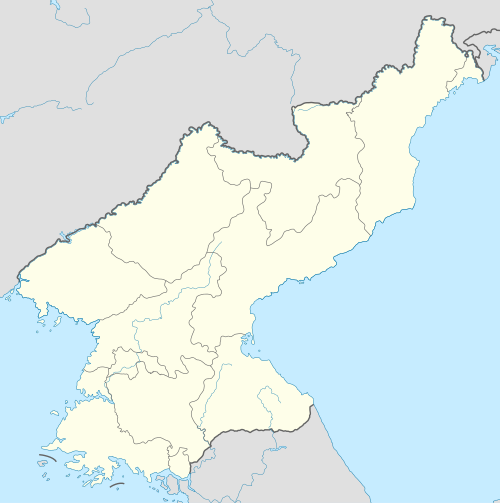


.jpg)
.jpg)

.jpg)
.jpg)

.jpg)


.jpg)
.jpg)


.jpg)
.jpg)
.jpg)
.jpg)


,_Dhaka,_Bangladesh_NK.JPG)


_Norfolk.jpg)


.jpg)
.jpg)


.png)


.JPG)


